Tetap teratur dengan koleksi
Simpan dan kategorikan konten berdasarkan preferensi Anda.
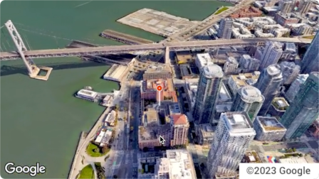
Aerial View API adalah layanan yang memungkinkan Anda membuat dan menampilkan video udara 3D fotorealistik dari alamat fisik mana pun di Amerika Serikat. Video ini menyimulasikan rekaman yang diambil oleh drone yang terbang berputar di atas.
Google telah membuat set data video tampilan udara yang telah dirender sebelumnya untuk Anda gunakan. Bangunan dan landmark besar di seluruh Amerika Serikat tercakup dalam Street View.
Kami juga menambahkan lebih banyak video tampilan udara setiap saat. Anda dapat menggunakan video yang sudah ada ini atau, jika video untuk alamat belum ada, Anda dapat meminta Google membuat video baru untuk Anda.
Alasan menggunakan Aerial View API
Berikut beberapa alasan mengapa Anda mungkin ingin menggunakan Aerial View API.
Anda ingin menjelajahi data 3D, tetapi Anda tidak terbiasa menggunakan Petak 3D, atau bekerja dengan perender
Anda menyukai konteks citra satelit, dan kemampuan untuk mengenali fasad bangunan dari Street View
Anda telah mempertimbangkan untuk menyewa operator drone untuk merekam properti Anda
Anda ingin menggunakan teknologi inovatif dan canggih
Anda sudah terbiasa menyematkan video di situs Anda
Yang dapat Anda lakukan dengan Aerial View API
Berikut daftar beberapa hal yang dapat Anda lakukan dengan Aerial View API.
Memberikan kesadaran dari sudut pandang burung terhadap bangunan dengan menandai jalan, taman, atau perairan di dekatnya
Memberi calon penyewa atau pembeli rumah gambaran tentang properti
Atur adegan untuk video pendek yang menunjukkan lokasi Anda kepada penonton
Menyoroti tempat wisata atau lokasi menarik saat membantu pengguna merencanakan liburan
Membantu pengemudi pengiriman atau pembeli menemukan tempat bisnis Anda
Cara kerja Aerial View API
Ada dua pendekatan yang dapat Anda lakukan untuk menggunakan Aerial View API.
Pendekatan
Alasan
Mencari video yang dihasilkan
Semua gambar udara yang Anda butuhkan telah dirender oleh Google (set data pra-render Google).
Membuat video baru
Anda memerlukan gambar tampilan udara yang belum dirender sebelumnya oleh Google.
Area cakupan
Aerial View API hanya mendukung alamat pos di Amerika Serikat tempat Google dapat merender video 3D.
Cara menggunakan Aerial View API
1
Tinjau Persyaratan Layanan Google Maps Platform
Perhatikan bahwa Anda tidak dapat mendownload, menyimpan, atau melakukan cache video tampilan udara.
Untuk mengetahui informasi selengkapnya, lihat
Persyaratan Layanan Google Maps Platform.
Kirim alamat pos AS atau videoId ke
endpoint lookupVideoMetadata() untuk menampilkan metadata video
tampilan udara.
Lihat Mengambil metadata video.
4
Mengambil video tampilan udara yang ada
Kirim alamat pos AS atau videoId ke endpoint
lookupVideo() untuk menampilkan video tampilan udara yang telah dirender sebelumnya.
Lihat Mengambil video yang dihasilkan.
5
Membuat video tampilan udara baru
Kirim alamat pos AS ke endpoint renderVideo() untuk
meminta pembuatan video tampilan udara baru untuk alamat yang ditentukan.
Lihat Membuat video baru.
[null,null,["Terakhir diperbarui pada 2025-08-31 UTC."],[[["\u003cp\u003eThe Aerial View API lets you create and display photorealistic 3D aerial videos of US addresses, simulating drone footage.\u003c/p\u003e\n"],["\u003cp\u003eGoogle provides a pre-rendered video dataset for many locations, or you can request new videos to be generated.\u003c/p\u003e\n"],["\u003cp\u003eUse the API to enhance user experiences with interactive 3D aerial views for various applications, such as real estate, travel planning, and business listings.\u003c/p\u003e\n"],["\u003cp\u003eAccess and display videos through the API, but note that downloading or storing them locally is not permitted.\u003c/p\u003e\n"],["\u003cp\u003eThe API is limited to US addresses where 3D video rendering is supported by Google.\u003c/p\u003e\n"]]],[],null,["The Aerial View API is a service that lets you create and display\nphotorealistic 3D aerial videos of any physical address within the United\nStates. The videos simulate footage taken by a drone circling overhead.\n\nGoogle has already created a dataset of pre-rendered aerial view videos for you\nto use. They cover large buildings and landmarks throughout the United States.\nAnd we're adding more aerial view videos all the time. You can simply use these\nexisting videos or, if a video does not yet exist for an address, you can\nrequest that Google generate a new one for you.\n| **Note:** Google automatically pre-renders videos for addresses periodically, so some addresses will have no wait time.\n\nWhy use Aerial View API\n\nHere are some reasons why you might want to use Aerial View API.\n\n- You want to explore 3D data, but you're not comfortable using 3D Tiles, or with working with a renderer\n\n- You like the context of satellite imagery, and the ability to recognize a building facade from Street View\n\n- You've considered hiring a drone operator to film your property\n\n- You want to use cutting-edge, innovative technology\n\n- You're comfortable embedding video in your web site\n\nWhat you can do with Aerial View API\n\nHere's a list of some of the things you can do with Aerial View API.\n\n- Provide birds-eye awareness of a building by highlighting nearby roads, parks, or bodies of water\n\n- Give a prospective renter or home buyer a sense of what a property is like\n\n- Set the scene for a short-form video showing the viewer where you are\n\n- Highlight attractions or points-of-interest when helping users plan a vacation\n\n- Help delivery drivers or shoppers find your place of business\n\nHow the Aerial View API works\n\nThere are two approaches that you can take to use the Aerial View API.\n| **Tip:** Both of these approaches should begin with you checking whether the video exists using the [`lookupVideoMetadata`](/maps/documentation/aerial-view/lookup-video-metadata) endpoint.\n\n| Approach | Rationale |\n|--------------------------|--------------------------------------------------------------------------------------------------------------|\n| Lookup a generated video | All of the aerial imagery that you need has already been rendered by Google (Google's pre-rendered dataset). |\n| Generate a new video | You need aerial view imagery that hasn't already been pre-rendered by Google. |\n\nCoverage areas\n\nAerial View API only supports postal addresses in the United States where\nGoogle is able to render 3D videos.\n\nHow to use the Aerial View API\n\n|---|------------------------------------------------------|----------------------------------------------------------------------------------------------------------------------------------------------------------------------------------------------------------------------|\n| 1 | **Review the Google Maps Platform Terms of Service** | Note that you cannot download, store, or cache the aerial view videos. For more information, see the [Google Maps Platform Terms of Service](https://cloud.google.com/maps-platform/terms/). |\n| 2 | **Get set up** | Start with [Set up your Google Cloud project](/maps/documentation/aerial-view/cloud-setup) and complete the instructions that follow. |\n| 3 | **Retrieve an aerial view video's metadata** | Send a US postal address or `videoId` to the `lookupVideoMetadata()` endpoint to return an aerial view video's metadata. See [Retrieve a video's metadata.](/maps/documentation/aerial-view/lookup-video-metadata) |\n| 4 | **Fetch an existing aerial view video** | Send a US postal address or `videoId` to the `lookupVideo()` endpoint to return a pre-rendered aerial view video. See [Fetch a generated video.](/maps/documentation/aerial-view/lookup-video) |\n| 5 | **Generate a new aerial view video** | Send a US postal address to the `renderVideo()` endpoint to request the generation of a new aerial view video for the specified address. See [Generate a new video.](/maps/documentation/aerial-view/generate-video) |"]]