Mantenha tudo organizado com as coleções
Salve e categorize o conteúdo com base nas suas preferências.
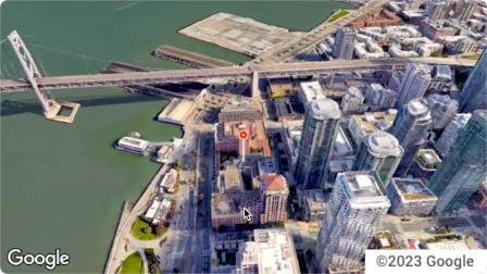
A API Aerial View é um serviço que permite criar e exibir vídeos aéreos em 3D fotorrealistas de qualquer endereço físico dos Estados Unidos. Os vídeos simulam uma filmagem feita por um drone que circula no ar.
O Google já criou um conjunto de dados de vídeos da vista aérea pré-renderizados para você usar. Elas cobrem grandes edifícios e pontos de referência em todos os Estados Unidos.
E estamos adicionando mais vídeos com vista aérea o tempo todo. Você pode usar esses vídeos ou, se não houver um vídeo para um endereço, pedir que o Google gere um novo.
Por que usar a API Aerial View
Confira alguns motivos para usar a API Aerial View.
Você quer analisar dados 3D, mas não se sente à vontade para usar blocos 3D ou trabalhar com um renderizador.
Você gosta do contexto das imagens de satélite e da capacidade de reconhecer a fachada de um prédio no Street View.
Você já pensou em contratar um operador de drone para filmar sua propriedade
Você quer usar tecnologia inovadora e de ponta
Você se sente à vontade para incorporar vídeos no seu site
O que você pode fazer com a API Aerial View
Confira uma lista de algumas coisas que você pode fazer com a API Aerial View.
Oferecer uma visão panorâmica de um edifício, destacando estradas, parques ou corpos d'água próximos
Dar a um possível locatário ou comprador de imóveis uma ideia de como é uma propriedade
Prepare o cenário para um vídeo curto mostrando ao espectador onde você está
Destacar atrações ou pontos de interesse ao ajudar os usuários a planejar férias
Ajude os motoristas de entrega ou compradores a encontrar seu estabelecimento
Como a API Aerial View funciona
Há duas abordagens para usar a API Aerial View.
Abordagem
Justificativa
Pesquisar um vídeo gerado
Todas as imagens aéreas necessárias já foram renderizadas pelo Google (conjunto de dados pré-renderizados do Google).
Gerar um novo vídeo
Você precisa de imagens da vista aérea que ainda não foram pré-renderizadas pelo Google.
Áreas de cobertura
A API Aerial View só é compatível com endereços postais nos Estados Unidos, onde o Google pode renderizar vídeos em 3D.
Como usar a API Aerial View
1
Leia os Termos de Serviço da Plataforma Google Maps
Envie um endereço postal dos EUA ou videoId para o endpoint lookupVideoMetadata() para retornar os metadados de um vídeo com vista aérea.
Consulte Recuperar os metadados de um vídeo.
4
Buscar um vídeo de visão aérea
Envie um endereço postal dos EUA ou videoId ao endpoint lookupVideo() para retornar um vídeo pré-renderizado com uma vista aérea.
Consulte Buscar um vídeo gerado.
5
Gerar um novo vídeo de visão aérea
Envie um endereço postal dos EUA para o endpoint renderVideo() para
solicitar a geração de um novo vídeo de vista aérea para o endereço especificado.
Consulte Gerar um novo vídeo.
[null,null,["Última atualização 2025-08-31 UTC."],[[["\u003cp\u003eThe Aerial View API lets you create and display photorealistic 3D aerial videos of US addresses, simulating drone footage.\u003c/p\u003e\n"],["\u003cp\u003eGoogle provides a pre-rendered video dataset for many locations, or you can request new videos to be generated.\u003c/p\u003e\n"],["\u003cp\u003eUse the API to enhance user experiences with interactive 3D aerial views for various applications, such as real estate, travel planning, and business listings.\u003c/p\u003e\n"],["\u003cp\u003eAccess and display videos through the API, but note that downloading or storing them locally is not permitted.\u003c/p\u003e\n"],["\u003cp\u003eThe API is limited to US addresses where 3D video rendering is supported by Google.\u003c/p\u003e\n"]]],[],null,["The Aerial View API is a service that lets you create and display\nphotorealistic 3D aerial videos of any physical address within the United\nStates. The videos simulate footage taken by a drone circling overhead.\n\nGoogle has already created a dataset of pre-rendered aerial view videos for you\nto use. They cover large buildings and landmarks throughout the United States.\nAnd we're adding more aerial view videos all the time. You can simply use these\nexisting videos or, if a video does not yet exist for an address, you can\nrequest that Google generate a new one for you.\n| **Note:** Google automatically pre-renders videos for addresses periodically, so some addresses will have no wait time.\n\nWhy use Aerial View API\n\nHere are some reasons why you might want to use Aerial View API.\n\n- You want to explore 3D data, but you're not comfortable using 3D Tiles, or with working with a renderer\n\n- You like the context of satellite imagery, and the ability to recognize a building facade from Street View\n\n- You've considered hiring a drone operator to film your property\n\n- You want to use cutting-edge, innovative technology\n\n- You're comfortable embedding video in your web site\n\nWhat you can do with Aerial View API\n\nHere's a list of some of the things you can do with Aerial View API.\n\n- Provide birds-eye awareness of a building by highlighting nearby roads, parks, or bodies of water\n\n- Give a prospective renter or home buyer a sense of what a property is like\n\n- Set the scene for a short-form video showing the viewer where you are\n\n- Highlight attractions or points-of-interest when helping users plan a vacation\n\n- Help delivery drivers or shoppers find your place of business\n\nHow the Aerial View API works\n\nThere are two approaches that you can take to use the Aerial View API.\n| **Tip:** Both of these approaches should begin with you checking whether the video exists using the [`lookupVideoMetadata`](/maps/documentation/aerial-view/lookup-video-metadata) endpoint.\n\n| Approach | Rationale |\n|--------------------------|--------------------------------------------------------------------------------------------------------------|\n| Lookup a generated video | All of the aerial imagery that you need has already been rendered by Google (Google's pre-rendered dataset). |\n| Generate a new video | You need aerial view imagery that hasn't already been pre-rendered by Google. |\n\nCoverage areas\n\nAerial View API only supports postal addresses in the United States where\nGoogle is able to render 3D videos.\n\nHow to use the Aerial View API\n\n|---|------------------------------------------------------|----------------------------------------------------------------------------------------------------------------------------------------------------------------------------------------------------------------------|\n| 1 | **Review the Google Maps Platform Terms of Service** | Note that you cannot download, store, or cache the aerial view videos. For more information, see the [Google Maps Platform Terms of Service](https://cloud.google.com/maps-platform/terms/). |\n| 2 | **Get set up** | Start with [Set up your Google Cloud project](/maps/documentation/aerial-view/cloud-setup) and complete the instructions that follow. |\n| 3 | **Retrieve an aerial view video's metadata** | Send a US postal address or `videoId` to the `lookupVideoMetadata()` endpoint to return an aerial view video's metadata. See [Retrieve a video's metadata.](/maps/documentation/aerial-view/lookup-video-metadata) |\n| 4 | **Fetch an existing aerial view video** | Send a US postal address or `videoId` to the `lookupVideo()` endpoint to return a pre-rendered aerial view video. See [Fetch a generated video.](/maps/documentation/aerial-view/lookup-video) |\n| 5 | **Generate a new aerial view video** | Send a US postal address to the `renderVideo()` endpoint to request the generation of a new aerial view video for the specified address. See [Generate a new video.](/maps/documentation/aerial-view/generate-video) |"]]