
简介
Distance Matrix API(旧版)是一项服务,可接受包含指定出行方式的出发地和目的地的 HTTPS 请求。对于出发地和目的地的每种组合,该服务都会返回行程距离和时长。
使用 Distance Matrix API 的原因
您可以使用 Distance Matrix API 帮助确定多个可能的出发地和目的地之间的最高效行程路线。例如,确定要派哪些工人前往工作地点,或从哪个仓库发送包裹。
Distance Matrix API 的功能
借助 Distance Matrix API,您可以提供一系列出发地和目的地之间的行程距离和用时。您可以指定多个选项,包括出行方式(例如驾车、骑自行车、乘坐公共交通工具或步行)以及公共交通方式(例如公交车、地铁、火车、有轨电车或轨道交通)。
Distance Matrix API 会根据起点和终点之间的推荐路线提供信息。您可以请求以下类型的距离数据:
- 所选出行方式的距离
- 以公里或英里为单位的距离
- 交通拥堵情况下的预计行程时间
Distance Matrix API 的工作原理
Distance Matrix API 使用任意数量的出发地(起点)和目的地,并返回每个出发地与所有请求的目的地之间的距离和行程时间,从请求中的第一个出发地开始,逐步进行到下一个出发地。
例如,如果您的请求将 A 和 B 指定为出发地,并将 C 和 D 指定为目的地,则它会按以下顺序返回距离和行程时间:
- A 到 C
- A 到 D
- B 到 C
- B 到 D
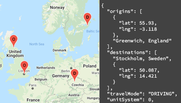
以下示例展示了 JSON 格式的请求,其中包含两个出发地:华盛顿特区和波士顿,以及一个目的地:纽约市,纽约州:
https://maps.googleapis.com/maps/api/distancematrix/json
  ?destinations=New%20York%20City%2C%20NY
  &origins=Washington%2C%20DC%7CBoston
  &units=imperial
  &key=YOUR_API_KEY
资源
下表汇总了可通过 Distance Matrix API 获得的资源以及返回的数据。
| 数据资源 | 返回的数据 | 返回格式 |
|---|---|---|
| 距离矩阵
以地点 ID、地址、 或纬度/经度坐标的形式提供出发地和目的地。 |
|
|
如何使用 Distance Matrix API
| 1 | 开始设置 | 首先,按照设置您的 Google Cloud 项目 中的说明进行操作,然后完成后续设置 说明。 |
| 2 | 尝试距离矩阵请求 | 获得 API 密钥后,您就可以直接通过浏览器开始测试 Distance Matrix API。 如需查看示例,请参阅使用入门指南中的示例请求。 |
| 3 | 撰写更复杂的请求 | 尝试提供多个出发地和目的地的请求。了解用于限制计算的可选参数,例如指定的出发时间或路线限制。请参阅可选参数 在距离矩阵请求和响应指南中。 |
| 4 | 了解响应基础知识 | 探索数据响应,为在应用中使用距离矩阵数据做好准备。如需了解详情,请参阅 距离矩阵响应 。 |
| 5 | 将距离矩阵数据整合到您自己的应用中! | 您可以使用此数据计算行程距离和用时。 |
可用的客户端库
您可以通过以下任一客户端库,使用您偏好的语言调用此 API:
- 适用于 Google 地图服务的 Java 客户端
- 适用于 Google 地图服务的 Python 客户端
- 适用于 Google 地图服务的 Go 客户端
- 适用于 Google 地图服务的 Node.js 客户端
适用于 Google 地图 服务的 Java 客户端、Python 客户端、Go 客户端和 Node.js 客户端是由社区提供支持的客户端库,并且根据 Apache 2.0 许可开放源代码。 您可以从 GitHub 下载这些客户端库,还可以在 GitHub 上找到安装说明和示例代码。
后续步骤
- 开始使用距离矩阵:前往使用入门。
- 开始使用示例请求和响应:前往距离矩阵 请求和响应。
- 遵循最佳实践:前往 Web 服务最佳 实践。