Solar API sử dụng dữ liệu địa điểm để xác định loại toà nhà và xác định toà nhà dựa trên ảnh vệ tinh. Trang này mô tả cách xác định thông tin về năng lượng mặt trời của toà nhà nào được trả về trong yêu cầu
buildingInsights.
Các loại toà nhà
Solar API hỗ trợ các toà nhà thuộc loại
premise. Loại này cho biết một địa điểm có tên, thường là một toà nhà hoặc tập hợp các toà nhà có tên chung.
Các loại khác, chẳng hạn như
subpremise hoặc
các khu phức hợp (ví dụ: các toà nhà riêng biệt nằm trên một khu đất, trừ phi
được đăng ký là premise) —
được không hỗ trợ.
Mái toà nhà
Solar API xác định vị trí tối ưu để lắp đặt tấm pin mặt trời trên mái nhà dựa trên ảnh vệ tinh. Các toà nhà dân cư, đặc biệt là mái nhà dốc hoặc mái nhà có độ dốc, được xác định với độ chính xác cao, trong khi các toà nhà có mái bằng (ví dụ: toà nhà chung cư hoặc toà nhà thương mại) có thể có độ chính xác khác nhau.
Nếu phản hồi
buildingInsights không bao gồm trường solarPanelConfigs, thì toà nhà đã được xử lý chính xác, nhưng chúng tôi không thể lắp đặt tấm pin trên mái nhà. Điều này có thể xảy ra nếu mái nhà quá nhỏ để lắp đặt tấm pin hoặc quá râm mát để tấm pin tạo ra năng lượng đáng kể.
Tìm kiếm theo địa chỉ
Bạn có thể chuyển đổi địa chỉ thành toạ độ vĩ độ và kinh độ bằng cách sử dụng Geocoding API hoặc Place Autocomplete API.
Sử dụng
place_idđể tham chiếu đến địa điểm được so khớp.Sử dụng toạ độ vĩ độ và kinh độ của địa điểm trong yêu cầu Solar API
buildingInsights.- Nếu Solar API tìm thấy một toà nhà phù hợp, hãy kiểm tra để đảm bảo rằng
place_idtrong phản hồibuildingInsightskhớp vớiplace_idtừ Geocoding API hoặc Place Autocomplete API. - Để giới hạn kết quả ở những địa điểm thuộc loại
premise, hãy thêm bộ lọc loại địa điểm vào phản hồi của Geocoding API hoặc Places API.{ "name": "buildings/ChIJh0CMPQW7j4ARLrRiVvmg6Vs", "center": { "latitude": 37.4449739, "longitude": -122.13914659999998 },... }
- Nếu Solar API tìm thấy một toà nhà phù hợp, hãy kiểm tra để đảm bảo rằng
Bạn có thể sử dụng ứng dụng mẫu nguồn mở hoặc đưa ra
buildingInsights yêu cầu để
kiểm tra place_id cho các toà nhà thuộc phạm vi của Solar API.
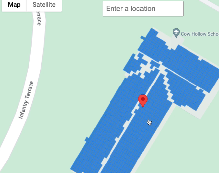
Chọn một vị trí trên bản đồ
Bạn cũng có thể cung cấp trải nghiệm bổ sung bằng cách cho phép người dùng chọn toà nhà trên bản đồ bằng Maps JavaScript
API. Trích xuất vĩ độ
và kinh độ của toà nhà từ sự kiện
chuột, sau đó truyền
các toạ độ đó vào yêu cầu
buildingInsights.