Zadbaj o dobrą organizację dzięki kolekcji
Zapisuj i kategoryzuj treści zgodnie ze swoimi preferencjami.
Deweloperzy z Europejskiego Obszaru Gospodarczego (EOG)
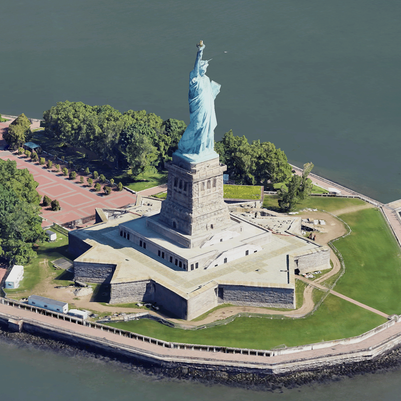
Fotorealistyczne kafelki 3D to fragmenty mapy zawierające dane geograficzne 3D Google w formacie OGC 3D Tiles.
Możesz renderować mapy 3D Google za pomocą własnego renderera 3D Tiles lub użyć biblioteki open source do wizualizacji geoprzestrzennej 3D.
Dlaczego warto korzystać z 3D Tiles?
Google oferuje kafelki 3D do zastosowań związanych z wizualizacją nowej generacji. Za pomocą kafelków 3D możesz tworzyć wspaniałe widoki 3D, tak jak w Google Earth. Te widoki pomagają użytkownikom lepiej zrozumieć kontekst geograficzny i ułatwiają poruszanie się po mapie. Mogą też służyć do opowiadania historii. Za pomocą wybranego renderera możesz też płynnie poruszać kamerą w scenie, aby oglądać ją z różnych perspektyw.
Obszary objęte ochroną
Sprawdź zasięg interfejsu Map Tiles API. Google regularnie aktualizuje i dodaje zdjęcia.
Eksplorator obszarów 3D: umożliwia wirtualne poznawanie dzielnic i obszarów w 3D z dużą ilością szczegółów wizualnych.
3D Storytelling: łączy opowiadanie historii z mapowaniem, umożliwiając twórcom tworzenie wciągających i interaktywnych narracji za pomocą fotorealistycznych kafelków 3D.
[null,null,["Ostatnia aktualizacja: 2025-08-29 UTC."],[[["\u003cp\u003ePhotorealistic 3D Tiles are map tiles containing Google's 3D geodata in the OGC 3D Tiles format, allowing rendering with your own or open source 3D Tiles renderers.\u003c/p\u003e\n"],["\u003cp\u003e3D Tiles empowers next-generation visualization, enabling stunning 3D perspective views for enhanced geographic context, navigation, and storytelling.\u003c/p\u003e\n"],["\u003cp\u003eGoogle's 3D Tiles offer coverage detailed in the Map Tiles API documentation, with regular updates and imagery additions.\u003c/p\u003e\n"],["\u003cp\u003eExplore 3D solutions like the 3D Area Explorer for detailed virtual exploration and 3D Storytelling for immersive narratives using Photorealistic 3D Tiles on the Google Maps Platform Architecture Center.\u003c/p\u003e\n"]]],[],null,["# Photorealistic 3D Tiles overview\n\n**European Economic Area (EEA) developers** If your billing address is in the European Economic Area, effective on 8 July 2025, the [Google\n| Maps Platform EEA Terms of Service](https://cloud.google.com/terms/maps-platform/eea) will apply to your use of the Services. [Learn more](/maps/comms/eea/faq). In addition, certain content from the Map Tiles API will no longer be returned. [Learn more](/maps/comms/eea/map-tiles).\n\n:statue_of_liberty:Photorealistic 3D Tiles are map tiles that contain Google's 3D\ngeodata in the\n[OGC 3D Tiles format](https://www.ogc.org/standards/3DTiles).\nYou can render Google's 3D maps with your own 3D Tiles renderer, or you can use\nan open source library for 3D geospatial visualization.\n\nWhy use 3D Tiles?\n-----------------\n\nGoogle offers 3D Tiles for next-generation visualization use cases. You can use\n3D Tiles to build stunning 3D perspective views, just as you can with Google\nEarth. These views help your users better understand geographic context, improve\nhow they navigate, and they can showcase a place for storytelling. Using a\nrenderer of your choice, you can also smoothly maneuver your camera through a\nscene to view it from different angles.\n\nCoverage areas\n--------------\n\nReview the Map Tiles API's\n[coverage](/maps/coverage#countryregion-coverage). Google regularly updates and\nadds imagery.\n\n3D solutions\n------------\n\nThe [Google Maps Platform Architecture Center](/maps/architecture)\ncontains examples of 3D solutions that you can examine to get started with your\napp:\n\n- [3D Area Explorer](/maps/architecture/3d-area-explorer):\n Lets you explore neighborhoods and areas virtually and in 3D with a\n high degree of visual detail.\n\n- [3D Storytelling](/maps/architecture/3d-storytelling):\n Bridges storytelling and mapping, enabling creators to craft immersive and\n interactive narratives using Photorealistic 3D Tiles."]]