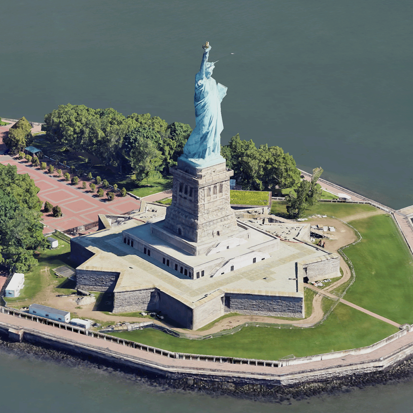
 포토리얼리스틱 3D 타일은 OGC 3D 타일 형식으로 Google의 3D 지리 데이터를 포함하는 지도 타일입니다.
자체 3D 타일 렌더러로 Google의 3D 지도를 렌더링하거나 3D 지리 공간 시각화를 위한 오픈소스 라이브러리를 사용할 수 있습니다.
3D 타일을 사용해야 하는 이유
Google은 차세대 시각화 사용 사례를 위한 3D 타일을 제공합니다. Google 어스에서와 마찬가지로 3D 타일을 사용하여 멋진 3D 원근법 뷰를 빌드할 수 있습니다. 이러한 뷰는 사용자가 지리적 맥락을 더 잘 이해하고 탐색 방식을 개선하는 데 도움이 되며, 스토리텔링을 위한 장소를 보여줄 수 있습니다. 원하는 렌더러를 사용하여 장면을 통해 카메라를 부드럽게 조작하여 다양한 각도에서 볼 수도 있습니다.
서비스 지역
Map Tiles API의 서비스 지역을 검토합니다. Google은 이미지를 정기적으로 업데이트하고 추가합니다.
3D 솔루션
Google Maps Platform 아키텍처 센터에는 앱을 시작하는 데 참고할 수 있는 3D 솔루션 예시가 포함되어 있습니다.
3D 지역 탐색기: 주변 지역과 지역을 가상으로, 3D로, 시각적 세부사항을 아주 자세히 살펴볼 수 있습니다.
3D 스토리텔링: 스토리텔링과 지도 작성을 연결하여 제작자가 포토리얼리스틱 3D 타일을 사용하여 실감 나는 양방향 내러티브를 만들 수 있습니다.
