Ubin satelit
Tetap teratur dengan koleksi
Simpan dan kategorikan konten berdasarkan preferensi Anda.
Developer Wilayah Ekonomi Eropa (EEA)
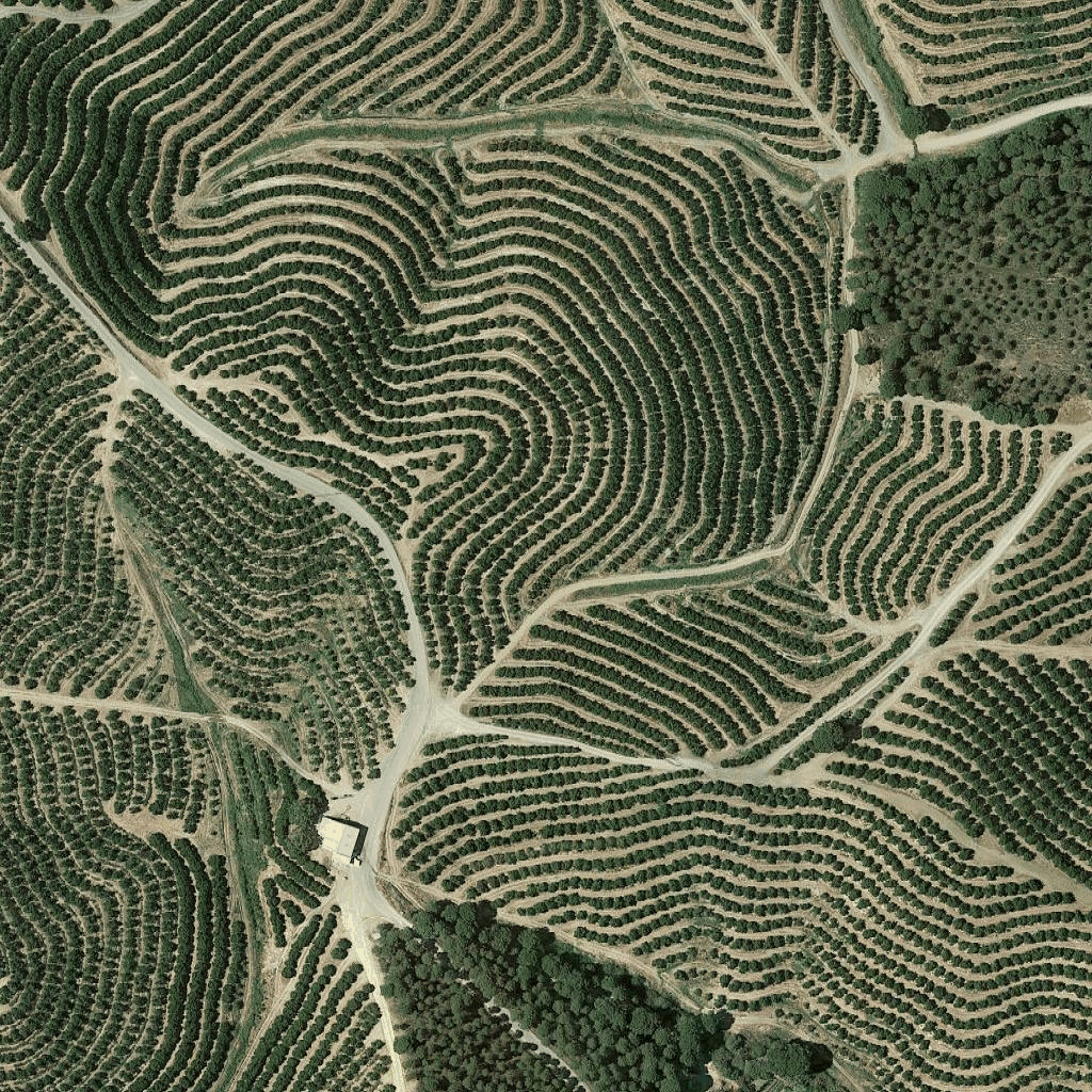
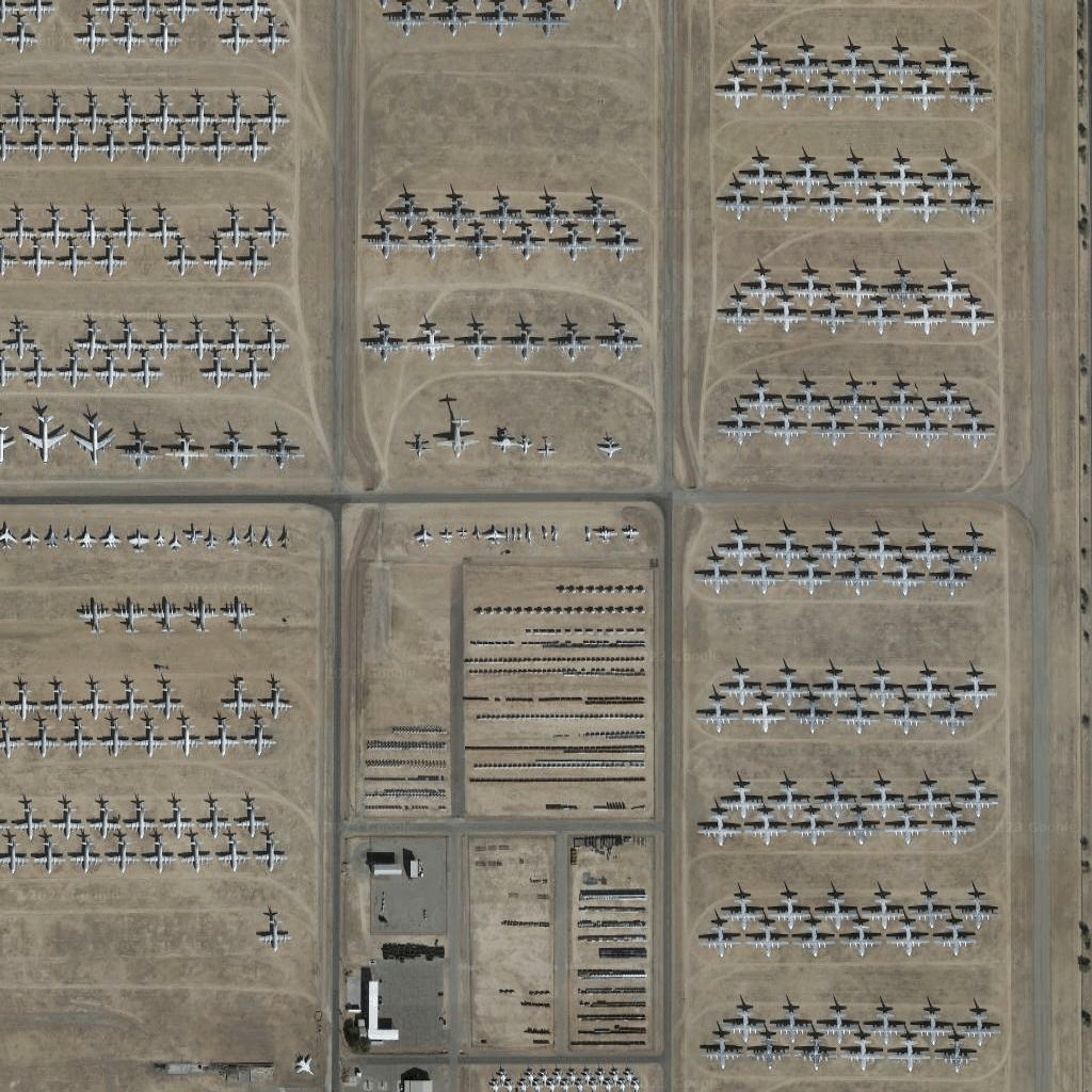
Petak gambar satelit adalah bentuk ortofotografi. Gambar tersebut adalah
gambar yang diambil oleh kamera satelit dan udara, dan memberikan
gambar vertikal (nadir atau hampir nadir) bumi.
Mendapatkan petak satelit
Anda dapat mulai membuat permintaan petak satelit setelah mendapatkan token sesi.
Karena token sesi berlaku untuk seluruh sesi, Anda tidak perlu
menentukan opsi peta dengan permintaan kartu.
Contoh kode berikut menunjukkan permintaan token sesi umum untuk petak peta satelit.
curl -X POST -d '{
"mapType": "satellite",
"language": "en-US",
"region": "US"
}' \
-H 'Content-Type: application/json' \
"https://tile.googleapis.com/v1/createSession?key=YOUR_API_KEY
Anda mendapatkan petak peta satelit dengan membuat permintaan HTTPS GET, seperti yang ditunjukkan dalam contoh berikut.
curl "https://tile.googleapis.com/v1/2dtiles/z/x/y?session=YOUR_SESSION_TOKEN&key=YOUR_API_KEY"
Contoh permintaan kartu
Pertimbangkan contoh kode berikut, yang meminta satu petak peta satelit pada
level zoom 15, dengan koordinat x dan y (6294, 13288).
curl "https://tile.googleapis.com/v1/2dtiles/15/6294/13288?session=YOUR_SESSION_TOKEN&key=YOUR_API_KEY" --output /tmp/example_tile.png
Tidak ada pesan respons dari server dalam contoh ini. Sebagai gantinya, kartu
hanya didownload ke file lokal.

Untuk mengetahui informasi tentang header pesan respons, lihat
Melakukan Pra-Pengambilan, Menyimpan dalam Cache, atau Menyimpan Konten.
Kecuali dinyatakan lain, konten di halaman ini dilisensikan berdasarkan Lisensi Creative Commons Attribution 4.0, sedangkan contoh kode dilisensikan berdasarkan Lisensi Apache 2.0. Untuk mengetahui informasi selengkapnya, lihat Kebijakan Situs Google Developers. Java adalah merek dagang terdaftar dari Oracle dan/atau afiliasinya.
Terakhir diperbarui pada 2025-08-29 UTC.
[null,null,["Terakhir diperbarui pada 2025-08-29 UTC."],[[["\u003cp\u003eSatellite image tiles are a type of orthophotography providing top-down imagery of the earth, captured by satellite and airborne cameras.\u003c/p\u003e\n"],["\u003cp\u003eTo request satellite tiles, you need to obtain a session token using your API key, specifying map type, language, and region.\u003c/p\u003e\n"],["\u003cp\u003eYou can then download individual tiles by making HTTPS GET requests, including the zoom level (z), x and y coordinates, session token, and API key in the URL.\u003c/p\u003e\n"],["\u003cp\u003eAn example request shows downloading a tile at zoom level 15 with specific coordinates to a local file, with no server response message besides the downloaded tile.\u003c/p\u003e\n"]]],["Satellite image tiles are top-down images from satellite or airborne cameras. To obtain them, first, request a session token via a POST request, including map type, language, and region. Then, make an HTTPS GET request to retrieve a specific tile by providing zoom level, x and y coordinates, session token, and API key. The requested tile is downloaded directly to a local file without a server response message. An example demonstrates getting a tile at zoom 15 with coordinates (6294, 13288).\n"],null,["# Satellite tiles\n\n**European Economic Area (EEA) developers** If your billing address is in the European Economic Area, effective on 8 July 2025, the [Google\n| Maps Platform EEA Terms of Service](https://cloud.google.com/terms/maps-platform/eea) will apply to your use of the Services. [Learn more](/maps/comms/eea/faq). In addition, certain content from the Map Tiles API will no longer be returned. [Learn more](/maps/comms/eea/map-tiles).\n\nSatellite image tiles are a form of orthophotography. They're\nimages captured by both satellite and airborne cameras, and they deliver\ntop-down (nadir or near-nadir) imagery of the earth.\n\nGetting satellite tiles\n-----------------------\n\nYou can begin making satellite tile requests after you get a session token.\nBecause the session token applies to the entire session, you don't have to\nspecify the map options with your tile requests.\n\nThe following code sample demonstrates a typical session token request for\nsatellite tiles. \n\n```json\ncurl -X POST -d '{\n \"mapType\": \"satellite\",\n \"language\": \"en-US\",\n \"region\": \"US\"\n}' \\\n-H 'Content-Type: application/json' \\\n\"https://tile.googleapis.com/v1/createSession?key=YOUR_API_KEY\n```\n\nYou get satellite tiles by making an HTTPS GET request, as shown in the\nfollowing example. \n\n```json\ncurl \"https://tile.googleapis.com/v1/2dtiles/\u003cvar class=\"apiparam\" translate=\"no\"\u003ez\u003c/var\u003e/\u003cvar class=\"apiparam\" translate=\"no\"\u003ex\u003c/var\u003e/\u003cvar class=\"apiparam\" translate=\"no\"\u003ey\u003c/var\u003e?session=\u003cvar class=\"apiparam\" translate=\"no\"\u003eYOUR_SESSION_TOKEN\u003c/var\u003e&key=YOUR_API_KEY\"\n```\n\nExample tile request\n--------------------\n\nConsider the following code example, that requests a single satellite tile at\nzoom level 15, with x and y coordinates of (6294, 13288). \n\n```json\ncurl \"https://tile.googleapis.com/v1/2dtiles/15/6294/13288?session=\u003cvar class=\"apiparam\" translate=\"no\"\u003eYOUR_SESSION_TOKEN\u003c/var\u003e&key=YOUR_API_KEY\" --output /tmp/example_tile.png\n```\n\nThere is no response message from the server in this example. Instead, the tile\njust downloads to a local file.\n\nFor information about response message headers, see\n[Pre-Fetching, Caching, or Storage of Content](/maps/documentation/tile/policies#pre-fetching,-caching,-or-storage-of-content)."]]