지형 타일
컬렉션을 사용해 정리하기
내 환경설정을 기준으로 콘텐츠를 저장하고 분류하세요.
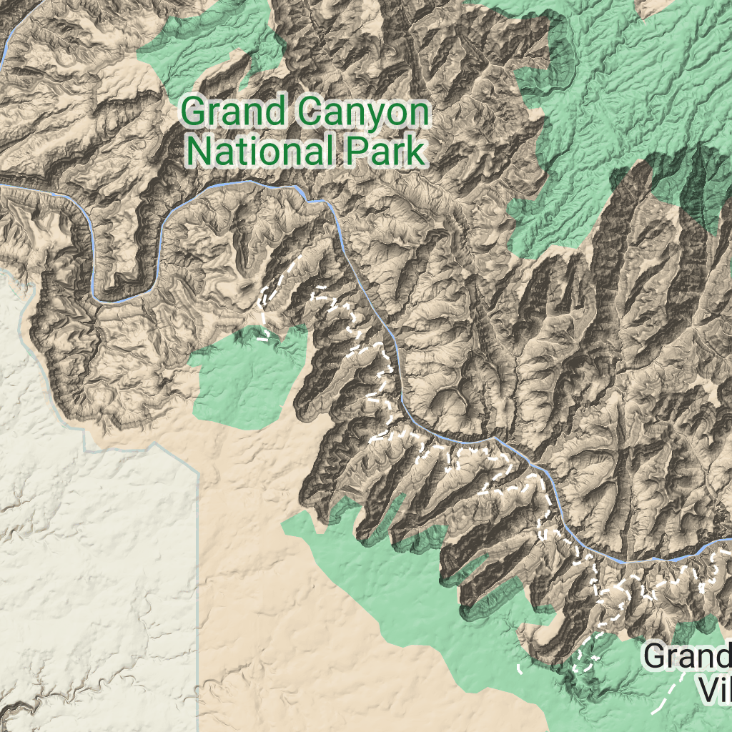
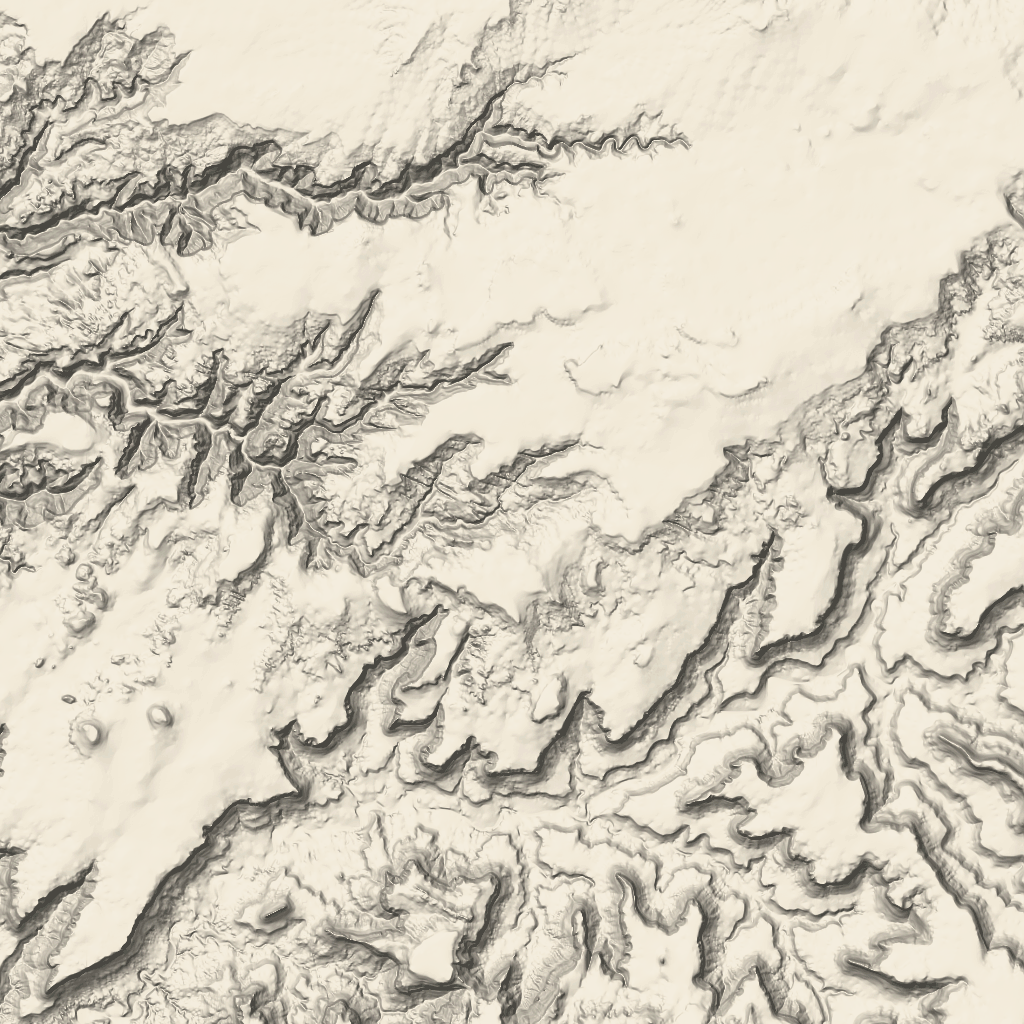
지형 타일은 음영 처리 매핑과 등고선이 포함된 이미지 타일입니다. 여기에는 식물과 같은 자연적 특징이 포함됩니다.
지형 타일 가져오기
세션 토큰을 가져온 후 지형 타일 요청을 시작할 수 있습니다.
세션 토큰은 전체 세션에 적용되므로 타일 요청과 함께 지도 옵션을 지정하지 않아도 됩니다.
다음 코드 샘플은 지형 타일의 일반적인 세션 토큰 요청을 보여줍니다.
curl -X POST -d '{
"mapType": "terrain",
"language": "en-US",
"region": "US",
"layerTypes": ["layerRoadmap"]
}' \
-H 'Content-Type: application/json' \
"https://tile.googleapis.com/v1/createSession?key=YOUR_API_KEY"
다음 예와 같이 HTTPS GET 요청을 실행하여 지형 타일을 가져옵니다.
curl "https://tile.googleapis.com/v1/2dtiles/z/x/y?session=YOUR_SESSION_TOKEN&key=YOUR_API_KEY"
타일 요청 예시
다음 예에서는 x 및 y 좌표가 (192, 401)이고 확대/축소 수준이 10인 단일 지형 타일을 요청합니다.
curl "https://tile.googleapis.com/v1/2dtiles/10/192/401?session=YOUR_SESSION_TOKEN&key=YOUR_API_KEY" --output /tmp/example_tile.png
이 예시에는 서버의 응답 메시지가 없습니다. 대신 타일이 로컬 파일에 다운로드됩니다.

응답 메시지 헤더에 대한 자세한 내용은 콘텐츠 프리패치, 캐싱 또는 저장을 참고하세요.
달리 명시되지 않는 한 이 페이지의 콘텐츠에는 Creative Commons Attribution 4.0 라이선스에 따라 라이선스가 부여되며, 코드 샘플에는 Apache 2.0 라이선스에 따라 라이선스가 부여됩니다. 자세한 내용은 Google Developers 사이트 정책을 참조하세요. 자바는 Oracle 및/또는 Oracle 계열사의 등록 상표입니다.
최종 업데이트: 2025-08-29(UTC)
[null,null,["최종 업데이트: 2025-08-29(UTC)"],[[["\u003cp\u003eTerrain tiles are image tiles that visually represent geographical features like hills, contours, and vegetation.\u003c/p\u003e\n"],["\u003cp\u003eTo request terrain tiles, you first need to obtain a session token using your API key and specifying map parameters.\u003c/p\u003e\n"],["\u003cp\u003eYou can then retrieve individual terrain tiles using an HTTPS GET request, providing the session token, API key, and desired tile coordinates (zoom level, x, and y).\u003c/p\u003e\n"],["\u003cp\u003eTerrain tiles are downloaded directly as image files without a server response message, allowing easy integration into mapping applications.\u003c/p\u003e\n"]]],["Terrain tiles, which include hillshade mapping, contour lines, and natural features, are accessed by first obtaining a session token via a POST request specifying the map type, language, region, and layer types. Subsequently, tiles are retrieved with HTTPS GET requests, providing the zoom level (z), x and y coordinates, and the session token. An example demonstrates requesting a tile at zoom level 10, with coordinates (192, 401). The tile data downloads to a local file, without a server response message.\n"],null,["# Terrain tiles\n\n**European Economic Area (EEA) developers** If your billing address is in the European Economic Area, effective on 8 July 2025, the [Google\n| Maps Platform EEA Terms of Service](https://cloud.google.com/terms/maps-platform/eea) will apply to your use of the Services. [Learn more](/maps/comms/eea/faq). In addition, certain content from the Map Tiles API will no longer be returned. [Learn more](/maps/comms/eea/map-tiles).\n\nTerrain tiles are image tiles that contain hillshade mapping\nand contour lines. They include natural features such as vegetation.\n\nGetting terrain tiles\n---------------------\n\nYou can begin making terrain tile requests after you get a session token.\nBecause a session token applies to the entire session, you don't have to specify\nthe map options with your tile requests.\n\nThe following code sample demonstrates a typical session token request for\nterrain tiles. \n\n```json\ncurl -X POST -d '{\n \"mapType\": \"terrain\",\n \"language\": \"en-US\",\n \"region\": \"US\",\n \"layerTypes\": [\"layerRoadmap\"]\n}' \\\n-H 'Content-Type: application/json' \\\n\"https://tile.googleapis.com/v1/createSession?key=YOUR_API_KEY\"\n```\n\nYou get terrain tiles by making an HTTPS GET request, as shown in the following\nexample. \n\n```json\ncurl \"https://tile.googleapis.com/v1/2dtiles/\u003cvar class=\"apiparam\" translate=\"no\"\u003ez\u003c/var\u003e/\u003cvar class=\"apiparam\" translate=\"no\"\u003ex\u003c/var\u003e/\u003cvar class=\"apiparam\" translate=\"no\"\u003ey\u003c/var\u003e?session=\u003cvar class=\"apiparam\" translate=\"no\"\u003eYOUR_SESSION_TOKEN\u003c/var\u003e&key=YOUR_API_KEY\"\n```\n\nExample tile request\n--------------------\n\nConsider the following example, which requests a single terrain tile with zoom\nlevel 10, with x and y coordinates of (192, 401). \n\n```json\ncurl \"https://tile.googleapis.com/v1/2dtiles/10/192/401?session=\u003cvar class=\"apiparam\" translate=\"no\"\u003eYOUR_SESSION_TOKEN\u003c/var\u003e&key=YOUR_API_KEY\" --output /tmp/example_tile.png\n```\n\nThere is no response message from the server in this example. Instead, the tile\njust downloads to a local file.\n\nFor information about response message headers, see\n[Pre-Fetching, Caching, or Storage of Content](/maps/documentation/tile/policies#pre-fetching,-caching,-or-storage-of-content)."]]