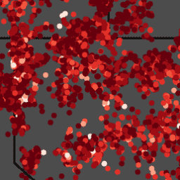
BLM AIM TerrADat TerrestrialAIM Point v1

BLM/AIM/v1/TerrADat/TerrestrialAIM
Dataset Availability
2011-05-10T00:00:00Z–2016-12-06T00:00:00Z
Dataset Provider
Earth Engine Snippet
FeatureCollection
ee.FeatureCollection("BLM/AIM/v1/TerrADat/TerrestrialAIM")
FeatureView
ui.Map.FeatureViewLayer("BLM/AIM/v1/TerrADat/TerrestrialAIM_FeatureView")
Tags
blm hydrology table vegetation
aim
biota
endangered
environment
grsg
health
landscape
range
terradat
terrestrialaim
wildlife

Description

Since 2011, the Bureau of Land Management (BLM) has collected field information to inform land health through its Assessment Inventory and Monitoring (AIM) strategy. To date, more than 6,000 terrestrial AIM field plots have been collected over BLM lands. The BLM AIM data archive is updated annually. Standardized core indicators are collected at each plot that are known to be both ecologically relevant and clearly tied to rangeland health. These indicators inform biotic integrity, soil and site stability, and hydrologic function. The terrestrial plot measurements include fractional bare ground cover, vegetation composition and height, plants of management concern, Non-native invasive species, plant canopy gaps, species richness, and soil aggregate stability. AIM represents one of the most extensive, publicly available plot measurement datasets across Western US federal lands, which can be integrated with remotely sensed imagery and other geospatial information for a range of analysis, classification, and validation purposes.

This dataset was created to monitor the status, condition and trend of national BLM resources in accordance with BLM policies. The methodology used for the collection of these data can be found on https://landscapetoolbox.org and the Monitoring Manual, 2nd Edition. These data should not be used for statistical or spatial inferences without knowledge of how the sample design was drawn or without calculating spatial weights for the points based on the sample design.

This feature class includes monitoring data collected nationally to understand the status, condition, and trend of resources on BLM lands. Data are collected in accordance with the BLM Assessment, Inventory, and Monitoring (AIM) Strategy. The AIM Strategy specifies a probabilistic sampling design, standard core indicators and methods, electronic data capture and management, and integration with remote sensing. Attributes include the BLM terrestrial core indicators: bare ground, vegetation composition, plant species of management concern, non-native invasive species, and percent canopy gaps (see Entity/Attribute Section for exact details on attributes). Data were collected and managed by BLM Field Offices, BLM Districts, and/or affiliated field crews with support from the BLM National Operations Center. Data are stored in a centralized database (TerrADat) at the BLM National Operations Center.

Data were collected by trained data collectors with the BLM and partner organizations. They followed the BLM core terrestrial data collection protocols. Data were captured electronically using the Database for Inventory, Monitoring, and Assessment. They were managed by the data collectors, with oversight from BLM field offices, state offices, and the National Operations Center. This dataset has undergone rigorous QA/QC to ensure data quality.

Table Schema

Table Schema

Name Type Description
BareSoilCover_FH DOUBLE

The basal cover of soil in the plot, not including soil that has cover above it. For example, points with sagebrush over bare soil are not counted in this indicator. This indicator is derived from the Line Point Intercept Method (150 points on three transects per plot).

DateEstablished STRING

The date the plot was established in DIMA, YYYY/MM/DD HH:MM:SS

DateLoadedInDb STRING

Date that the Database for Inventory, Monitoring, and Assessment (DIMA) was uploaded into TerrADat. Follows a standard date, but changes with the year data was collected (YYYY-09-01).

DateVisited STRING

The date that data were collected at the plot, YYYY/MM/DD HH:MM:SS

EcologicalSiteId STRING

Unique ID referring to the ecological site, defined by NRCS as "a distinctive kind of land with specific characteristics that differs from other kinds of land in its ability to produce a distinctive kind and amount of vegetation." IDs are from the Ecological Site Information System.

GapPct_25_50 DOUBLE

The percentage of the plot's soil surface covered by gaps between plant canopies that are from 25-50 cm in size. This indicator is measured using the GAP Intercept Method (three transects per plot).

GapPct_51_100 DOUBLE

The percentage of the plot's soil surface covered by gaps between plant canopies that are from 50-100 cm in size. This indicator is measured using the GAP Intercept Method (three transects per plot).

GapPct_101_200 DOUBLE

The percentage of the plot's soil surface covered by gaps between plant canopies that are from 101-200 cm in size. This indicator is measured using the GAP Intercept Method (three transects per plot).

GapPct_200_plus DOUBLE

The percentage of the plot's soil surface covered by gaps between plant canopies that are greater than 200 cm in size. This indicator is measured using the GAP Intercept Method (three transects per plot).

GapPct_25_plus DOUBLE

The percentage of the plot's soil surface covered by gaps between plant canopies that are greater than 25 cm in size. This indicator is measured using the GAP Intercept Method (three transects per plot).

HerbaceousHgt_Avg DOUBLE

Average height of herbaceous plants in the plot. This was collected using the Vegetation Height Method (30 points on 3 transects per plot).

InvAnnForbCover_AH DOUBLE

The cover of non-native invasive annual forbs in the plot. This indicator is derived from the Line Point Intercept Method (150 points on three transects per plot). Non-native invasive status and growth form are designated by local natural resource specialists, often after consulting the USDA PLANTS database.

InvAnnForbGrassCover_AH DOUBLE

The cover of non-native invasive annual forbs and grasses in the plot. This indicator is derived from the Line Point Intercept Method (150 points on three transects per plot). Non- native invasive status and growth form are designated by local natural resource specialists, often after consulting the USDA PLANTS database.

InvAnnGrassCover_AH DOUBLE

The cover of non-native invasive annual grasses in the plot. This indicator is derived from the Line Point Intercept Method (150 points on three transects per plot). Non-native invasive status and growth form are designated by local natural resource specialists, often after consulting the USDA PLANTS database.

InvPerenForbCover_AH DOUBLE

The cover of non-native invasive perennial forbs in the plot. This indicator is derived from the Line Point Intercept Method (150 points on three transects per plot). Non-native invasive status and growth form are designated by local natural resource specialists, often after consulting the USDA PLANTS database.

InvPerenForbGrassCover_AH DOUBLE

The cover of non-native invasive perennial forbs and grasses in the plot. This indicator is derived from the Line Point Intercept Method (150 points on three transects per plot). Non- native invasive status and growth form are designated by local natural resource specialists, often after consulting the USDA PLANTS database.

InvPerenGrassCover_AH DOUBLE

The cover of non-native invasive perennial grasses in the plot. This indicator is derived from the Line Point Intercept Method (150 points on three transects per plot). Non-native invasive status and growth form are designated by local natural resource specialists, often after consulting the USDA PLANTS database.

InvPerenGrassHgt_Avg DOUBLE

Average height of invasive perennial grasses in the plot. This was collected using the Vegetation Height Method (30 points on 3 transects per plot).

InvPlantCover_AH DOUBLE

The cover of non-native invasive plants in the plot. This indicator is derived from the Line Point Intercept Method (150 points on three transects per plot). Non-native invasive status and growth form are designated by local natural resource specialists, often after consulting the USDA PLANTS database.

InvPlant_NumSp DOUBLE

The number of non-native invasive plant species found in the entire plot area during a timed search (Species Inventory). Non-native invasive status and growth form are designated by local natural resource specialists, often after consulting the USDA PLANTS database.

InvShrubCover_AH DOUBLE

The cover of non-native invasive shrubs in the plot. This indicator is derived from the Line Point Intercept Method (150 points on three transects per plot). Non-native invasive status and growth form are designated by local natural resource specialists, often after consulting the USDA PLANTS database.

InvSubShrubCover_AH DOUBLE

The cover of non-native invasive sub-shrubs in the plot. This indicator is derived from the Line Point Intercept Method (150 points on three transects per plot). Non-native invasive status and growth form are designated by local natural resource specialists, often after consulting the USDA PLANTS database.

InvSucculentCover_AH DOUBLE

The cover of non-native invasive succulents in the plot. This indicator is derived from the Line Point Intercept Method (150 points on three transects per plot). Non-native invasive status and growth form are designated by local natural resource specialists, often after consulting the USDA PLANTS database.

InvTreeCover_AH DOUBLE

The cover of non-native invasive trees in the plot. This indicator is derived from the Line Point Intercept Method (150 points on three transects per plot). Non-native invasive status and growth form are designated by local natural resource specialists, often after consulting the USDA PLANTS database.

NonInvAnnForbCover_AH DOUBLE

The cover of non-invasive annual forbs in the plot. This indicator is derived from the Line Point Intercept Method (150 points on three transects per plot). Non-native invasive status and growth form are designated by local natural resource specialists, often after consulting the USDA PLANTS database.

NonInvAnnForbGrassCover_AH DOUBLE

The cover of non-invasive annual forbs and grasses in the plot. This indicator is derived from the Line Point Intercept Method (150 points on three transects per plot). Non-native invasive status and growth form are designated by local natural resource specialists, often after consulting the USDA PLANTS database.

NonInvAnnGrassCover_AH DOUBLE

The cover of non-invasive annual grasses in the plot. This indicator is derived from the Line Point Intercept Method (150 points on three transects per plot). Non-native invasive status and growth form are designated by local natural resource specialists, often after consulting the USDA PLANTS database.

NonInvPerenForbCover_AH DOUBLE

The cover of non-invasive perennial forbs in the plot. This indicator is derived from the Line Point Intercept Method (150 points on three transects per plot). Non-native invasive status and growth form are designated by local natural resource specialists, often after consulting the USDA PLANTS database.

NonInvPerenForbGrassCover_AH DOUBLE

The cover of non-invasive perennial forbs and grasses in the plot. This indicator is derived from the Line Point Intercept Method (150 points on three transects per plot). Non-native invasive status and growth form are designated by local natural resource specialists, often after consulting the USDA PLANTS database.

NonInvPerenGrassCover_AH DOUBLE

The cover of non-invasive perennial grasses in the plot. This indicator is derived from the Line Point Intercept Method (150 points on three transects per plot). Non-native invasive status and growth form are designated by local natural resource specialists, often after consulting the USDA PLANTS database.

NonInvPerenGrassHgt_Avg DOUBLE

Average height of non-invasive perennial grasses in the plot. This was collected using the Vegetation Height Method (30 points on 3 transects per plot).

NonInvShrubCover_AH DOUBLE

The cover of non-invasive shrubs in the plot. This indicator is derived from the Line Point Intercept Method (150 points on three transects per plot). Non-native invasive status and growth form are designated by local natural resource specialists, often after consulting the USDA PLANTS database.

NonInvSubShrubCover_AH DOUBLE

The cover of non-invasive sub-shrubs in the plot. This indicator is derived from the Line Point Intercept Method (150 points on three transects per plot). Non-native invasive status and growth form are designated by local natural resource specialists, often after consulting the USDA PLANTS database.

NonInvSucculentCover_AH DOUBLE

The cover of non-invasive succulents in the plot. This indicator is derived from the Line Point Intercept Method (150 points on three transects per plot). Non-native invasive status and growth form are designated by local natural resource specialists, often after consulting the USDA PLANTS database.

NonInvTreeCover_AH DOUBLE

The cover of non-invasive trees in the plot. This indicator is derived from the Line Point Intercept Method (150 points on three transects per plot). Non-native invasive status and growth form are designated by local natural resource specialists, often after consulting the USDA PLANTS database.

OtherShrubHgt_Avg DOUBLE

Average height of non-sagebrush shrubs that are preferred shrubs for sage grouse in the plot. Other Shrub species codes from the USDA Plants Database include: AMAL2, AMUT, ATCO, CEVE, CHNA2, CHVI8, GRSP, GUSA2, JUOC, JUOS, KRLA2, PAMY, PUTR2, ROWO, SAVE4, SYAL, SYOR2, and TECA2. This was collected using the Vegetation Height protocol (30 points on 3 transects per plot).

PlotID STRING

Name for each location or plot where data is collected, as assigned by the data collector. Formats vary. Duplicate Plot IDs might exist among different Sites and Projects, but not within the same Site. Each AIM plot is the center point of a 55-meter radius (110-meter diameter) circle in which monitoring indicators (dataset attributes) were collected. Points were randomly selected using a spatially balanced sampling design within the desired inference space. Most of the attributes were collected along three 50- or 25-meter transects, offset from the center point by 5 meters, radiating out from the center point at 0, 120, and 240 degrees.

PlotKey STRING

Unique numeric ID associated with each plot location. This is automatically generated in DIMA the first time a plot is created. Future visit to the same plot generally use the same Plot Key.

PrimaryKey STRING

Unique identifier for each plot. It includes the Plot Key as well as the data loaded into TerrADat.

ProjectName STRING

Refers to the broader project area the data was collected in. Generally includes the state, BLM management office, and year.

SagebrushCover_AH DOUBLE

The cover of sagebrush in the plot. This indicator is derived from the Line Point Intercept Method (150 points on three transects per plot). Sagebrush species codes from the USDA PLANTS database include: ARAR8; ARARL3; ARARL; ARNO4; ARARN; ARBI3; ARCAB3; ARBO5; ARCAC5; ARCAV2; ARCAV; ARFR4; ARPA16; ARPE6; ARPY2; ARRI2; PIDE4; ARSP5; ARTRS2; ARTRT; ARTRV; ARTRX; ARTRV; ARTRP4; ARTRW8; ARTRW; ARTRT2; ARTRR2; ARTRR4; and SPAR2.

SageabrushHgt_Avg DOUBLE

Average height of sagebrush in the plot. This was collected using the Vegetation Height Method (30 points on 3 transects per plot). Sagebrush species codes from the USDA PLANTS database include: ARAR8; ARARL3; ARARL; ARNO4; ARARN; ARBI3; ARCAB3; ARBO5; ARCAC5; ARCAV2; ARCAV; ARFR4; ARPA16; ARPE6; ARPY2; ARRI2; PIDE4; ARSP5; ARTRS2; ARTRT; ARTRV; ARTRX; ARTRV; ARTRP4; ARTRW8; ARTRW; ARTRT2; ARTRR2; ARTRR4; and SPAR2.

SiteID STRING

This is used by data collectors for grouping plots, e.g., by type or management area. Common values are names of management units (such as allotments) or the subject of data collection (such as reclamation).

SoilStability_All DOUBLE

The average soil aggregate stability of all samples in the plot. This indicator is measured using the Soil Aggregate Stability Test (up to 18 samples per plot). In this test, stability ranges from 1-6, with 1 being the least stable and 6 being the most stable.

SoilStability_Protected DOUBLE

The average soil aggregate stability of samples collected under plant canopies in the plot. This indicator is measured using the Soil Aggregate Stability Test (up to 18 samples per plot). In this test, stability ranges from 1-6, with 1 being the least stable and 6 being the most stable.

SoilStability_Unprotected DOUBLE

The average soil aggregate stability of samples collected between plant canopies (e.g., with no cover directly above them) in the plot. This indicator is measured using the Soil Aggregate Stability Test (up to 18 samples per plot). In this test, stability ranges from 1-6, with 1 being the least stable and 6 being the most stable.

TotalFoliarCover_FH DOUBLE

The foliar cover of plants in the plot. This indicator is derived from the Line Point Intercept Method (150 points on three transects per plot).

WoodyHgt_Avg DOUBLE

Average height of woody plants in the plot. This was collected using the Vegetation Height Method (30 points on 3 transects per plot).

Terms of Use

Terms of Use

These data are considered public domain.

These data are provided by Bureau of Land Management (BLM) "as is" and might contain errors or omissions. The User assumes the entire risk associated with its use of these data and bears all responsibility in determining whether these data are fit for the User's intended use. The information contained in these data is dynamic and may change over time. The data are not better than the sources from which they were derived, and both scale and accuracy may vary across the data set. These data might not have the accuracy, resolution, completeness, timeliness, or other characteristics appropriate for applications that potential users of the data may contemplate. The User is encouraged to carefully consider the content of the metadata file associated with these data. These data are neither legal documents nor land surveys, and must not be used as such. Official records may be referenced at most BLM offices. Please report any errors in the data to the BLM office from which it was obtained. The BLM should be cited as the data source in any products derived from these data. Any Users wishing to modify the data should describe the types of modifications they have performed. The User should not misrepresent the data, nor imply that changes made were approved or endorsed by BLM. This data may be updated by the BLM without notification.

The BLM assumes no responsibility for errors or omissions. No warranty is made by the BLM as to the accuracy, reliability, or completeness of these data for individual use or aggregate use with other data; nor shall the act of distribution to contractors, partners, or beyond, constitute any such warranty for individual or aggregate data use with other data. Although these data have been processed successfully on computers of BLM, no warranty, expressed or implied, is made by BLM regarding the use of these data on any other system, or for general or scientific purposes, nor does the fact of distribution constitute or imply any such warranty. In no event shall the BLM have any liability whatsoever for payment of any consequential, incidental, indirect, special, or tort damages of any kind, including, but not limited to, any loss of profits arising out of the use or reliance on the geographic data or arising out of the delivery, installation, operation, or support by BLM.

Explore with Earth Engine

Code Editor (JavaScript)

var greens = ee.List([
  '#00441B', '#00682A', '#37A055', '#5DB96B', '#AEDEA7', '#E7F6E2', '#F7FCF5'
]);
var reds = ee.List([
  '#67000D', '#9E0D14', '#E32F27', '#F6553D', '#FCA082', '#FEE2D5', '#FFF5F0'
]);

function normalize(value, min, max) {
  return value.subtract(min).divide(ee.Number(max).subtract(min));
}

function setColor(feature, property, min, max, palette) {
  var value = normalize(feature.getNumber(property), min, max)
                  .multiply(palette.size())
                  .min(palette.size().subtract(1))
                  .max(0);
  return feature.set({style: {color: palette.get(value.int())}});
}

var fc = ee.FeatureCollection('BLM/AIM/v1/TerrADat/TerrestrialAIM');
var woodyHeightStyle = function(f) {
  return setColor(f, 'WoodyHgt_Avg', 0, 100, greens);
};
var bareSoilStyle = function(f) {
  return setColor(f, 'BareSoilCover_FH', 0, 100, reds);
};

var treeHeight = fc.filter('WoodyHgt_Avg > 1').map(woodyHeightStyle);
var bareSoil = fc.filter('BareSoilCover_FH > 1').map(bareSoilStyle);

Map.addLayer(bareSoil.style({styleProperty: 'style', pointSize: 3}));
Map.addLayer(treeHeight.style({styleProperty: 'style', pointSize: 1}));

Map.setCenter(-110, 40, 6);
Open in Code Editor

Visualize as a FeatureView

A FeatureView is a view-only, accelerated representation of a FeatureCollection. For more details, visit the FeatureView documentation.

Code Editor (JavaScript)

var fvLayer = ui.Map.FeatureViewLayer(
  'BLM/AIM/v1/TerrADat/TerrestrialAIM_FeatureView');

var visParams = {
  isVisible: false,
  pointSize: 7,
  rules: [
    {
      filter: ee.Filter.expression('WoodyHgt_Avg > 1'),
      isVisible: true,
      color: {
        property: 'WoodyHgt_Avg',
        mode: 'linear',
        palette: ['00441b', '00682a', '37a055', '5db96b',
                  'aedea7', 'e7f6e2', 'f7fcf5'],
        min: 0,
        max: 100
      }
    }
  ]
};

fvLayer.setVisParams(visParams);
fvLayer.setName('Average woody plant height');

Map.setCenter(-110, 40, 6);
Map.add(fvLayer);
Open in Code Editor