- 数据集可用性
- 2006-01-24T00:00:00Z–2011-05-13T00:00:00Z
- 数据集提供商
- Conservation Science Partners
- 标签
说明
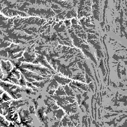
地形地貌数据集表示地形(在 EE 中以 ERGo/1_0/US/landforms 的形式提供)和岩性(在 EE 中以 ERGo/1_0/US/lithology 的形式提供)数据层的空间交集。它提供了 247 种独特的组合,而可能的组合总数为 270 种。每种类型的值都是通过连接地貌和岩性类型(例如,1101 是“碳酸盐”岩性上的“山峰/山脊”地貌)。此数据层有时称为“陆地刻面”表征。
地形图层基于 USGS 的 10 米 NED DEM(在 EE 中以 USGS/NED 的形式提供)。岩性层不基于任何 DEM。
此数据集仅在美国提供,因为岩性数据层仅在美国提供,不过这些数据可能也适用于其他国家/地区。
频段
像素大小
90 米
频段
| 名称 | 最小值 | 最大值 | 像素尺寸 | 说明 |
|---|---|---|---|---|
constant |
1100 | 4220 | 米 | 地貌与岩性交集 |
使用条款
使用条款
引用
引用:
Theobald, D. M. Harrison-Atlas, D.,Monahan, W. B., & Albano, C. M. (2015).用于气候适应规划的具有生态学意义的地貌和地形多样性地图。PloS one, 10(12), e0143619
使用 Earth Engine 探索
代码编辑器 (JavaScript)
var dataset = ee.Image('CSP/ERGo/1_0/US/physiography');
var physiography = dataset.select('constant');
var physiographyVis = {
  min: 1100.0,
  max: 4220.0,
};
Map.setCenter(-105.4248, 40.5242, 8);
Map.addLayer(physiography, physiographyVis, 'Physiography');
