- 数据集可用性
- 2006-01-24T00:00:00Z–2011-05-12T00:00:00Z
- 数据集提供程序
- JAXA 地球观测研究中心
- Earth Engine 代码段
-
ee.ImageCollection("JAXA/ALOS/AW3D30/V3_2")
- 标签
说明
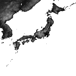
ALOS World 3D - 30 米 (AW3D30) 是一个全球数字地表模型 (DSM) 数据集,水平分辨率约为 30 米(1 弧秒网格)。该数据集基于 World 3D Topographic Data 的 DSM 数据集(5 米网格版本)。如需了解详情,请参阅数据集文档。
版本 3.2 于 2021 年 1 月发布,是通过重新考虑高纬度地区的格式、辅助数据和处理方法而创建的改进版本。在高纬度地区,每个纬度区域采用不同的像素间距。海岸线数据(辅助数据集之一)已更改,并使用了新的数据集。此外,我们还使用了 AW3D 版本 3 作为日本的来源数据。此外,我们还改进了在此过程中检测异常值的方法。
AW3D DSM 海拔由使用立体光学图像对的图像匹配过程计算得出。系统会在处理期间自动识别云、雪和冰,并应用遮罩信息。不过,有时仍会存在不匹配的点,尤其是在云、雪和冰区域周围(或边缘),这会导致最终 DSM 中出现一些高度误差。
以下是一些数据值超出有效海拔范围的区域示例。不可能的低负值集中在南极洲(大约为 -63.77、-61.660、-77.22、-150.27 和 -73.29、168.14);印度尼西亚(大约为 -5.36、134.55);巴西(大约为 -1.667113844、-50.6269684);秘鲁(大约为 -10.45048137、-75.39459876),分别为 -1013、-998、-635 和 -610。在北极地区的几个位置(大致位于 (79.83, -77.67) 和 (69.54, -75.42) 附近)、斐济的几个位置(大致位于 (-16.58, 179.44) 和 (-18.96, 178.39) 附近)以及尼泊尔的几个位置(大致位于 (28.50, 84.56) 附近)发现了不可能高的正值,这些值分别约为 15369、15213 和 10900。
频段
像素大小
30 米
乐队
| 名称 | 最小值 | 最大值 | 说明 | ||||||||||||||||||||||||||||||||||||||||||||||||||||||||||||||||||||||||||||||||||||||||||||||||
|---|---|---|---|---|---|---|---|---|---|---|---|---|---|---|---|---|---|---|---|---|---|---|---|---|---|---|---|---|---|---|---|---|---|---|---|---|---|---|---|---|---|---|---|---|---|---|---|---|---|---|---|---|---|---|---|---|---|---|---|---|---|---|---|---|---|---|---|---|---|---|---|---|---|---|---|---|---|---|---|---|---|---|---|---|---|---|---|---|---|---|---|---|---|---|---|---|---|---|---|
DSM |
-433* | 8768* | 海拔高度。16 位有符号。 海拔(以米为单位),基于 ITRF97 和 GRS80 使用 EGM96†1 地形模型从椭球高度转换而来。 |
||||||||||||||||||||||||||||||||||||||||||||||||||||||||||||||||||||||||||||||||||||||||||||||||
STK |
1* | 54* | 用于生成 DSM 的场景单元 DSM 的堆叠编号。该频段是通过将 5 米分辨率 DSM 的堆叠数重新采样为 30 米分辨率而得出的。 |
||||||||||||||||||||||||||||||||||||||||||||||||||||||||||||||||||||||||||||||||||||||||||||||||
MSK |
频段的 8 位掩码。 |
||||||||||||||||||||||||||||||||||||||||||||||||||||||||||||||||||||||||||||||||||||||||||||||||||
使用条款
使用条款
您可以根据 ALOS 全球数字地表模型使用条款中指定的条件免费使用此数据集。
引用
- T. Tadono, H. Ishida, F. Oda, S. Naito, K. Minakawa, H. Iwamoto
- Precise Global DEM Generation By ALOS PRISM, ISPRS Annals of the Photogrammetry, Remote Sensing and Spatial Information Sciences, Vol.II-4, pp.71-76, 2014. PDF 文件
J. Takaku, T. Tadono, K. Tsutsui:从 ALOS PRISM 生成高分辨率全球 DSM,国际摄影测量、遥感和空间信息科学档案,第 XL-4 卷,第 243-248 页,ISPRS,2014 年。PDF 文件
J. Takaku, T. Tadono, K. Tsutsui, M. Ichikawa:验证通过 ALOS PRISM 生成的“AW3D”全球 DSM,ISPRS Annals of the Photogrammetry, Remote Sensing and Spatial Information Sciences, Vol.III-4, pp.25-31, 2016. PDF 文件
T. Tadono, H. Nagai, H. Ishida, F. Oda, S. Naito, K. Minakawa, H. Iwamoto:ALOS PRISM 生成的 30 米网格全球数字地表模型的初步验证,国际摄影测量、遥感和空间信息科学档案,ISPRS,第 XLI-B4 卷,第 157-162 页,2016 年。PDF 文件
使用 Earth Engine 进行探索
Code Editor (JavaScript)
var dataset = ee.ImageCollection('JAXA/ALOS/AW3D30/V3_2');
var elevation = dataset.select('DSM');
var elevationVis = {
  min: 0,
  max: 5000,
  palette: ['0000ff', '00ffff', 'ffff00', 'ff0000', 'ffffff']
};
Map.setCenter(138.73, 35.36, 11);
Map.addLayer(elevation, elevationVis, 'Elevation');

// Reproject an image mosaic using a projection from one of the image tiles,
// rather than using the default projection returned by .mosaic().
var proj = elevation.first().select(0).projection();
var slopeReprojected = ee.Terrain.slope(elevation.mosaic()
                             .setDefaultProjection(proj));
Map.addLayer(slopeReprojected, {min: 0, max: 45}, 'Slope');
