- 数据集可用时间
- 2000-02-11T00:00:00Z–2000-02-22T00:00:00Z
- 数据集生产者
- WWF
- 标签
说明
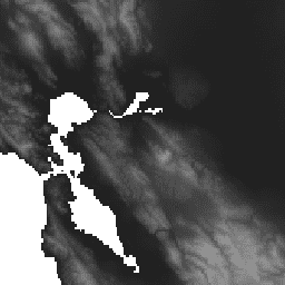
HydroSHEDS 是一种地图产品,可提供水文信息,以一致的格式用于区域和全球范围的应用。它提供了一套不同比例的地理参考数据集(矢量和栅格),包括河流网络、分水岭边界、排水方向和流量累积。HydroSHEDS 基于美国国家航空航天局 (NASA) 的航天飞机雷达地形测绘任务 (SRTM) 于 2000 年获取的海拔数据。
此水文条件化的高程数据集是迭代条件化和校正过程的结果。请注意,调理过程会改变原始 DEM,并可能导致它不适合用于推导排水方向以外的应用。内流盆地(内陆洼地)在其最低点“播种”了一个无数据单元,以终止水流。有关基础数字高程模型的完整详细信息,请访问 HydroSHEDS 网站并参阅相关文档。
此数据集的分辨率为 30 角秒。以 30 角秒为单位提供的数据集包括水文条件 DEM、排水(流向)方向和流量累积。
请注意,对于北纬 60 度以上的区域,HydroSHEDS 数据的质量明显较低,因为没有可用的底层 SRTM 海拔数据,因此使用了分辨率较低的 DEM(USGS 提供的 HYDRO1k)。
HydroSHEDS 由世界自然基金会 (WWF) 的保护科学计划与美国地质调查局、国际热带农业中心、大自然保护协会和德国卡塞尔大学环境系统研究中心合作开发。
频段
波段
像素大小:927.67 米(所有波段)
| 名称 | 单位 | 最小值 | 最大值 | 像素大小 | 说明 |
|---|---|---|---|---|---|
b1 |
米 | -415* | 8247* | 927.67 米 | 海拔 |
使用条款
使用条款
HydroSHEDS 数据可免费用于非商业目的和商业用途。如需了解详情,请参阅许可协议。
引用
Lehner, B.,Verdin, K.、Jarvis, A. (2008):New global hydrography derived from spaceborne elevation data. Eos, Transactions, AGU, 89(10): 93-94.
通过 Earth Engine 探索
代码编辑器 (JavaScript)
var dataset = ee.Image('WWF/HydroSHEDS/30CONDEM');
var elevation = dataset.select('b1');
var elevationVis = {
  min: -50.0,
  max: 3000.0,
  gamma: 2.0,
};
Map.setCenter(-121.652, 38.022, 8);
Map.addLayer(elevation, elevationVis, 'Elevation');