- 数据集可用性
- 2000-02-11T00:00:00Z–2000-02-22T00:00:00Z
- 数据集提供商
- WWF
- 标签
说明
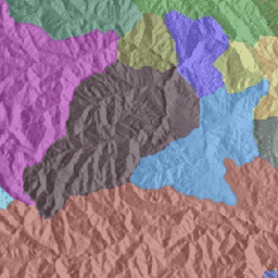
HydroSHEDS 是一种地图产品,可提供统一格式的水文地理信息,适用于区域和全球范围的应用。它提供了一套不同比例的地理参考数据集(矢量和栅格),包括河流网络、分水岭边界、排水方向和流量累积。HydroSHEDS 基于美国国家航空航天局 (NASA) 的航天飞机雷达地形测绘任务 (SRTM) 于 2000 年获取的海拔数据。
此数据集基于 15 角秒(赤道处约为 500 米)分辨率的栅格数据,提供了嵌套的分层集水区多边形。流域的范围从 1 级(粗略)到 12 级(详细),使用 Pfafstetter 代码。
技术文档:
https://hydrosheds.org/images/inpages/HydroBASINS_TechDoc_v1c.pdf
请注意,对于北纬 60 度以上的地区,HydroSHEDS 数据的质量明显较低,因为没有可用的底层 SRTM 高程数据,因此使用了分辨率较低的 DEM(USGS 提供的 HYDRO1k)。
HydroSHEDS 由世界自然基金会 (WWF) 的保护科学计划与美国地质调查局、国际热带农业中心、大自然保护协会和德国卡塞尔大学环境系统研究中心合作开发。
表架构
表架构
| 名称 | 类型 | 说明 |
|---|---|---|
| HYBAS_ID | INT | 前 1 位数字表示地区: * 1 = 非洲 * 2 = 欧洲 * 3 = 西伯利亚 * 4 = 亚洲 * 5 = 澳大利亚 * 6 = 南美洲 * 7 = 北美洲 * 8 = 北极(北美洲) * 9 = 格陵兰。 接下来的 2 位数字定义了 Pfafstetter 级别 (01-12)。值“00”用于包含所有原始子盆地和所有 Pfafstetter 代码(所有级别)的“级别 0”层级;“级别 0”仅存在于 HydroBASINS 的标准格式(不含湖泊)中。 接下来的 6 位数字表示 HydroSHEDS 网络中的唯一标识符;大于 900,000 的值表示湖泊,仅出现在自定义格式(包含湖泊)中 最后 1 位数字表示子流域相对于河流网络的位置(0 = 无侧;1 = 左侧;2 = 右侧)。边仅针对自定义格式(含湖泊)定义。 |
| NEXT_DOWN | INT | 下一个下游多边形的 Hybas_id。 |
| NEXT_SINK | INT | 下一个下游汇的 Hybas_id。 |
| MAIN_BAS | INT | 最下游汇的 Hybas_id,即主要河流盆地的出口。 |
| DIST_SINK | 双精度 | 从多边形出口到下一个下游汇的距离(以公里为单位)。 |
| DIST_MAIN | 双精度 | 从多边形出口到最下游的汇的距离(以公里为单位)。 |
| SUB_AREA | 双精度 | 流域面积(以平方公里为单位)。 |
| UP_AREA | 双精度 | 总上游面积,以平方公里为单位。 |
| PFAF_ID | INT | Pfafstetter 代码。 |
| ENDO | INT | 内陆盆地(无地表径流与海洋相连)的指示器:0 = 不属于内陆盆地;1 = 属于内陆盆地;2 = 内陆盆地的汇(即最下游的多边形)。 |
| COAST | INT | 合并沿海盆地的指示器:0 = 否;1 = 是。沿海盆地是指排入海洋的小型沿海流域的集合体,位于较大的河流流域之间。 |
| ORDER | INT | 河流阶数(经典排序系统)的指示器: * 1 阶表示从汇到源的主干河; * 2 阶表示流入 1 阶河流的所有支流; * 3 阶表示流入 2 阶河流的所有支流;依此类推; * 0 级用于小型沿海分水岭的集合。 |
| SORT | INT | 指示器,用于显示 shapefile 中存储原始多边形的记录编号(序列)(即,从原始 shapefile 中的 1 开始向上计数)。原始多边形按从下游到上游的顺序排序。此字段可用于将多边形排序回其原始序列,或执行拓扑搜索。 |
使用条款
使用条款
HydroSHEDS 数据可免费用于非商业用途和商业用途。如需了解详情,请参阅许可协议。
引用
Lehner, B.、Verdin, K.、Jarvis, A. (2008): New global hydrography derived from spaceborne elevation data. Eos, Transactions, AGU, 89(10): 93-94.
Lehner, B.、Grill G. (2013):Global river hydrography and network routing: baseline data and new approaches to study the world's large river systems. Hydrological Processes, 27(15): 2171-2186. 如需了解数据,请访问 www.hydrosheds.org
使用 Earth Engine 探索
代码编辑器 (JavaScript)
var dataset = ee.FeatureCollection('WWF/HydroSHEDS/v1/Basins/hybas_1');

var visualization = {
  color: '808080',
  strokeWidth: 1
};

dataset = dataset.draw(visualization);

Map.setCenter(-117.731, 53.033, 7);
Map.addLayer(dataset, null, 'Basins');
以 FeatureView 形式直观呈现
FeatureView 是 FeatureCollection 的只读加速表示形式。如需了解详情,请访问
FeatureView 文档。
代码编辑器 (JavaScript)
var fvLayer = ui.Map.FeatureViewLayer(
  'WWF/HydroSHEDS/v1/Basins/hybas_1_FeatureView');

var visParams = {
  color: '808080',
  lineWidth: 1
};

fvLayer.setVisParams(visParams);
fvLayer.setName('Basins');

Map.setCenter(-117.731, 53.033, 7);
Map.add(fvLayer);
