- 数据集可用性
- 2000-02-11T00:00:00Z–2000-02-22T00:00:00Z
- 数据集提供商
- WWF
- 标签
说明
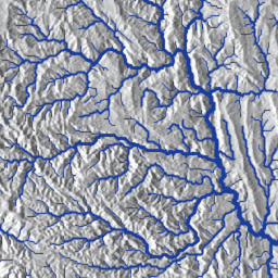
HydroSHEDS 是一种地图产品,可提供统一格式的水文地理信息,适用于区域和全球范围的应用。它提供了一套不同比例的地理参考数据集(矢量和栅格),包括河流网络、分水岭边界、排水方向和流量累积。HydroSHEDS 基于美国国家航空航天局 (NASA) 的航天飞机雷达地形测绘任务 (SRTM) 于 2000 年获取的海拔数据。
此数据集提供表示河流网络的多段线,这些多段线源自其他 HydroSHEDS 数据集,并与这些数据集保持一致。这些数据基于 15 角秒(赤道处约为 500 米)分辨率的栅格数据。
请注意,对于北纬 60 度以上的地区,HydroSHEDS 数据的质量明显较低,因为没有可用的底层 SRTM 高程数据,因此使用了分辨率较低的 DEM(USGS 提供的 HYDRO1k)。
HydroSHEDS 由世界自然基金会 (WWF) 的保护科学计划与美国地质调查局、国际热带农业中心、大自然保护协会和德国卡塞尔大学环境系统研究中心合作开发。
表架构
表架构
| 名称 | 类型 | 说明 |
|---|---|---|
| BAS_ID | INT | 流域标识符。根据 HydroSHEDS 框架标识水文河流盆地 |
| BAS_NAME | STRING | 流域名称(如有)。基于 HydroSHEDS 原始流域和其他来源。 |
| BB_DIS_ORD | INT | 主干河流的流量顺序。主干河道 (BB_ID) 最下游河段的河道顺序 (RIV_ORD)。 |
| BB_ID | INT | 主干河流标识符。表示连续的河流单元(定义为从源头/上游到汇流处/下游的流经路径)。 |
| BB_LEN_KM | 双精度 | 主干河流长度。主干河 (BB_ID) 各河段的长度 (LENGTH_KM) 总和。 |
| BB_OCEAN | 双精度 | 海洋连通性。确定河段是否属于直接连接到海洋的主干河 (BB_ID)(值为 1),否则值为 0。用于根据与海洋的连通性总结统计信息。 |
| BB_VOL_TCM | 双精度 | 主干河流域。主干河道 (BB_ID) 各河段的流量 (VOLUME_TCM) 总和。 |
| CONTINENT | STRING | 大洲的名称。请参阅 CON_ID。 |
| CON_ID | 双精度 | 覆盖面所属的大洲的标识符。大陆边界根据 HydroBASINS 划定。 * 1 = 北美洲 * 2 = 南美洲 * 3 = 欧洲 * 4 = 非洲 * 5 = 亚洲 * 6 = 澳大利亚 |
| 国家/地区 | STRING | 国家/地区名称 |
| CSI | 双精度 | 连接状态。指数范围为 0 到 100%;100% = 完全连接;0% = 无连接。 |
| CSI_D | STRING | 主要压力因素 (DOM)。可能的字段值包括:DOF、DOR、SED、USE、RDD、URB。 |
| CSI_FF | INT | CSI 高于或低于畅通阈值。表示河段的 CSI 值是否低于(值 = 0)或高于(值 = 1)95% 的阈值。该属性用于计算河流的自由流动状态(请参阅 CSI_FF1 和 CSI_FF2)。 |
| CSI_FF1 | INT | 自由流动状态(两个类别)。表示属于“自由流动”状态(值为 1)或“非自由流动”状态(值为 3)的河流的河段。 请注意,值 2 保留给状态为“连接良好”(请参阅 CSI_FF2)的河段。 |
| CSI_FF2 | INT | 自由流动状态(三个类别)。表示属于“自由流动”状态(值为 1)的河流的河段,或“连通性良好”状态(值为 2)的河段,或“受影响”状态(值为 3)的河流或河段。 |
| CSI_FFID | INT | 河段标识符。用于区分相邻河段的其他标识符。 |
| DIS_AV_CMS | 双精度 | 以立方米/秒 (CMS) 为单位的长期(1971-2000 年)平均自然化流量。 |
| DOF | 双精度 | 碎片化程度。指数从 0 到 100%(请参阅手稿的扩展数据图 5a)。 |
| DOR | 双精度 | 监管程度。指数从 0 到 100%(请参阅手稿的扩展数据图 5b)。 |
| ERO_YLD_TO | 双精度 | 每个河段每年侵蚀量的总和(以吨为单位)。计算方式为河段集水区内的泥沙侵蚀量之和(即泥沙侵蚀量不会沿河网累积)。 |
| FLD | 双精度 | 河段集水区内的淹没(洪泛区)范围(百分比)。 |
| GOID | INT | 地图项 ID。 |
| HYFALL | 双精度 | 表示河段中是否存在一个或多个瀑布(1 表示存在,0 表示不存在)。 |
| INC | 双精度 | 过滤字段。在 Grill 等人 (2019) 的研究中,我们考虑了所有河段以用于路线规划,但仅分析了部分河段 (INC = 1) 并生成了相应的结果。 |
| LENGTH_KM | 双精度 | 河段的长度(以公里为单位)。 |
| NDOID | INT | 标识下一个下游河段的 NOID。如果值为 0,则河段表示终端河段(海洋、内陆洼地)。 |
| NOID | INT | 网络对象标识符。与 GOID 的用途相同 |
| NUOID | STRING | 标识下一个上游河段的 NOID。如果给定“NoData”,则河段为源头河段。否则,该字段会包含 2 个或更多 NOID。如果存在多个 NOID,则这些 NOID 会以英文下划线分隔。 |
| OBJECTID | INT | 对象标识符 |
| RDD | 双精度 | 道路施工。指数从 0 到 100%(请参阅手稿的扩展数据图 5e)。 |
| REACH_ID | INT | 覆盖面标识符。覆盖面标识符可用于将此数据集与 HydroATLAS 数据库相关联。 |
| RIV_ORD | INT | 河流顺序。此处定义的河流等级是根据长期平均流量 (DIS_AV_CMS) 使用对数级数计算得出的:* 1 = > 100000 * 2 = 10000 - 100000 * 3 = 1000 - 10000 * 4 = 100 - 1000 * 5 = 10 - 100 * 6 = 1 - 10 * 7 = 0.1 - 1 * 8 = 0.01 - 0.1 * 9 = 0.001 - 0.01 * 10 = < 0.001 |
| SED | 双精度 | 沉积物捕获。指数从 0 到 100%(请参阅手稿的扩展数据图 5c)。 |
| Shape_Leng | 双精度 | 请改用 LENGTH_KM 字段。 |
| UPLAND_SKM | 双精度 | 河段的上游分水岭面积(平方公里,SKM)。 |
| URB | 双精度 | 城市化。指数从 0 到 100%(请参阅手稿的扩展数据图 5f)。 |
| 使用 | 双精度 | 用水量。指数从 0 到 100%(请参阅手稿的扩展数据图 5d)。 |
| VOLUME_TCM | 双精度 | 覆盖渠道的流量(以千立方米 [TCM] 为单位)。使用河道的宽度、长度和深度计算。 |
使用条款
使用条款
HydroSHEDS 数据可免费用于非商业用途和商业用途。如需了解详情,请参阅许可协议。
引用
Lehner, B.、Verdin, K.、Jarvis, A. (2008): New global hydrography derived from spaceborne elevation data. Eos, Transactions, AGU, 89(10): 93-94.
Grill, G.,Lehner, B.、Thieme, M.、Geenen, B.、Tickner, D.、Antonelli, F.、Babu, S.、Borrelli, P.、Cheng, L.、Crochetiere, H. and Macedo, H.E., 2019 年。绘制世界自由流淌的河流。 Nature, 569(7755), p.215. 如需了解数据,请访问 www.hydrosheds.org
使用 Earth Engine 探索
代码编辑器 (JavaScript)
var dataset = ee.FeatureCollection('WWF/HydroSHEDS/v1/FreeFlowingRivers');

// Paint 'RIV_ORD' (river order) value to an image for visualization.
var datasetVis = ee.Image().byte().paint(dataset, 'RIV_ORD', 2);

var visParams = {
  min: 1,
  max: 10,
  palette: ['08519c', '3182bd', '6baed6', 'bdd7e7', 'eff3ff']
};

Map.setCenter(-122.348, 45.738, 9);
Map.addLayer(datasetVis, visParams, 'Free flowing rivers');
Map.addLayer(dataset, null, 'FeatureCollection', false);
以 FeatureView 形式直观呈现
FeatureView 是 FeatureCollection 的只读加速表示形式。如需了解详情,请访问
FeatureView 文档。
代码编辑器 (JavaScript)
var fvLayer = ui.Map.FeatureViewLayer(
  'WWF/HydroSHEDS/v1/FreeFlowingRivers_FeatureView');

var visParams = {
  lineWidth: 2,
  color: {
    property: 'RIV_ORD',
    mode: 'linear',
    palette: ['08519c', '3182bd', '6baed6', 'bdd7e7', 'eff3ff'],
    min: 1,
    max: 10
  }
};

fvLayer.setVisParams(visParams);
fvLayer.setName('Free flowing rivers');

Map.setCenter(-122.348, 45.738, 9);
Map.add(fvLayer);
