NICFI Satellite Data Program Basemaps for Tropical Forest Monitoring - Americas
使用集合让一切井井有条
根据您的偏好保存内容并对其进行分类。
说明
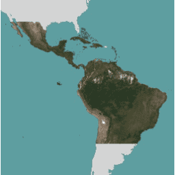
此图片集提供热带地区的高分辨率卫星监测数据,主要目的是减少和扭转热带森林的损失,有助于应对气候变化、保护生物多样性、促进森林再生、恢复和增强,以及促进可持续发展,所有这些用途都必须是非商业用途。
如需了解如何访问基础地图,请按照此处提供的注册说明操作。
NICFI 卫星数据计划镶嵌图(也称为 Planet-NICFI 镶嵌图)包含每月和每半年生成的半年期集合。镶嵌的类型存储在图片元数据字段“cadence”中。使用该字段以及每个镶嵌块的开始日期和结束日期来查找所需的影像。
有关基本地图的完整详细信息,请参阅 NICFI 卫星数据计划基本地图规范。
如需详细了解 NICFI(挪威国际气候和森林倡议)卫星数据计划及所提供的数据,请访问该计划的网站。
为了支持 NICFI 的使命,您可以将这些数据用于许多项目,包括但不限于:
- 推进有关世界热带森林及其提供的关键服务的科学研究。
- 在热带森林发展中国家和管辖区实施并改进可持续森林管理和土地利用政策。
- 提高热带地区的透明度和问责制。
- 保护和改善热带森林国家/地区的原住民和当地社区的权利。
- 创新解决方案,以减轻全球商品和金融市场对森林造成的压力。
频段
像素尺寸
4.77 米
频段
名称 |
最小值 |
最大值 |
缩放 |
像素尺寸 |
说明 |
B |
0
|
10000
|
0.0001 |
米
|
蓝色 |
G |
0
|
10000
|
0.0001 |
米
|
绿色 |
R |
0
|
10000
|
0.0001 |
米
|
红色 |
N |
0
|
10000
|
0.0001 |
米
|
近红外线 |
图片属性
图片属性
名称 |
类型 |
说明 |
步频 |
STRING |
镶嵌图覆盖的时间间隔:每月或每半年 |
使用条款
使用条款
为了支持 NICFI 卫星数据计划的宗旨,此数据在使用、复制和分发方面存在限制。如需查看完整的许可协议,请点击此处。
版权声明:
图片 © 20xx Planet Labs PBC(其中 xx 表示所用内容的年份)
引用
Planet 团队 (2017)。Planet Application Program Interface: In Space for Life
on Earth. San Francisco, CA. https://api.planet.com
使用 Earth Engine 探索
代码编辑器 (JavaScript)
// This collection is not publicly accessible. To sign up for access,
// please see https://developers.planet.com/docs/integrations/gee/nicfi
var nicfi = ee.ImageCollection('projects/planet-nicfi/assets/basemaps/americas');
// Filter basemaps by date and get the first image from filtered results
var basemap= nicfi.filter(ee.Filter.date('2021-03-01','2021-07-01')).first();
Map.centerObject(basemap, 4);
var vis = {'bands':['R','G','B'],'min':64,'max':5454,'gamma':1.8};
Map.addLayer(basemap, vis, '2021-03 mosaic');
Map.addLayer(
basemap.normalizedDifference(['N','R']).rename('NDVI'),
{min:-0.55,max:0.8,palette: [
'8bc4f9', 'c9995c', 'c7d270','8add60','097210'
]}, 'NDVI', false);
在代码编辑器中打开
[null,null,[],[[["\u003cp\u003eThis dataset provides high-resolution satellite monitoring of the tropics to reduce and reverse tropical forest loss for non-commercial use.\u003c/p\u003e\n"],["\u003cp\u003eIt includes monthly and biannual mosaics with imagery available from 2015 to 2024.\u003c/p\u003e\n"],["\u003cp\u003eAccess to the dataset requires signing up through Planet, the dataset provider and catalog owner.\u003c/p\u003e\n"],["\u003cp\u003eThe dataset is intended for research, policy implementation, transparency, and the protection of indigenous rights related to tropical forests.\u003c/p\u003e\n"],["\u003cp\u003eImagery is at 4.77-meter resolution and includes Blue, Green, Red, and Near-infrared bands.\u003c/p\u003e\n"]]],[],null,["# NICFI Satellite Data Program Basemaps for Tropical Forest Monitoring - Americas\n\ninfo\n\n\nThis dataset is part of a Publisher Catalog, and not managed by Google Earth Engine.\n\nContact support@planet.com\n\nfor bugs or [view more datasets](https://developers.google.com/earth-engine/datasets/publisher/planet-nicfi)\nfrom the Planet Catalog. [Learn more about Publisher datasets](/earth-engine/datasets/publisher). \n[](https://planet.com/nicfi) \n\nCatalog Owner\n: Planet\n\nDataset Availability\n: 2015-12-01T00:00:00Z--2025-07-01T00:00:00Z\n\nDataset Provider\n:\n\n\n [Planet](https://planet.com/nicfi)\n\nTags\n:\n[basemaps](/earth-engine/datasets/tags/basemaps) [forest](/earth-engine/datasets/tags/forest) [nicfi](/earth-engine/datasets/tags/nicfi) [planet](/earth-engine/datasets/tags/planet) [planet-nicfi](/earth-engine/datasets/tags/planet-nicfi) [publisher-dataset](/earth-engine/datasets/tags/publisher-dataset) [satellite-imagery](/earth-engine/datasets/tags/satellite-imagery) [sr](/earth-engine/datasets/tags/sr) [surface-reflectance](/earth-engine/datasets/tags/surface-reflectance) [tropics](/earth-engine/datasets/tags/tropics) \n\n#### Description\n\nThis image collection provides access to high-resolution satellite\nmonitoring of the tropics for the primary purpose of reducing and reversing the\nloss of tropical forests, contributing to combating climate change, conserving\nbiodiversity, contributing to forest regrowth, restoration and enhancement, and\nfacilitating sustainable development, all of which must be Non-Commercial Use.\n\nTo learn how to access the Basemaps, follow the\n[sign up instructions here](https://developers.planet.com/docs/integrations/gee/nicfi/).\n\nThe NICFI Satellite Data Program mosaics (also referred to as Planet-NICFI\nmosaics) contain both monthly and biannual collections generated every\n6 months. The type of the mosaic is stored in the image metadata field\n'cadence'. Use that field along with the start and end date for each mosaic\nto find the desired imagery.\n\nFull details about the Basemaps are available in\n[NICFI Satellite Data Program Basemap spec](https://assets.planet.com/docs/NICFI_Basemap_Spec_Addendum.pdf).\n\nFor more information about the NICFI (Norway's International Climate\nand Forest Initiative) Satellite Data Program and the data offered,\nplease visit\n[the Program's website](https://assets.planet.com/docs/NICFI_General_FAQs.pdf).\n\nIn support of NICFI's mission, you can use this data for a number of projects\nincluding, but not limited to:\n\n- Advance scientific research about the world's tropical forests and the critical services they provide.\n- Implement and improve policies for sustainable forest management and land use in developing tropical forest countries and jurisdictions.\n- Increase transparency and accountability in the tropics.\n- Protect and improve the rights of indigenous peoples and local communities in tropical forest countries.\n- Innovate solutions towards reducing pressure on forests from global commodities and financial markets.\n\n### Bands\n\n\n**Pixel Size**\n\n4.77 meters\n\n**Bands**\n\n| Name | Min | Max | Scale | Pixel Size | Description |\n|------|-----|-------|--------|------------|---------------|\n| `B` | 0 | 10000 | 0.0001 | meters | Blue |\n| `G` | 0 | 10000 | 0.0001 | meters | Green |\n| `R` | 0 | 10000 | 0.0001 | meters | Red |\n| `N` | 0 | 10000 | 0.0001 | meters | Near-infrared |\n\n### Image Properties\n\n**Image Properties**\n\n| Name | Type | Description |\n|---------|--------|-----------------------------------------------------|\n| cadence | STRING | The interval the mosaic covers: monthly or biannual |\n\n### Terms of Use\n\n**Terms of Use**\n\nThis data has usage, reproduction, and distribution restrictions in support\nof the NICFI Satellite Data Program purpose. The full licensing agreement is available\n[here](https://assets.planet.com/docs/Planet_ParticipantLicenseAgreement_NICFI.pdf).\n\nCopyright notice:\n\nImage © 20xx Planet Labs PBC (where xx denotes the year of the content\nused)\n\n### Citations\n\nCitations:\n\n- Planet Team (2017). Planet Application Program Interface: In Space for Life\n on Earth. San Francisco, CA. \u003chttps://api.planet.com\u003e\n\n### Explore with Earth Engine\n\n| **Important:** Earth Engine is a platform for petabyte-scale scientific analysis and visualization of geospatial datasets, both for public benefit and for business and government users. Earth Engine is free to use for research, education, and nonprofit use. To get started, please [register for Earth Engine access.](https://console.cloud.google.com/earth-engine)\n\n### Code Editor (JavaScript)\n\n```javascript\n// This collection is not publicly accessible. To sign up for access,\n// please see https://developers.planet.com/docs/integrations/gee/nicfi\nvar nicfi = ee.ImageCollection('projects/planet-nicfi/assets/basemaps/americas');\n\n// Filter basemaps by date and get the first image from filtered results\nvar basemap= nicfi.filter(ee.Filter.date('2021-03-01','2021-07-01')).first();\n\nMap.centerObject(basemap, 4);\n\nvar vis = {'bands':['R','G','B'],'min':64,'max':5454,'gamma':1.8};\n\nMap.addLayer(basemap, vis, '2021-03 mosaic');\nMap.addLayer(\n basemap.normalizedDifference(['N','R']).rename('NDVI'),\n {min:-0.55,max:0.8,palette: [\n '8bc4f9', 'c9995c', 'c7d270','8add60','097210'\n ]}, 'NDVI', false);\n```\n[Open in Code Editor](https://code.earthengine.google.com/?scriptPath=Examples:Datasets/planet-nicfi/projects_planet-nicfi_assets_basemaps_americas) \n[NICFI Satellite Data Program Basemaps for Tropical Forest Monitoring - Americas](/earth-engine/datasets/catalog/projects_planet-nicfi_assets_basemaps_americas) \nThis image collection provides access to high-resolution satellite monitoring of the tropics for the primary purpose of reducing and reversing the loss of tropical forests, contributing to combating climate change, conserving biodiversity, contributing to forest regrowth, restoration and enhancement, and facilitating sustainable development, all of which must be Non-Commercial Use. ... \nprojects/planet-nicfi/assets/basemaps/americas, basemaps,forest,nicfi,planet,planet-nicfi,publisher-dataset,satellite-imagery,sr,surface-reflectance,tropics \n2015-12-01T00:00:00Z/2025-07-01T00:00:00Z \n-30.4 -118.5 30.4 -34.5 \nGoogle Earth Engine \nhttps://developers.google.com/earth-engine/datasets\n\n- [](https://doi.org/https://planet.com/nicfi)\n- [](https://doi.org/https://developers.google.com/earth-engine/datasets/catalog/projects_planet-nicfi_assets_basemaps_americas)"]]