Die Forest Data Partnership stärkt die Zusammenarbeit und Anwendung im Bereich der globalen Überwachung von rohstoffbedingter Entwaldung, Waldschädigung und Wiederaufforstungsbemühungen auf der ganzen Welt.
-
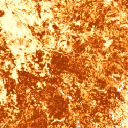
Modell für die Wahrscheinlichkeit von Kakao 2025a
Hinweis: Dieses Dataset wurde noch nicht von Fachkollegen überprüft. Weitere Informationen finden Sie in dieser README-Datei auf GitHub. Diese Bildsammlung enthält die geschätzte Wahrscheinlichkeit pro Pixel, dass der zugrunde liegende Bereich von der Ware belegt ist. Die Wahrscheinlichkeitsschätzungen werden mit einer Auflösung von 10 Metern bereitgestellt und wurden von … generiert. agriculture biodiversity conservation crop eudr forestdatapartnership -
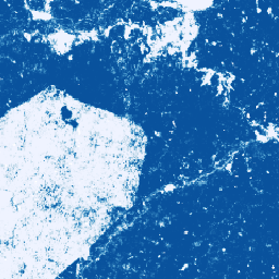
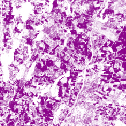
Kaffeewahrscheinlichkeitsmodell 2025a
Hinweis: Dieses Dataset wurde noch nicht von Fachkollegen überprüft. Weitere Informationen finden Sie in dieser README-Datei auf GitHub. Diese Bildsammlung enthält die geschätzte Wahrscheinlichkeit pro Pixel, dass der zugrunde liegende Bereich von der Ware belegt ist. Die Wahrscheinlichkeitsschätzungen werden mit einer Auflösung von 10 Metern bereitgestellt und wurden von … generiert. agriculture biodiversity conservation crop eudr forestdatapartnership -
Forest Persistence v0
Hinweis: Dieses Dataset wurde noch nicht von Fachkollegen überprüft. Weitere Informationen finden Sie in der GitHub-README-Datei, die mit diesem Modell verknüpft ist. Dieses Bild enthält einen pixelgenauen Wert (im Bereich [0, 1]), der angibt, ob der Pixelbereich im Jahr 2020 von unberührtem Wald bedeckt war. Diese Werte sind … biodiversity conservation deforestation eudr forest-biomass forestdatapartnership -
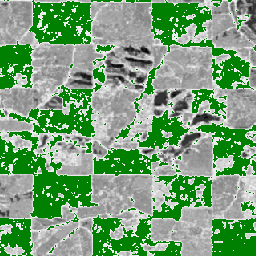
Palm Probability-Modell 2025a
Hinweis: Dieses Dataset wurde noch nicht von Fachkollegen überprüft. Weitere Informationen finden Sie in dieser README-Datei auf GitHub. Diese Bildsammlung enthält die geschätzte Wahrscheinlichkeit pro Pixel, dass der zugrunde liegende Bereich von der Ware belegt ist. Die Wahrscheinlichkeitsschätzungen werden mit einer Auflösung von 10 Metern bereitgestellt und wurden von … generiert. agriculture biodiversity conservation crop eudr forestdatapartnership -
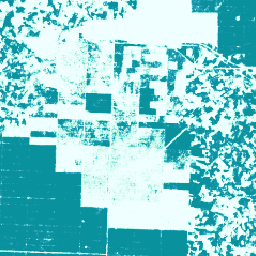
Wahrscheinlichkeitsmodell für Gummibäume 2025a
Hinweis: Dieses Dataset wurde noch nicht von Fachkollegen überprüft. Weitere Informationen finden Sie in dieser README-Datei auf GitHub. Diese Bildsammlung enthält die geschätzte Wahrscheinlichkeit pro Pixel, dass der zugrunde liegende Bereich von der Ware belegt ist. Die Wahrscheinlichkeitsschätzungen werden mit einer Auflösung von 10 Metern bereitgestellt und wurden von … generiert. agriculture biodiversity conservation crop eudr forestdatapartnership