Оптимизируйте свои подборки
Сохраняйте и классифицируйте контент в соответствии со своими настройками.
Лаборатория «Земля и углерод», созданная Институтом мировых ресурсов (WRI) и Фондом Земли Безоса, учредила исследовательский консорциум «Глобальный надзор за пастбищами». Консорциум, в состав которого входят эксперты в области геопространственного мониторинга, машинного обучения, экологии и сельского хозяйства из ведущих мировых исследовательских институтов, разрабатывает глобальные продукты для лугопастбищных угодий и выпаса скота в XXI веке.
Ежегодный доминирующий класс пастбищ GPW, версия 1
Этот набор данных содержит глобальные ежегодные карты доминантных классов лугов (культивируемых и естественных/полуестественных) с 2000 по 2022 год с пространственным разрешением 30 м. Карта, составленная в рамках инициативы Land & Carbon Lab Global Pasture Watch, включает в себя все типы земельного покрова, занимающие не менее 30%…
Ежегодные вероятности появления возделываемых пастбищ, GPW, версия 1
Этот набор данных содержит глобальные ежегодные карты вероятности распространения возделываемых пастбищ с 2000 по 2022 год с пространственным разрешением 30 м. Карта, составленная в рамках инициативы Land & Carbon Lab Global Pasture Watch, включает в себя любой тип земельного покрова, содержащий не менее 30% сухих или…
Ежегодная вероятность появления естественных/полуестественных пастбищ (GPW, версия 1)
Этот набор данных содержит глобальные ежегодные карты вероятности естественных/полуестественных пастбищ с 2000 по 2022 год с пространственным разрешением 30 м. Карта, составленная в рамках инициативы Land & Carbon Lab Global Pasture Watch, включает в себя любой тип земельного покрова, содержащий не менее 30% сухих или…
Годовая некалиброванная валовая первичная продуктивность (uGPP) GPW, версия 1
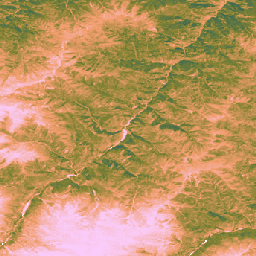
Этот набор данных содержит глобальные некалиброванные данные о валовой первичной продуктивности на основе данных ЭО с 2000 года с пространственным разрешением 30 м. Текущий набор данных, созданный в рамках инициативы Land & Carbon Lab Global Pasture Watch, содержит значения валовой первичной продуктивности (ВПП) по всему миру с пространственным разрешением 30 м с 2000 года. Значения ВПП…
[null,null,[],[[["\u003cp\u003eThe Global Pasture Watch research consortium, initiated by the Land & Carbon Lab, focuses on developing global products for grasslands and livestock grazing.\u003c/p\u003e\n"],["\u003cp\u003eThe consortium comprises experts in geospatial monitoring, machine learning, ecology, and agriculture from leading research institutions.\u003c/p\u003e\n"],["\u003cp\u003eThree key datasets are provided: annual probability maps of cultivated grasslands, dominant class maps of grasslands, and annual probability maps of natural/semi-natural grasslands.\u003c/p\u003e\n"],["\u003cp\u003eThese datasets offer global coverage from 2000 to 2022 at a 30-meter spatial resolution.\u003c/p\u003e\n"],["\u003cp\u003eThe mapped grassland extent includes any land cover type containing at least 30% grassland.\u003c/p\u003e\n"]]],["The Land & Carbon Lab, in collaboration with the WRI and Bezos Earth Fund, formed the Global Pasture Watch consortium. This group of experts develops global products for grassland and livestock monitoring. They produce annual maps from 2000-2022 at 30-meter resolution detailing the probability of cultivated, natural/semi-natural grasslands, and dominant grassland classes. The maps identify any land cover containing at least 30% of dry or.\n"],null,["# Global Pasture Watch\n\nThe Land \\& Carbon Lab, convened by the World Resources Institute (WRI) and the Bezos Earth Fund, established the Global Pasture Watch research consortium. The consortium, which is made up of experts in geospatial monitoring, machine learning, ecology and agriculture across some of the world's leading research institutions, is developing global products for grasslands and livestock grazing in the 21st century. \n[](https://landcarbonlab.org/data/global-grassland-and-livestock-monitoring) \n-\n\n |-------------------------------------------------------------------------------------------------------------------------------------------------------------------------------------------------------------------------------------------------------------------------------------------------------------------------------------|\n | [### GPW Annual Dominant Class of Grasslands v1](/earth-engine/datasets/catalog/projects_global-pasture-watch_assets_ggc-30m_v1_grassland_c) |\n | This dataset provides global annual dominant class maps of grasslands (cultivated and natural/semi-natural) from 2000 to 2022 at 30-m spatial resolution. Produced by Land \\& Carbon Lab Global Pasture Watch initiative, the mapped grassland extent includes any land cover type, which contains at least 30% ... |\n | [global](/earth-engine/datasets/tags/global) [global-pasture-watch](/earth-engine/datasets/tags/global-pasture-watch) [land](/earth-engine/datasets/tags/land) [landcover](/earth-engine/datasets/tags/landcover) [landuse](/earth-engine/datasets/tags/landuse) [landuse-landcover](/earth-engine/datasets/tags/landuse-landcover) |\n\n-\n\n |-------------------------------------------------------------------------------------------------------------------------------------------------------------------------------------------------------------------------------------------------------------------------------------------------------------------------------------|\n | [### GPW Annual Probabilities of Cultivated Grasslands v1](/earth-engine/datasets/catalog/projects_global-pasture-watch_assets_ggc-30m_v1_cultiv-grassland_p) |\n | This dataset provides global annual probability maps of cultivated grassland from 2000 to 2022 at 30-m spatial resolution. Produced by Land \\& Carbon Lab Global Pasture Watch initiative, the mapped grassland extent includes any land cover type, which contains at least 30% of dry or ... |\n | [global](/earth-engine/datasets/tags/global) [global-pasture-watch](/earth-engine/datasets/tags/global-pasture-watch) [land](/earth-engine/datasets/tags/land) [landcover](/earth-engine/datasets/tags/landcover) [landuse](/earth-engine/datasets/tags/landuse) [landuse-landcover](/earth-engine/datasets/tags/landuse-landcover) |\n\n-\n\n |-------------------------------------------------------------------------------------------------------------------------------------------------------------------------------------------------------------------------------------------------------------------------------------------------------------------------------------|\n | [### GPW Annual Probabilities of Natural/Semi-natural Grasslands v1](/earth-engine/datasets/catalog/projects_global-pasture-watch_assets_ggc-30m_v1_nat-semi-grassland_p) |\n | This dataset provides global annual probability maps of natural/semi-natural grassland from 2000 to 2022 at 30-m spatial resolution. Produced by Land \\& Carbon Lab Global Pasture Watch initiative, the mapped grassland extent includes any land cover type, which contains at least 30% of dry or ... |\n | [global](/earth-engine/datasets/tags/global) [global-pasture-watch](/earth-engine/datasets/tags/global-pasture-watch) [land](/earth-engine/datasets/tags/land) [landcover](/earth-engine/datasets/tags/landcover) [landuse](/earth-engine/datasets/tags/landuse) [landuse-landcover](/earth-engine/datasets/tags/landuse-landcover) |\n\n-\n\n |---------------------------------------------------------------------------------------------------------------------------------------------------------------------------------------------------------------------------------------------------------------------------------------------------------------------------------------|\n | [### GPW Annual uncalibrated Gross Primary Productivity (uGPP) v1](/earth-engine/datasets/catalog/projects_global-pasture-watch_assets_ggpp-30m_v1_ugpp_m) |\n | This dataset provides global uncalibrated EO-based Gross Primary Productivity from 2000 at 30-m spatial resolution. Produced by Land \\& Carbon Lab Global Pasture Watch initiative, the current dataset provides Gross Primary Productivity (GPP) values globally at 30-m spatial resolution from 2000 onwards. GPP values are ... |\n | [global](/earth-engine/datasets/tags/global) [global-pasture-watch](/earth-engine/datasets/tags/global-pasture-watch) [land](/earth-engine/datasets/tags/land) [landcover](/earth-engine/datasets/tags/landcover) [landuse](/earth-engine/datasets/tags/landuse) [plant-productivity](/earth-engine/datasets/tags/plant-productivity) |"]]