-
GHSL:2018 年全球建筑高度 (P2023A)

此空间栅格数据集以 100 米的分辨率描绘了 2018 年的全球建筑高度分布情况。用于预测建筑高度的输入数据包括 ALOS 全球数字地表模型(30 米)、NASA 航天飞机雷达地形测绘任务 … alos building built built-environment builtup copernicus -
GHSL:1975-2030 年全球建筑体积 (P2023A)

此栅格数据集描绘了全球建筑体积分布情况,以每 100 米网格单元的立方米数表示。该数据集测量了总建筑体积以及分配给以非住宅 (NRES) 为主的网格单元的建筑体积。估算值基于建成区 … alos building built-environment copernicus dem ghsl -
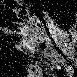
GHSL:全球建成区地表 10 米 (P2023A)

此栅格数据集描绘了 2018 年从 S2 图像数据中观察到的建成区地表分布情况,以每 10 米网格单元的平方米数表示。该数据集测量了:a) 总建成区地表,以及 b) 分配给以非住宅 (NRES) 为主的网格单元的建成区地表。 built built-environment builtup copernicus ghsl jrc -
GHSL:1975-2030 年全球建成区地表 (P2023A)
此栅格数据集描绘了建成区地表分布情况,以每 100 米网格单元的平方米数表示。该数据集测量了:a) 总建成区地表,以及 b) 分配给以非住宅 (NRES) 为主的网格单元的建成区地表。数据经过时空插值或 … built built-environment builtup copernicus ghsl jrc
Datasets tagged built-environment in Earth Engine
[null,null,[],[],["The content describes four spatial raster datasets from the Global Human Settlement Layer (GHSL). One dataset maps global building heights in 2018 at 100m resolution. Two datasets map built-up surfaces: one at 100m resolution from 1975-2030, and another at 10m resolution for 2018. These built up surfaces also differentiate between residential and non-residential. The final dataset details the global building volume from 1975-2030, measured in cubic meters per 100m grid cell.\n"]]