-
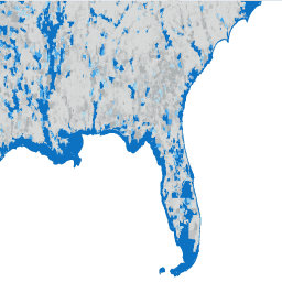
TIGER:2020 年制表(人口普查)街区
美国人口普查局会定期发布名为 TIGER 的地理数据库。此数据集包含 2020 年的人口普查街区,大致相当于一个城市街区。有 800 多万个多边形地图项覆盖美国、哥伦比亚特区、波多黎各和岛屿地区。… 人口普查 城市 基础设施边界 社区 表 tiger -
TIGER:美国人口普查街区组 (BG) 2010
美国人口普查局会定期发布名为 TIGER 的地理数据库。此数据集包含 2010 年的人口普查街区组,即同一人口普查区内的一组街区,这些街区的四位数人口普查街区编号的第一位数字相同。有 … 人口普查 城市 基础设施边界 社区 表 tiger -
TIGER:美国人口普查街区组 (BG) 2020

美国人口普查局会定期发布名为 TIGER 的地理数据库。此数据集包含 2020 年的人口普查街区组,即同一人口普查区内的一组街区,这些街区的四位数人口普查街区编号的第一位数字相同。有 … 人口普查 城市 基础设施边界 社区 表 tiger -
TIGER:美国人口普查街区
美国人口普查局会定期发布名为 TIGER 的地理数据库。此数据集包含 2010 年的人口普查街区,大致相当于一个城市街区。有 1100 多万个多边形地图项覆盖美国、哥伦比亚特区、波多黎各和岛屿地区。… 人口普查 城市 基础设施边界 社区 表 tiger -
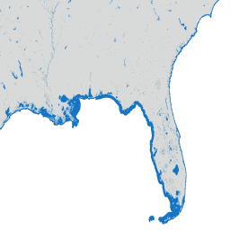
TIGER:美国人口普查县 2016

美国人口普查局 TIGER 数据集包含美国各州主要法律划分的 2016 年边界。在大多数州,这些实体被称为“县”。在路易斯安那州,这些划分被称为“教区”。阿拉斯加州有称为“自治市”的政府实体,这些实体在政府职能方面与县类似。… 人口普查 县 基础设施边界 表 tiger us -
TIGER:美国人口普查县 2018

美国人口普查局 TIGER 数据集包含美国各州主要法律划分的 2018 年边界。在大多数州,这些实体被称为“县”。在路易斯安那州,这些划分被称为“教区”。阿拉斯加州有称为“自治市”的政府实体,这些实体在政府职能方面与县类似。… 人口普查 县 基础设施边界 表 tiger us -
TIGER:美国人口普查道路
此美国人口普查局 TIGER 数据集包含 2016 年版本中的所有路段,其中包含 1900 多万个单独的线地图项,覆盖美国、哥伦比亚特区、波多黎各和岛屿地区。每个地图项都代表一个路段几何图形(… 人口普查 基础设施边界 道路 表 tiger us -
TIGER:美国人口普查州 2016

美国人口普查局 TIGER 数据集包含美国主要政府划分的 2016 年边界。除了 50 个州之外,人口普查局还包括哥伦比亚特区、波多黎各和每个岛屿地区(美属萨摩亚、… 人口普查 基础设施边界 州 州 表 tiger -
TIGER:美国人口普查州 2018
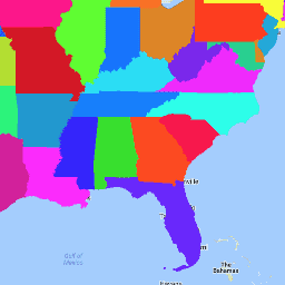
美国人口普查局 TIGER 数据集包含美国主要政府划分的 2018 年边界。除了 50 个州之外,人口普查局还包括哥伦比亚特区、波多黎各和每个岛屿地区(美属萨摩亚、… 人口普查 基础设施边界 州 州 表 tiger -
TIGER:美国人口普查区

美国人口普查局会定期发布名为 TIGER 的地理数据库。此数据集包含 2020 年的人口普查区。人口普查区的面积差异很大,但在城市地区大致相当于一个社区。有 85000 多个多边形地图项覆盖美国、哥伦比亚特区、… 人口普查 城市 基础设施边界 社区 表 tiger -
TIGER:美国人口普查区人口统计信息 - 个人资料 1
美国人口普查局会定期发布名为 TIGER 的地理数据库。此表包含按人口普查区汇总的 2010 年人口普查人口统计信息个人资料 1 值。人口普查区的面积差异很大,但在城市地区大致相当于一个社区。有大约 74,000 个多边形地图项… 人口普查 基础设施边界 表 tiger us
Datasets tagged census in Earth Engine
[null,null,[],[],["The U.S. Census Bureau's TIGER geodatabase provides detailed geographic data, including census blocks, block groups, tracts, and 5-digit ZIP Code tabulation areas. Datasets also include 2016 and 2018 boundaries for counties and states, along with 2016 road segments. These resources cover the US, District of Columbia, Puerto Rico, and island areas, offering polygon and line features for analysis of urban, county and neighborhood areas.\n"]]