-
Google 全球基于 Landsat 的 CCDC 细分数据集(1999-2019 年)
此集合包含对 20 年份的 Landsat 地表反射率数据运行连续变化检测和分类 (CCDC) 算法后预先计算的结果。CCDC 是一种断点查找算法,它使用带有动态 RMSE 阈值的谐波拟合来检测时间序列数据中的断点。… change-detection google landcover landsat-derived landuse landuse-landcover -
JRC 全球地表水域绘图图层,版本 1.4
此数据集包含 1984 年至 2021 年间地表水的位置和时间分布图,并提供了这些水面的范围和变化情况的统计数据。如需了解详情,请参阅相关期刊文章:高分辨率绘制全球地表水及其 … change-detection geophysical google jrc landsat-derived surface -
MCD64A1.061 MODIS 燃烧面积月度全球 500 米
结合使用 Terra 和 Aqua 的 MCD64A1 版本 6.1 烧毁面积数据产品是一种每月全球网格化 500 米数据产品,包含每个像素的烧毁面积和质量信息。MCD64A1 烧毁区域绘制方法采用 500 米 MODIS 地表反射率图像与 1 公里 MODIS 活火灾观测数据相结合。该算法… burn change-detection fire geophysical global mcd64a1 -
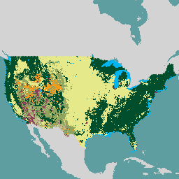
USFS Landscape Change Monitoring System v2024.10(美国本土和美国境外)
此产品属于景观变化监测系统 (LCMS) 数据套件。该数据集显示了 LCMS 模型模拟的每年变化、土地覆盖和/或土地利用类别,涵盖美国大陆 (CONUS) 以及美国大陆以外 (OCONUS) 的区域,包括阿拉斯加州 (AK)、波多黎各、美属维尔京群岛、美属萨摩亚、北马里亚纳群岛、关岛、美属 … change-detection forest gtac landcover landuse landuse-landcover -
VNP64A1:每月烧毁面积 L4 全球 500 米 SIN 网格
每日 Suomi NPP 美国宇航局可见光谱红外成像辐射计套件 (VIIRS) 烧毁面积 (VNP64A1) 版本 1 数据产品是一种每月全球网格化 500 米产品,包含每个像素的烧毁面积和质量信息。VNP64 烧毁区域绘制方法采用 750 米 VIIRS … burn change-detection fire land nasa noaa
Datasets tagged change-detection in Earth Engine
[null,null,[],[[["\u003cp\u003eThis webpage features curated datasets focused on land change detection using satellite imagery.\u003c/p\u003e\n"],["\u003cp\u003eDatasets provide insights into surface water changes, burned areas, and land cover/use transformations.\u003c/p\u003e\n"],["\u003cp\u003eData sources include Landsat, MODIS, VIIRS, and algorithms like CCDC for analyzing temporal patterns.\u003c/p\u003e\n"],["\u003cp\u003eGlobal and regional coverage is offered, with examples such as the USFS Landscape Change Monitoring System.\u003c/p\u003e\n"],["\u003cp\u003eThe collection spans multiple decades, enabling long-term change analysis and monitoring efforts.\u003c/p\u003e\n"]]],[],null,["# Datasets tagged change-detection in Earth Engine\n\n-\n\n |---------------------------------------------------------------------------------------------------------------------------------------------------------------------------------------------------------------------------------------------------------------------------------------------------------------------------------------------------|\n | [### Google Global Landsat-based CCDC Segments (1999-2019)](/earth-engine/datasets/catalog/GOOGLE_GLOBAL_CCDC_V1) |\n | This collection contains precomputed results from running the Continuous Change Detection and Classification (CCDC) algorithm on 20 years of Landsat surface reflectance data. CCDC is a break-point finding algorithm that uses harmonic fitting with a dynamic RMSE threshold to detect breakpoints in time-series data. The ... |\n | [change-detection](/earth-engine/datasets/tags/change-detection) [google](/earth-engine/datasets/tags/google) [landcover](/earth-engine/datasets/tags/landcover) [landsat-derived](/earth-engine/datasets/tags/landsat-derived) [landuse](/earth-engine/datasets/tags/landuse) [landuse-landcover](/earth-engine/datasets/tags/landuse-landcover) |\n\n-\n\n |---------------------------------------------------------------------------------------------------------------------------------------------------------------------------------------------------------------------------------------------------------------------------------------------------------------------------|\n | [### JRC Global Surface Water Mapping Layers, v1.4](/earth-engine/datasets/catalog/JRC_GSW1_4_GlobalSurfaceWater) |\n | This dataset contains maps of the location and temporal distribution of surface water from 1984 to 2021 and provides statistics on the extent and change of those water surfaces. For more information see the associated journal article: High-resolution mapping of global surface water and its ... |\n | [change-detection](/earth-engine/datasets/tags/change-detection) [geophysical](/earth-engine/datasets/tags/geophysical) [google](/earth-engine/datasets/tags/google) [jrc](/earth-engine/datasets/tags/jrc) [landsat-derived](/earth-engine/datasets/tags/landsat-derived) [surface](/earth-engine/datasets/tags/surface) |\n\n-\n\n |-----------------------------------------------------------------------------------------------------------------------------------------------------------------------------------------------------------------------------------------------------------------------------------------------------------------------------------------|\n | [### MCD64A1.061 MODIS Burned Area Monthly Global 500m](/earth-engine/datasets/catalog/MODIS_061_MCD64A1) |\n | The Terra and Aqua combined MCD64A1 Version 6.1 Burned Area data product is a monthly, global gridded 500m product containing per-pixel burned-area and quality information. The MCD64A1 burned-area mapping approach employs 500m MODIS Surface Reflectance imagery coupled with 1km MODIS active fire observations. The algorithm ... |\n | [burn](/earth-engine/datasets/tags/burn) [change-detection](/earth-engine/datasets/tags/change-detection) [fire](/earth-engine/datasets/tags/fire) [geophysical](/earth-engine/datasets/tags/geophysical) [global](/earth-engine/datasets/tags/global) [mcd64a1](/earth-engine/datasets/tags/mcd64a1) |\n\n-\n\n |-----------------------------------------------------------------------------------------------------------------------------------------------------------------------------------------------------------------------------------------------------------------------------------------------------------------------------|\n | [### USFS Landscape Change Monitoring System v2024.10 (CONUS and OCONUS)](/earth-engine/datasets/catalog/USFS_GTAC_LCMS_v2024-10) |\n | This product is part of the Landscape Change Monitoring System (LCMS) data suite. It shows LCMS-modeled change, land cover, and/or land use classes for each year and covers the Conterminous United States (CONUS) as well as areas outside the CONUS (OCONUS) including Alaska (AK), Puerto ... |\n | [change-detection](/earth-engine/datasets/tags/change-detection) [forest](/earth-engine/datasets/tags/forest) [gtac](/earth-engine/datasets/tags/gtac) [landcover](/earth-engine/datasets/tags/landcover) [landuse](/earth-engine/datasets/tags/landuse) [landuse-landcover](/earth-engine/datasets/tags/landuse-landcover) |\n\n-\n\n |---------------------------------------------------------------------------------------------------------------------------------------------------------------------------------------------------------------------------------------------------------------------------------------------------------------------------------------|\n | [### VNP64A1: Burned Area Monthly L4 Global 500m SIN Grid](/earth-engine/datasets/catalog/NOAA_VIIRS_001_VNP64A1) |\n | The daily Suomi National Polar-Orbiting Partnership (Suomi NPP) NASA Visible Infrared Imaging Radiometer Suite (VIIRS) Burned Area (VNP64A1) Version 1 data product is a monthly, global gridded 500m product containing per-pixel burned area and quality information. The VNP64 burned area mapping approach employs 750m VIIRS ... |\n | [burn](/earth-engine/datasets/tags/burn) [change-detection](/earth-engine/datasets/tags/change-detection) [fire](/earth-engine/datasets/tags/fire) [land](/earth-engine/datasets/tags/land) [nasa](/earth-engine/datasets/tags/nasa) [noaa](/earth-engine/datasets/tags/noaa) |"]]