-
科特迪瓦 BNETD 2020 土地覆盖图
科特迪瓦 BNETD 2020 土地覆盖图由科特迪瓦政府通过国家机构(国家研究办公室技术和发展地理信息中心 [BNETD-CIGN])制作,并获得了欧盟的技术和财政支持。方法… 分类 森林砍伐 森林 土地覆盖 土地利用-土地覆盖 -
2020 年全球森林分类(适用于 IPCC 地上生物量第 1 层级估算值),V1
此数据集按 2020 年的状态/状况划分了全球森林类别,分辨率约为 30 米。这些数据有助于根据 2006 年 IPCC 国家温室气体排放指南的 2019 年修订版,生成自然森林地上干木质生物量密度 (AGBD) 的第一级估算值。 地上 生物质 碳 分类 森林 森林生物质 -
全球 3 类 PALSAR-2/PALSAR 森林/非森林地图
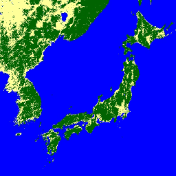
您可以在 JAXA/ALOS/PALSAR/YEARLY/FNF4 中找到此数据集的较新版本,其中包含 2017 年至 2020 年的 4 个类。全球森林/非森林地图 (FNF) 是通过对全球 25 米分辨率 PALSAR-2/PALSAR SAR 拼接图中的 SAR 图像(回波系数)进行分类而生成的,以便强回波像素和弱回波像素… alos alos2 classification eroc forest forest-biomass -
全球 4 类 PALSAR-2/PALSAR 森林/非森林地图
全球森林/非森林图 (FNF) 是通过对全球 25 米分辨率 PALSAR-2/PALSAR SAR 拼接图中的 SAR 图像(回波系数)进行分类而生成的,以便将强回波像素和弱回波像素分别分配为“森林”和“非森林”。在本指南中,“森林”是指具有以下特征的自然森林: alos alos2 classification eroc forest forest-biomass
Datasets tagged classification in Earth Engine
[null,null,[],[[["\u003cp\u003eThe webpage provides access to various global and regional forest classification datasets.\u003c/p\u003e\n"],["\u003cp\u003eDatasets include land cover maps, forest/non-forest classifications, and biomass estimations.\u003c/p\u003e\n"],["\u003cp\u003eData sources include satellite imagery from PALSAR-2/PALSAR and organizations like BNETD and NASA.\u003c/p\u003e\n"],["\u003cp\u003eThese datasets support research on deforestation, forest monitoring, and carbon stock assessments.\u003c/p\u003e\n"],["\u003cp\u003eUsers can leverage these resources to analyze forest cover change and contribute to environmental studies.\u003c/p\u003e\n"]]],[],null,["# Datasets tagged classification in Earth Engine\n\n-\n\n |--------------------------------------------------------------------------------------------------------------------------------------------------------------------------------------------------------------------------------------------------------------------------------------------------------------------------------|\n | [### Cote d'Ivoire BNETD 2020 Land Cover Map](/earth-engine/datasets/catalog/BNETD_land_cover_v1) |\n | The Cote d'Ivoire BNETD 2020 Land Cover Map was produced by the Ivorian Government through a national institution, the Center for Geographic Information and Digital from the National Study Office Techniques and Development (BNETD-CIGN), with technical and financial support from the European Union. The methodology ... |\n | [classification](/earth-engine/datasets/tags/classification) [deforestation](/earth-engine/datasets/tags/deforestation) [forest](/earth-engine/datasets/tags/forest) [landcover](/earth-engine/datasets/tags/landcover) [landuse-landcover](/earth-engine/datasets/tags/landuse-landcover) |\n\n-\n\n |---------------------------------------------------------------------------------------------------------------------------------------------------------------------------------------------------------------------------------------------------------------------------------------------------------------------------|\n | [### Global 2020 Forest Classification for IPCC Aboveground Biomass Tier 1 Estimates, V1](/earth-engine/datasets/catalog/NASA_ORNL_global_forest_classification_2020_V1) |\n | This dataset provides classes of global forests delineated by status/condition in 2020 at approximately 30m resolution. The data support generating Tier 1 estimates for Aboveground dry woody Biomass Density (AGBD) in natural forests in the 2019 Refinement to the 2006 IPCC Guidelines for National Greenhouse ... |\n | [aboveground](/earth-engine/datasets/tags/aboveground) [biomass](/earth-engine/datasets/tags/biomass) [carbon](/earth-engine/datasets/tags/carbon) [classification](/earth-engine/datasets/tags/classification) [forest](/earth-engine/datasets/tags/forest) [forest-biomass](/earth-engine/datasets/tags/forest-biomass) |\n\n-\n\n |-------------------------------------------------------------------------------------------------------------------------------------------------------------------------------------------------------------------------------------------------------------------------------------------------------------------------------|\n | [### Global 3-class PALSAR-2/PALSAR Forest/Non-Forest Map](/earth-engine/datasets/catalog/JAXA_ALOS_PALSAR_YEARLY_FNF) |\n | A newer version of this dataset with 4 classes for 2017-2020 can be found in JAXA/ALOS/PALSAR/YEARLY/FNF4 The global forest/non-forest map (FNF) is generated by classifying the SAR image (backscattering coefficient) in the global 25m resolution PALSAR-2/PALSAR SAR mosaic so that strong and low backscatter pixels ... |\n | [alos](/earth-engine/datasets/tags/alos) [alos2](/earth-engine/datasets/tags/alos2) [classification](/earth-engine/datasets/tags/classification) [eroc](/earth-engine/datasets/tags/eroc) [forest](/earth-engine/datasets/tags/forest) [forest-biomass](/earth-engine/datasets/tags/forest-biomass) |\n\n-\n\n |-----------------------------------------------------------------------------------------------------------------------------------------------------------------------------------------------------------------------------------------------------------------------------------------------------------------------------------|\n | [### Global 4-class PALSAR-2/PALSAR Forest/Non-Forest Map](/earth-engine/datasets/catalog/JAXA_ALOS_PALSAR_YEARLY_FNF4) |\n | The global forest/non-forest map (FNF) is generated by classifying the SAR image (backscattering coefficient) in the global 25m resolution PALSAR-2/PALSAR SAR mosaic so that strong and low backscatter pixels are assigned as \"forest\" and \"non-forest\", respectively. Here, \"forest\" is defined as the natural forest with ... |\n | [alos](/earth-engine/datasets/tags/alos) [alos2](/earth-engine/datasets/tags/alos2) [classification](/earth-engine/datasets/tags/classification) [eroc](/earth-engine/datasets/tags/eroc) [forest](/earth-engine/datasets/tags/forest) [forest-biomass](/earth-engine/datasets/tags/forest-biomass) |"]]