-
可可概率模型 2025a

此图片集提供估计的每像素概率,表示相应区域被相应商品占据的可能性。概率估计值以 10 米为单位提供,由机器学习模型生成。如需了解详情,请参阅有关“森林数据合作伙伴计划”的技术文档… 农业 生物多样性 可可 保护 作物 eudr -
可可概率模型 2025b

此图片集提供估计的每像素概率,表示相应区域被相应商品占据的可能性。概率估计值以 10 米为单位提供,由机器学习模型生成。如需了解详情,请参阅有关“森林数据合作伙伴计划”的技术文档… 农业 alphaearth-derived 生物多样性 可可 保护 农作物 -
Coffee Probability 模型 2025a

此图片集提供估计的每像素概率,表示相应区域被相应商品占据的可能性。概率估计值以 10 米为单位提供,由机器学习模型生成。如需了解详情,请参阅有关“森林数据合作伙伴计划”的技术文档… 农业 生物多样性 咖啡 保护 作物 eudr -
Coffee Probability 模型 2025b

此图片集提供估计的每像素概率,表示相应区域被相应商品占据的可能性。概率估计值以 10 米为单位提供,由机器学习模型生成。如需了解详情,请参阅有关“森林数据合作伙伴计划”的技术文档… 农业 alphaearth-derived 生物多样性 咖啡 保护 作物 -
Farmscapes 2020
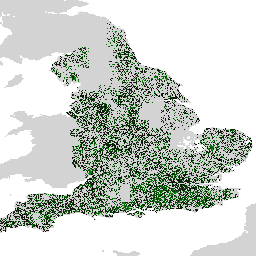
Farmscapes 2020 数据集提供了高分辨率 (25cm) 的概率地图,其中包含英格兰农业景观中的三种关键半自然特征:树篱、林地和石墙。此数据集是与牛津大学 Leverhulme Centre for Nature Recovery 合作开发的,可作为应用的基础数据… 生物多样性 气候 保护 生态连通性 森林 土地利用和土地覆盖 -
Farmscapes 2020 矢量化

这是 Farmscapes 2020 光栅数据集的矢量化版本。该数据集提供了多边形几何图形,用于表示英格兰农业景观中的精细半自然景观特征(具体而言是树篱、林地和石墙)。此数据集是与 Oxford Leverhulme Centre for Nature Recovery 合作开发的,旨在… 生物多样性 气候 保护 生态连通性 森林 土地利用和土地覆盖 -
Forest Persistence v0

此图片提供了一个逐像素得分(范围为 [0, 1]),用于指示相应像素区域在 2020 年是否被未受干扰的森林占据。这些得分以 30 米分辨率提供,是通过一种证据汇聚方法生成的,该方法可将多种森林… 生物多样性 保护 森林砍伐 Eudr 森林生物质 forestdatapartnership -
森林类型学 (ForTy) 2020 v1.0

森林类型学 (ForTy) v1 数据集包含 2020 年全球每类概率地图,分辨率为 10 米,覆盖南纬 65° 至北纬 84° 之间的所有陆地区域。六类分类与粮农组织和欧盟森林砍伐法规 (EUDR) 的定义一致:第 1 类… alphaearth-derived biodiversity climate conservation deforestation eudr -
全球油棕种植园地图

该数据集是 2019 年全球工业和小农户油棕榈地图,分辨率为 10 米。它涵盖了检测到油棕榈种植园的区域。分类后的图片是基于 Sentinel-1 和 Sentinel-2 半年合成数据的卷积神经网络的输出。如需了解更多…,请参阅相关文章 农业 生物多样性 保护 作物 全球 土地利用 -
2020 年世界天然森林

“2020 年世界天然森林”数据集提供了一张 2020 年全球天然森林概率地图,分辨率为 10 米。此图层旨在支持《欧盟零毁林法案》(EUDR) 等倡议,以及其他森林保护和监测工作。地图… biodiversity climate conservation deforestation eudr forest -
Palm Probability 模型 2025a

此图片集提供估计的每像素概率,表示相应区域被相应商品占据的可能性。概率估计值以 10 米为单位提供,由机器学习模型生成。如需了解详情,请参阅有关“森林数据合作伙伴计划”的技术文档… 农业 生物多样性 保护 作物 eudr forestdatapartnership -
Palm 概率模型 2025b

此图片集提供估计的每像素概率,表示相应区域被相应商品占据的可能性。概率估计值以 10 米为单位提供,由机器学习模型生成。如需了解详情,请参阅有关“森林数据合作伙伴计划”的技术文档… 农业 alphaearth-derived 生物多样性 保护 作物 eudr -
RESOLVE 生态区 2017 年
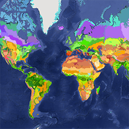
RESOLVE 生态区域数据集于 2017 年更新,其中描绘了代表我们这个生机勃勃的星球的 846 个陆地生态区域。您可以在 https://ecoregions2017.appspot.com/ 或 Earth Engine 中查看样式化地图。从最简单的定义来看,生态区域是指具有区域范围的生态系统。具体而言,生态区代表着不同的组合… 生物多样性 保护 生态区 生态系统 全球 表格 -
Rubber Probability 模型 2025b

此图片集提供估计的每像素概率,表示相应区域被相应商品占据的可能性。概率估计值以 10 米为单位提供,由机器学习模型生成。如需了解详情,请参阅有关“森林数据合作伙伴计划”的技术文档… 农业 alphaearth-derived 生物多样性 保护 作物 eudr -
Rubber Tree Probability 模型 2025a

此图片集提供估计的每像素概率,表示相应区域被相应商品占据的可能性。概率估计值以 10 米为单位提供,由机器学习模型生成。如需了解详情,请参阅有关“森林数据合作伙伴计划”的技术文档… 农业 生物多样性 保护 作物 eudr forestdatapartnership -
物种分布,澳大利亚哺乳动物

这些物种分布模型输出由 Google 与 QCIF 和 EcoCommons 合作开发,表示物种相对出现可能性的估计值(即,值越高表示在给定调查方法和给定调查… alphaearth-derived biodiversity conservation ecosystems nature-trace publisher-dataset
Datasets tagged conservation in Earth Engine
[null,null,[],[],["The datasets include a 2019 global map of industrial and smallholder oil palm plantations derived from Sentinel-1 and Sentinel-2 data, and a 2017 depiction of 846 terrestrial ecoregions. Additionally, there are per-pixel probability models at 10-meter resolution for cocoa, palm, and rubber tree occupancy, as well as a 2020 per-pixel score indicating undisturbed forest areas. Each model is associated with GitHub README for additional information.\n"]]