-
LSIB 2017:大规模国际边界多边形,详细
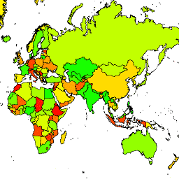
美国地理学家办公室提供了大规模国际边界 (LSIB) 数据集。它派生自另外两个数据集:美国国家地理空间情报局 (NGA) 提供的 LSIB 线矢量文件和世界矢量海岸线 (WVS)。内部边界反映了美国政府… 边界 国家/地区 dos infrastructure-boundaries political table -
LSIB 2017:简化版大型国际边界多边形
美国地理学家办公室提供了大规模国际边界 (LSIB) 数据集。详细版本 (2013) 派生自另外两个数据集:LSIB 线矢量文件和美国国家地理空间情报局 (NGA) 提供的世界矢量海岸线 (WVS)。内部边界… 边界 国家/地区 dos infrastructure-boundaries political table
Datasets tagged dos in Earth Engine
[null,null,[],[[["\u003cp\u003eThe United States Office of the Geographer provides the Large Scale International Boundary (LSIB) dataset in two versions: detailed and simplified.\u003c/p\u003e\n"],["\u003cp\u003eThe LSIB datasets reflect the U.S. government's official view of international boundaries and are derived from authoritative sources like the LSIB line vector file and World Vector Shorelines.\u003c/p\u003e\n"],["\u003cp\u003eBoth LSIB datasets include interior and disputed boundaries, offering comprehensive coverage of political borders worldwide.\u003c/p\u003e\n"]]],[],null,["# Datasets tagged dos in Earth Engine\n\n-\n\n |-----------------------------------------------------------------------------------------------------------------------------------------------------------------------------------------------------------------------------------------------------------------------------------------------------------------------------|\n | [### LSIB 2017: Large Scale International Boundary Polygons, Detailed](/earth-engine/datasets/catalog/USDOS_LSIB_2017) |\n | The United States Office of the Geographer provides the Large Scale International Boundary (LSIB) dataset. It is derived from two other datasets: a LSIB line vector file and the World Vector Shorelines (WVS) from the National Geospatial-Intelligence Agency (NGA). The interior boundaries reflect U.S. government ... |\n | [borders](/earth-engine/datasets/tags/borders) [countries](/earth-engine/datasets/tags/countries) [dos](/earth-engine/datasets/tags/dos) [infrastructure-boundaries](/earth-engine/datasets/tags/infrastructure-boundaries) [political](/earth-engine/datasets/tags/political) [table](/earth-engine/datasets/tags/table) |\n\n-\n\n |------------------------------------------------------------------------------------------------------------------------------------------------------------------------------------------------------------------------------------------------------------------------------------------------------------------------------|\n | [### LSIB 2017: Large Scale International Boundary Polygons, Simplified](/earth-engine/datasets/catalog/USDOS_LSIB_SIMPLE_2017) |\n | The United States Office of the Geographer provides the Large Scale International Boundary (LSIB) dataset. The detailed version (2013) is derived from two other datasets: a LSIB line vector file and the World Vector Shorelines (WVS) from the National Geospatial-Intelligence Agency (NGA). The interior boundaries ... |\n | [borders](/earth-engine/datasets/tags/borders) [countries](/earth-engine/datasets/tags/countries) [dos](/earth-engine/datasets/tags/dos) [infrastructure-boundaries](/earth-engine/datasets/tags/infrastructure-boundaries) [political](/earth-engine/datasets/tags/political) [table](/earth-engine/datasets/tags/table) |"]]