-
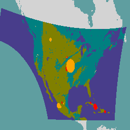
FIRMS:资源管理系统火灾信息

Earth Engine 版资源管理系统火灾信息 (FIRMS) 数据集包含以栅格化形式提供的 LANCE 火灾检测产品。LANCE 使用标准 MODIS MOD14/MYD14 火灾和热异常产品处理近乎实时 (NRT) 的活跃火灾位置。每个… eosdis fire firms geophysical hotspot lance -
GOES-16 FDCC 系列 ABI 级别 2 火灾/热点特征描述 CONUS

火灾 (HSC) 产品包含四张图片:一张为火灾掩码,另外三张包含用于标识火灾温度、火灾面积和火灾辐射功率的像素值。ABI L2+ FHS 元数据掩码会为每个经由地球导航的像素分配一个标志,该标志用于指示相应像素是否满足以下条件: abi fdc fire goes goes-16 goes-east -
GOES-16 FDCF 系列 ABI 级别 2 火灾/热点特征描述 完整磁盘

火灾 (HSC) 产品包含四张图片:一张为火灾掩码,另外三张包含用于标识火灾温度、火灾面积和火灾辐射功率的像素值。ABI L2+ FHS 元数据掩码会为每个经由地球导航的像素分配一个标志,该标志用于指示相应像素是否满足以下条件: abi fdc fire goes goes-16 goes-east -
GOES-17 FDCC 系列 ABI 级别 2 火灾/热点特征 CONUS

火灾 (HSC) 产品包含四张图片:一张为火灾掩码,另外三张包含用于标识火灾温度、火灾面积和火灾辐射功率的像素值。ABI L2+ FHS 元数据掩码会为每个经由地球导航的像素分配一个标志,该标志用于指示相应像素是否满足以下条件: abi fdc fire goes goes-17 goes-s -
GOES-17 FDCF 系列 ABI 级别 2 火灾/热点特征描述 完整磁盘

火灾 (HSC) 产品包含四张图片:一张为火灾掩码,另外三张包含用于标识火灾温度、火灾面积和火灾辐射功率的像素值。ABI L2+ FHS 元数据掩码会为每个经由地球导航的像素分配一个标志,该标志用于指示相应像素是否满足以下条件: abi fdc fire goes goes-17 goes-s -
GOES-18 FDCC 系列 ABI 级别 2 火灾/热点特征描述 CONUS

火灾 (HSC) 产品包含四张图片:一张为火灾掩码,另外三张包含用于标识火灾温度、火灾面积和火灾辐射功率的像素值。ABI L2+ FHS 元数据掩码会为每个经由地球导航的像素分配一个标志,该标志用于指示相应像素是否满足以下条件: abi fdc fire goes goes-18 goes-t -
GOES-18 FDCF 系列 ABI 级别 2 火灾/热点特征描述 完整磁盘

火灾 (HSC) 产品包含四张图片:一张为火灾掩码,另外三张包含用于标识火灾温度、火灾面积和火灾辐射功率的像素值。ABI L2+ FHS 元数据掩码会为每个经由地球导航的像素分配一个标志,该标志用于指示相应像素是否满足以下条件: abi fdc fire goes goes-18 goes-t -
GOES-19 FDCC 系列 ABI 级别 2 火灾/热点特征描述 CONUS

GOES 卫星是 NOAA 运营的静止气象卫星。火灾 (HSC) 产品包含四张图片:一张为火灾掩码,另外三张包含用于标识火灾温度、火灾面积和火灾辐射功率的像素值。ABI L2+ FHS 元数据… abi fdc fire goes goes-19 goes-east -
GOES-19 FDCF 系列 ABI 级别 2 火灾/热点特征描述 完整磁盘

火灾 (HSC) 产品包含四张图片:一张为火灾掩码,另外三张包含用于标识火灾温度、火灾面积和火灾辐射功率的像素值。ABI L2+ FHS 元数据掩码会为每个经由地球导航的像素分配一个标志,该标志用于指示相应像素是否满足以下条件: abi fdc fire goes goes-19 goes-east -
VJ114IMGTDL_NRT 每日栅格数据:VIIRS (NOAA-20) 375 米波段活火灾

NOAA-20 (JPSS-1) 可见光红外成像辐射仪套件 (VIIRS) 活跃火灾检测产品基于该仪器的 375 米标称分辨率数据。与其他分辨率较低(≥ 1 公里)的卫星火灾检测产品相比,改进后的 375 米数据对相对较小的火灾的响应更大,并且可以更准确地确定火灾的起火时间和火势蔓延情况。 eosdis fire firms geophysical hotspot lance -
VNP14IMGTDL_NRT 每日栅格数据:VIIRS (S-NPP) 375 米波段活跃火灾

Suomi NPP 可见光红外成像辐射计套件 (VIIRS) 活火检测产品基于该仪器的 375 米标称分辨率数据。与其他分辨率较低(≥ 1 公里)的卫星火灾检测产品相比,改进后的 375 米数据对相对较小的火灾的响应更大,并且可以更准确地确定火灾的起火时间和火势蔓延情况。 eosdis fire firms geophysical hotspot lance
Datasets tagged hotspot in Earth Engine
[null,null,[],[],["The data describes fire detection products from various sources. FIRMS data uses MODIS to process near real-time active fire locations. VIIRS fire detection products, from both NOAA-20 and S-NPP, utilize 375m resolution data for improved detection of smaller fires. GOES-16, GOES-17 and GOES-18 provide fire data including a fire mask, fire temperature, area, and radiative power for both CONUS and Full Disk.\n"]]
