-
GSMaP Operational: Global Satellite Mapping of Precipitation - V6
Global Satellite Mapping of Precipitation (GSMaP) provides a global hourly rain rate with a 0.1 x 0.1 degree resolution. GSMaP is a product of the Global Precipitation Measurement (GPM) mission, which provides global precipitation observations at three hour intervals. Values are estimated using multi-band passive … climate geophysical gpm hourly jaxa precipitation -
GSMaP Reanalysis: Global Satellite Mapping of Precipitation
Global Satellite Mapping of Precipitation (GSMaP) provides a global hourly rain rate with a 0.1 x 0.1 degree resolution. GSMaP is a product of the Global Precipitation Measurement (GPM) mission, which provides global precipitation observations at three hour intervals. Values are estimated using multi-band passive … climate geophysical gpm hourly jaxa precipitation -
GSMaP Operational: Global Satellite Mapping of Precipitation - V7
Global Satellite Mapping of Precipitation (GSMaP) provides a global hourly rain rate with a 0.1 x 0.1 degree resolution. GSMaP is a product of the Global Precipitation Measurement (GPM) mission, which provides global precipitation observations at three hour intervals. Values are estimated using multi-band passive … climate geophysical gpm hourly jaxa precipitation -
GSMaP Operational: Global Satellite Mapping of Precipitation - V8
Global Satellite Mapping of Precipitation (GSMaP) provides a global hourly rain rate with a 0.1 x 0.1 degree resolution. GSMaP is a product of the Global Precipitation Measurement (GPM) mission, which provides global precipitation observations at three hour intervals. Values are estimated using multi-band passive … climate geophysical gpm hourly jaxa precipitation -
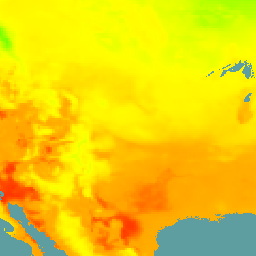
NLDAS-2: North American Land Data Assimilation System Forcing Fields
Land Data Assimilation System (LDAS) combines multiple sources of observations (such as precipitation gauge data, satellite data, and radar precipitation measurements) to produce estimates of climatological properties at or near the Earth''s surface. This dataset is the primary (default) forcing file (File A) for Phase … climate evaporation forcing geophysical hourly humidity -
NOAA CDR: Ocean Near-Surface Atmospheric Properties, Version 2
The Ocean Near-Surface Atmospheric Properties dataset is part of the NOAA Ocean Surface Bundle (OSB) and provides a high quality Climate Data Record (CDR) of air temperature, wind speed, and specific humidity over ice-free ocean surfaces. These atmospheric properties are calculated based on brightness temperature … atmospheric cdr hourly humidity noaa ocean -
NOAA CDR: Ocean Heat Fluxes, Version 2
The Ocean Heat Fluxes dataset is part of the NOAA Ocean Surface Bundle (OSB) and provides a high quality Climate Data Record (CDR) of the air/ocean heat fluxes over ice-free oceans. This dataset is calculated from the OSB CDR parameters of near-surface atmospheric and sea … atmospheric cdr flux heat hourly noaa -
NOAA CDR WHOI: Sea Surface Temperature, Version 2
The Sea Surface Temperature - WHOI dataset is part of the NOAA Ocean Surface Bundle (OSB) and provides a high quality Climate Data Record (CDR) of sea surface temperature over ice-free oceans. The SST values are found through modeling the diurnal variability in combination with … atmospheric cdr hourly noaa ocean oisst
[null,null,[],[[["This page showcases a variety of climate and geophysical datasets, including those focused on precipitation, ocean properties, and land data assimilation."],["The Global Satellite Mapping of Precipitation (GSMaP) datasets provide hourly global rain rate data at a 0.1 x 0.1 degree resolution, available in both operational and reanalysis versions."],["Several NOAA Climate Data Records (CDRs) offer insights into ocean near-surface atmospheric properties, ocean heat fluxes, and sea surface temperatures."],["The North American Land Data Assimilation System (NLDAS) dataset provides forcing fields for land surface modeling, incorporating observations from various sources."],["These datasets are valuable for studying climate patterns, weather forecasting, and understanding Earth's geophysical processes."]]],[]]