-
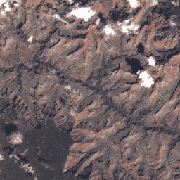
Landsat Global Land Survey 2005,Landsat 7 场景

GLS2005 数据集包含 9,500 张正射校正的叶片中等分辨率卫星图像,这些图像是在 2004 年至 2007 年间收集的,覆盖了地球的陆地。GLS2005 主要使用 Landsat 5 和经过间隙填充的 Landsat 7 数据,并使用 EO-1 ALI 和 Terra ASTER 数据填充任何 … etm gls l7 landsat radiance satellite-imagery -
USGS Landsat 7 Collection 2 Tier 1 原始场景

Landsat 7 Collection 2 Tier 1 DN 值,表示经过缩放和校准的传感器辐射。数据质量最高的 Landsat 场景被归入 Tier 1,并被认为适合进行时间序列处理分析。Tier 1 包含经过 Level-1 Precision Terrain (L1TP) 处理的数据,这些数据具有 … c2 etm global l7 landsat le7 -
USGS Landsat 7 Collection 2 Tier 1 和实时数据原始场景
Landsat 7 Collection 2 Tier 1 和实时数据 DN 值,表示经过缩放和校准的传感器辐射。数据质量最高的 Landsat 场景被归入 Tier 1,并被认为适合进行时间序列处理分析。Tier 1 包含经过 Level-1 Precision Terrain (L1TP) 处理的 … c2 etm global l7 landsat le7 -
USGS Landsat 7 Collection 2 Tier 2 原始场景

Landsat 7 Collection 2 Tier 2 DN 值,表示经过缩放和校准的传感器辐射。在处理期间未达到 Tier 1 标准的场景会被分配到 Tier 2。这包括经过 Systematic terrain (L1GT) 和 Systematic (L1GS) 处理的场景,以及任何不 … c2 etm global l7 landsat le7
Datasets tagged l7 in Earth Engine
[null,null,[],[],["The core content details several Landsat 7 datasets from the USGS. The GLS2005 dataset features 9500 orthorectified satellite images collected between 2004-2007, utilizing Landsat 5, 7, EO-1 ALI, and Terra ASTER data. Landsat 7 Collection 2 data is divided into Tier 1 and Tier 2 based on quality; Tier 1 data contains high-quality, calibrated radiance data suitable for time-series analysis, whereas Tier 2 includes lower-quality processed data. There is also a tier 1 real time data.\n"]]