-
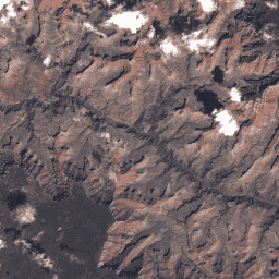
USGS Landsat 7 Collection 2 Tier 1 原始场景
Landsat 7 集合 2 第 1 层级 DN 值,表示经过缩放和校准的传感器端辐射度。数据质量最高的 Landsat 场景会被划分到第 1 层级,并且被视为适合进行时间序列处理分析。第 1 层级包括经过处理的第 1 级精确地形 (L1TP) 数据,具有以下特点: c2 etm global l7 landsat le7 -
USGS Landsat 7 Collection 2 Tier 1 和实时数据原始场景
Landsat 7 Collection 2 Tier 1 和实时数据 DN 值,表示经过缩放和校准的传感器发射亮度。数据质量最高的 Landsat 场景会被划分到第 1 层级,并且被视为适合进行时间序列处理分析。第 1 层级包括经过处理的 1 级精确地形 (L1TP)… c2 etm global l7 landsat le7 -
USGS Landsat 7 Collection 2 Tier 2 原始场景
Landsat 7 集合 2 第 2 层级数字值,表示经过缩放和校准的传感器端辐射度。在处理过程中,如果场景不符合第 1 层级的条件,则会被分配到第 2 层级。这包括系统化地形 (L1GT) 和系统化 (L1GS) 处理的场景,以及不符合以下条件的任何 L1TP 场景: c2 etm global l7 landsat le7
Datasets tagged le7 in Earth Engine
[null,null,[],[[["\u003cp\u003eThe datasets provided contain Landsat 7 Collection 2 raw scenes, representing scaled and calibrated at-sensor radiance.\u003c/p\u003e\n"],["\u003cp\u003eTier 1 scenes have the highest data quality and are suitable for time-series analysis, including Level-1 Precision Terrain (L1TP) processed data.\u003c/p\u003e\n"],["\u003cp\u003eTier 2 scenes do not meet Tier 1 criteria and include Systematic terrain (L1GT) and Systematic (L1GS) processed scenes.\u003c/p\u003e\n"],["\u003cp\u003eA Real-Time dataset is available alongside Tier 1, offering the most recent data for immediate analysis.\u003c/p\u003e\n"]]],["Landsat 7 data is categorized into Collection 2 Tier 1, Tier 1 and Real-Time, and Tier 2. All represent scaled, calibrated at-sensor radiance using DN values. Tier 1, with the highest data quality, suits time-series analysis and comprises Level-1 Precision Terrain (L1TP) processed scenes. Tier 2 includes scenes not meeting Tier 1 standards, including Systematic terrain (L1GT) and Systematic (L1GS) data. Tier 1 and Real-Time data are also available.\n"],null,["# Datasets tagged le7 in Earth Engine\n\n-\n\n |---------------------------------------------------------------------------------------------------------------------------------------------------------------------------------------------------------------------------------------------------------------------------------------------------------------------------|\n | [### USGS Landsat 7 Collection 2 Tier 1 Raw Scenes](/earth-engine/datasets/catalog/LANDSAT_LE07_C02_T1) |\n | Landsat 7 Collection 2 Tier 1 DN values, representing scaled, calibrated at-sensor radiance. Landsat scenes with the highest available data quality are placed into Tier 1 and are considered suitable for time-series processing analysis. Tier 1 includes Level-1 Precision Terrain (L1TP) processed data that have ... |\n | [c2](/earth-engine/datasets/tags/c2) [etm](/earth-engine/datasets/tags/etm) [global](/earth-engine/datasets/tags/global) [l7](/earth-engine/datasets/tags/l7) [landsat](/earth-engine/datasets/tags/landsat) [le7](/earth-engine/datasets/tags/le7) |\n\n-\n\n |-------------------------------------------------------------------------------------------------------------------------------------------------------------------------------------------------------------------------------------------------------------------------------------------------------------------------------|\n | [### USGS Landsat 7 Collection 2 Tier 1 and Real-Time data Raw Scenes](/earth-engine/datasets/catalog/LANDSAT_LE07_C02_T1_RT) |\n | Landsat 7 Collection 2 Tier 1 and Real-Time data DN values, representing scaled, calibrated at-sensor radiance. Landsat scenes with the highest available data quality are placed into Tier 1 and are considered suitable for time-series processing analysis. Tier 1 includes Level-1 Precision Terrain (L1TP) processed ... |\n | [c2](/earth-engine/datasets/tags/c2) [etm](/earth-engine/datasets/tags/etm) [global](/earth-engine/datasets/tags/global) [l7](/earth-engine/datasets/tags/l7) [landsat](/earth-engine/datasets/tags/landsat) [le7](/earth-engine/datasets/tags/le7) |\n\n-\n\n |------------------------------------------------------------------------------------------------------------------------------------------------------------------------------------------------------------------------------------------------------------------------------------------------------|\n | [### USGS Landsat 7 Collection 2 Tier 2 Raw Scenes](/earth-engine/datasets/catalog/LANDSAT_LE07_C02_T2) |\n | Landsat 7 Collection 2 Tier 2 DN values, representing scaled, calibrated at-sensor radiance. Scenes not meeting Tier 1 criteria during processing are assigned to Tier 2. This includes Systematic terrain (L1GT) and Systematic (L1GS) processed scenes, as well as any L1TP scenes that do not ... |\n | [c2](/earth-engine/datasets/tags/c2) [etm](/earth-engine/datasets/tags/etm) [global](/earth-engine/datasets/tags/global) [l7](/earth-engine/datasets/tags/l7) [landsat](/earth-engine/datasets/tags/landsat) [le7](/earth-engine/datasets/tags/le7) |"]]