-
AG100:ASTER 全球发射率数据集 100 米 V003

高级星载热发射和反射辐射计全球发射率数据库 (ASTER-GED) 由美国国家航空航天局 (NASA) 的喷气推进实验室 (JPL)(加利福尼亚理工学院)开发。此产品包括所有 5 个 ASTER 热红外波段的平均发射率和标准差… aster 高程 发射率 地球物理 红外 jpl -
GCOM-C/SGLI L3 地表温度 (V1)

此产品是陆地表面的温度。此数据集还提供了一个更新的版本 JAXA/GCOM-C/L3/LAND/LST/V3,该版本使用此算法进行处理。GCOM-C 会进行长期持续的全球观测和数据收集,以阐明辐射收支波动背后的机制,并… 气候 g-portal gcom gcom-c jaxa 陆地 -
GCOM-C/SGLI L3 地表温度 (V2)
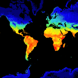
此产品是陆地表面的温度。对于 2021 年 11 月 28 日之后的数据,请参阅 V3 数据集。GCOM-C 会进行长期持续的全球观测和数据收集,以阐明辐射预算和碳循环波动背后的机制,从而准确预测… 气候 g-portal gcom gcom-c jaxa 陆地 -
GCOM-C/SGLI L3 地表温度(版本 3)

此产品是陆地表面的温度。这是一个持续更新的数据集,延迟时间为 3-4 天。GCOM-C 会进行长期持续的全球观测和数据收集,以阐明辐射预算和碳循环波动背后的机制,从而做出… 气候 g-portal gcom gcom-c jaxa 陆地 -
LST Day:Malaria Atlas Project 填充了缺失数据的白天陆地表面温度(每 8 天 1 千米)

白天陆地表面温度 (LST) 是根据约 1 千米的 MODIS MOD11A2 v6.1 产品得出的。将 8 天合成数据转换为摄氏度,然后使用 Weiss 等人 (2014) 概述的方法进行缺口填充,以消除因云覆盖等因素而导致的数据缺失。… 气候 lst malariaatlasproject 地图 publisher-dataset 地表温度 -
LST Day:Malaria Atlas Project 填充了缺失数据的白天陆地表面温度(每年 1 千米)

白天陆地表面温度 (LST) 是根据约 1 千米的 MODIS MOD11A2 v6.1 产品得出的。将 8 天合成数据转换为摄氏度,然后使用 Weiss 等人 (2014) 概述的方法进行缺口填充,以消除因云覆盖等因素而导致的数据缺失。… 气候 lst malariaatlasproject 地图 publisher-dataset 地表温度 -
LST Day:Malaria Atlas Project 填充了缺失数据的白天陆地表面温度(每月 1 千米)

白天陆地表面温度 (LST) 是根据约 1 千米的 MODIS MOD11A2 v6.1 产品得出的。将 8 天合成数据转换为摄氏度,然后使用 Weiss 等人 (2014) 概述的方法进行缺口填充,以消除因云覆盖等因素而导致的数据缺失。… 气候 lst malariaatlasproject 地图 publisher-dataset 地表温度 -
LST Night:Malaria Atlas Project 填充了缺失数据的夜间地表温度(每 8 天 1 千米)

夜间陆地表面温度 (LST) 源自约 1 公里的 MODIS MOD11A2 v6.1 产品。将 8 天合成数据转换为摄氏度,然后使用 Weiss 等人 (2014) 概述的方法进行缺口填充,以消除因云覆盖等因素而导致的数据缺失。… 气候 lst malariaatlasproject 地图 publisher-dataset 地表温度 -
LST Night:Malaria Atlas Project 填充了缺失数据的夜间地表温度(每年 1 千米)

夜间陆地表面温度 (LST) 源自约 1 公里的 MODIS MOD11A2 v6.1 产品。将 8 天合成数据转换为摄氏度,然后使用 Weiss 等人 (2014) 概述的方法进行缺口填充,以消除因云覆盖等因素而导致的数据缺失。… 气候 lst malariaatlasproject 地图 publisher-dataset 地表温度 -
LST Night:Malaria Atlas Project 填充了缺失数据的夜间地表温度(每月 1 千米)

夜间陆地表面温度 (LST) 源自约 1 公里的 MODIS MOD11A2 v6.1 产品。将 8 天合成数据转换为摄氏度,然后使用 Weiss 等人 (2014) 概述的方法进行缺口填充,以消除因云覆盖等因素而导致的数据缺失。… 气候 lst malariaatlasproject 地图 publisher-dataset 地表温度 -
MOD11A1.061 Terra 地表温度和发射率每日全球 1 公里

MOD11A1 V6.1 产品以 1200 x 1200 公里的网格提供每日陆地表面温度 (LST) 和发射率值。温度值源自 MOD11_L2 观测带产品。在 30 度纬度以上,部分像素可能有多项观测结果,其中晴空条件… 气候 每日 发射率 全球 lst modis -
MOD11A2.061 Terra 地表温度和发射率 8 天全球 1 公里

MOD11A2 V6.1 产品以 1200 x 1200 公里网格的形式提供平均 8 天的地表温度 (LST)。MOD11A2 中的每个像素值都是相应 8 天内收集的所有 MOD11A1 LST 像素的简单平均值。MOD11A2 会执行… 8 天 气候 发射率 全球 lst mod11a2 -
MOD21A1D.061 Terra 地表温度和 3 波段发射率每日全球 1 公里
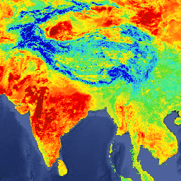
MOD21A1D 数据集每天根据白天 2 级网格化 (L2G) 中间 LST 产品生成,空间分辨率为 1,000 米。L2G 流程将每日 MOD21 条带颗粒映射到正弦 MODIS 网格,并存储落在网格单元上的所有观测结果… 气候 每日 发射率 全球 lst nasa -
MOD21A1N.061 Terra 地表温度和 3 波段发射率每日全球 1 公里

MOD21A1N 数据集每天根据夜间 2 级网格化 (L2G) 中间 LST 产品生成,空间分辨率为 1,000 米。L2G 流程将每日 MOD21 条带颗粒映射到正弦 MODIS 网格,并存储落在网格单元上的所有观测结果… 气候 每日 发射率 全球 lst nasa -
MOD21C1.061 Terra 地表温度和 3 波段发射率每日 L3 全球 0.05 度 CMG

MOD21C1 数据集每天生成一次,采用 0.05 度(赤道处为 5,600 米)气候模型网格 (CMG),数据源为白天 2 级网格化 (L2G) 中间 LST 产品。L2G 流程将每日 MOD21 条带颗粒映射到正弦 MODIS 网格,并存储所有… 气候 每日 发射率 全球 lst nasa -
MOD21C2.061 Terra 地表温度和 3 波段发射率 8 天 L3 全球 0.05 度 CMG
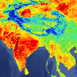
MOD21C2 数据集是一种 8 天合成 LST 产品,它使用基于简单平均方法的算法。该算法会计算 8 天内所有无云 MOD21A1D 和 MOD21A1N 每日采集数据的平均值。与 MOD21A1 数据集不同的是,… 气候 发射率 全球 lst nasa 地表温度 -
MOD21C3.061 Terra 地表温度和 3 波段发射率月度 L3 全球 0.05 度 CMG
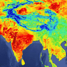
MOD21C3 数据集是一种月度合成 LST 产品,它使用基于简单平均方法的算法。该算法会计算 8 天内所有无云 MOD21A1D 和 MOD21A1N 每日采集数据的平均值。与 MOD21A1 数据集不同的是,… 气候 发射率 全球 lst 月度 nasa -
MYD11A1.061 Aqua 地表温度和发射率每日全球 1 公里

MYD11A1 V6.1 产品以 1200 x 1200 公里网格的形式提供每日陆地表面温度 (LST) 和发射率值。温度值源自 MYD11_L2 扫描带产品。在 30 度纬度以上,部分像素可能有多项观测结果,其中晴空条件… aqua 气候 每日 发射率 全球 lst -
MYD11A2.061 Aqua 地表温度和发射率 8 天全球 1 公里
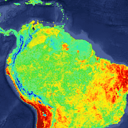
MYD11A2 V6.1 产品以 1200 x 1200 公里的网格提供平均 8 天的地表温度 (LST)。MYD11A2 中的每个像素值都是在相应 8 天内收集的所有相应 MYD11A1 LST 像素的简单平均值。MYD11A2 会执行… 8 天 aqua climate emissivity global lst -
MYD21A1D.061 Aqua 地表温度和 3 波段发射率每日全球 1 公里
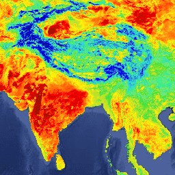
MYD21A1D 数据集每天根据白天 L2 网格化 (L2G) 中间 LST 产品生成,空间分辨率为 1,000 米。L2G 流程将每日 MOD21 条带颗粒映射到正弦 MODIS 网格,并存储落在网格单元上的所有观测结果… aqua 气候 每日 发射率 全球 lst -
MYD21A1N.061 Aqua 地表温度和 3 波段发射率每日全球 1 公里
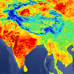
MYD21A1N 数据集每天根据夜间 2 级网格化 (L2G) 中间 LST 产品生成,空间分辨率为 1,000 米。L2G 流程将每日 MOD21 条带颗粒映射到正弦 MODIS 网格,并存储落在网格单元上的所有观测结果… aqua 气候 每日 发射率 全球 lst -
MYD21C1.061 Aqua 地表温度和 3 波段发射率每日 L3 全球 0.05 度 CMG

MYD21C1 数据集每天生成一次,采用 0.05 度(赤道处为 5,600 米)的气候模型网格 (CMG),数据源为白天第 2 级网格化 (L2G) 中间 LST 产品。L2G 流程将每日 MYD21 扫描带颗粒映射到正弦 MODIS 网格,并存储所有… aqua 气候 每日 发射率 全球 lst -
MYD21C2.061 Aqua 地表温度和 3 波段发射率 8 天 L3 全球 0.05 度 CMG

MYD21C2 数据集是一种 8 天合成 LST 产品,它使用基于简单平均方法的算法。该算法会计算 8 天内所有无云 MYD21A1D 和 MYD21A1N 每日采集的平均值。与 MYD21A1 数据集不同,… aqua 气候 发射率 全球 lst nasa -
MYD21C3.061 Aqua 地表温度和 3 波段发射率月度 L3 全球 0.05 度 CMG

MYD21C3 数据集是一种月度合成 LST 产品,它使用基于简单平均方法的算法。该算法会计算 8 天内所有无云 MYD21A1D 和 MYD21A1N 每日采集的平均值。与 MYD21A1 数据集不同,… aqua 气候 发射率 全球 lst 每月 -
OpenLandMap 长期地表温度日间月度中位数

2000 年至 2017 年的地表温度昼间月平均值。使用 R 中的 data.table 软件包和分位数函数得出。如需详细了解 MODIS LST 产品,请参阅此页面。不包括南极洲。如需在 Earth Engine 之外访问和直观呈现地图,请使用此页面。… 气候 envirometrix lst mod11a2 modis monthly -
OpenLandMap 长期地表温度(白天)月度标准差

基于 2000-2017 年时间序列的 1 公里长期 MODIS LST 白天和夜间温度标准差。使用 R 中的 data.table 软件包和分位数函数得出。如需详细了解 MODIS LST 产品,请参阅此页面。不包括南极洲。如需访问… 气候 envirometrix lst mod11a2 modis monthly -
OpenLandMap 长期地表温度月度昼夜差

基于 2000-2017 年时间序列的 1 公里长期 MODIS LST 白天和夜间差异。使用 R 中的 data.table 软件包和分位数函数得出。如需详细了解 MODIS LST 产品,请参阅此页面。不包括南极洲。如需访问和直观呈现… 气候 day envirometrix lst mod11a2 modis -
USGS Landsat 4 Level 2,Collection 2,Tier 1

此数据集包含大气校正后的地表反射率和从 Landsat TM 传感器生成的数据中得出的地表温度。这些影像包含 4 个可见光和近红外 (VNIR) 波段以及 2 个经过处理的短波红外 (SWIR) 波段(正射校正的地表反射率),以及 1 个热红外波段。 cfmask cloud fmask global landsat lasrc -
USGS Landsat 4 Level 2,Collection 2,Tier 2
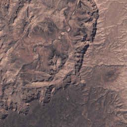
此数据集包含大气校正后的地表反射率和从 Landsat TM 传感器生成的数据中得出的地表温度。这些影像包含 4 个可见光和近红外 (VNIR) 波段以及 2 个经过处理的短波红外 (SWIR) 波段(正射校正的地表反射率),以及 1 个热红外波段。 cfmask cloud fmask global landsat lasrc -
USGS Landsat 5 Level 2,Collection 2,Tier 1
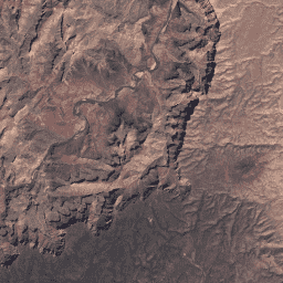
此数据集包含大气校正后的地表反射率和从 Landsat TM 传感器生成的数据中得出的地表温度。这些影像包含 4 个可见光和近红外 (VNIR) 波段以及 2 个经过处理的短波红外 (SWIR) 波段(正射校正的地表反射率),以及 1 个热红外波段。 cfmask cloud fmask global landsat lasrc -
USGS Landsat 5 Level 2,Collection 2,Tier 2
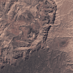
此数据集包含大气校正后的地表反射率和从 Landsat TM 传感器生成的数据中得出的地表温度。这些影像包含 4 个可见光和近红外 (VNIR) 波段以及 2 个经过处理的短波红外 (SWIR) 波段(正射校正的地表反射率),以及 1 个热红外波段。 cfmask cloud fmask global landsat lasrc -
USGS Landsat 7 Level 2、Collection 2、Tier 1
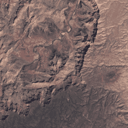
此数据集包含由 Landsat 7 ETM+ 传感器生成的数据得出的经过大气校正的地面反射率和地表温度。这些影像包含 4 个可见光和近红外 (VNIR) 波段以及 2 个短波红外 (SWIR) 波段,经过处理后可获得正射校正的地表反射率,以及 1 个热红外波段。 cfmask cloud etm fmask global landsat -
USGS Landsat 7 Level 2,Collection 2,Tier 2
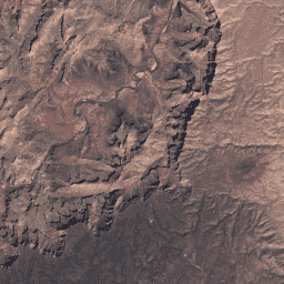
此数据集包含由 Landsat 7 ETM+ 传感器生成的数据得出的经过大气校正的地面反射率和地表温度。这些影像包含 4 个可见光和近红外 (VNIR) 波段以及 2 个短波红外 (SWIR) 波段,经过处理后可获得正射校正的地表反射率,以及 1 个热红外波段。 cfmask cloud etm fmask global landsat -
USGS Landsat 8 Level 2,Collection 2,Tier 1
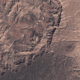
此数据集包含由 Landsat 8 OLI/TIRS 传感器生成的数据得出的经过大气校正的地表反射率和地表温度。这些图像包含 5 个可见光和近红外 (VNIR) 波段以及 2 个经过处理的短波红外 (SWIR) 波段(正射校正的地表反射率),以及 1 个热红外波段。 cfmask cloud fmask global l8sr landsat -
USGS Landsat 8 第 2 级、集合 2、第 2 层级
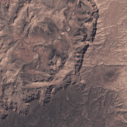
此数据集包含由 Landsat 8 OLI/TIRS 传感器生成的数据得出的经过大气校正的地表反射率和地表温度。这些图像包含 5 个可见光和近红外 (VNIR) 波段以及 2 个经过处理的短波红外 (SWIR) 波段(正射校正的地表反射率),以及 1 个热红外波段。 cfmask cloud fmask global l8sr landsat -
USGS Landsat 9 Level 2,Collection 2,Tier 1
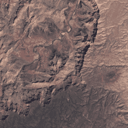
此数据集包含大气校正后的地表反射率和地表温度,这些数据均源自 Landsat 9 OLI/TIRS 传感器生成的数据。这些图像包含 5 个可见光和近红外 (VNIR) 波段以及 2 个经过处理的短波红外 (SWIR) 波段(正射校正的地表反射率),以及 1 个热红外波段。 cfmask cloud fmask global l9sr landsat -
USGS Landsat 9 Level 2、Collection 2、Tier 2
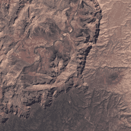
此数据集包含大气校正后的地表反射率和地表温度,这些数据均源自 Landsat 9 OLI/TIRS 传感器生成的数据。这些图像包含 5 个可见光和近红外 (VNIR) 波段以及 2 个经过处理的短波红外 (SWIR) 波段(正射校正的地表反射率),以及 1 个热红外波段。 cfmask cloud fmask global l9sr landsat
Datasets tagged lst in Earth Engine
[null,null,[],[],["The data covers land surface temperature (LST) and emissivity from various sources. GCOM-C datasets track terrestrial LST, with V3 as the ongoing version, and are designed for global observation of radiation and carbon cycle. Landsat datasets provide atmospherically corrected surface reflectance and LST with several VNIR, SWIR, and thermal bands. MODIS data offers daily, 8-day, and monthly LST and emissivity, alongside day/night temperature differences and long term statistics. Oxford MAP provides gap-filled day and night LST data.\n"]]
