-
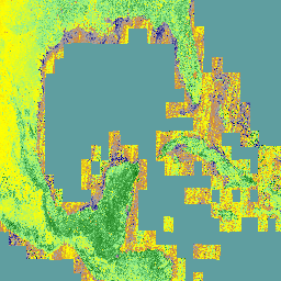
AG100:ASTER 全球发射率数据集 100 米 V003

高级星载热发射和反射辐射计全球发射率数据库 (ASTER-GED) 由美国国家航空航天局 (NASA) 的喷气推进实验室 (JPL)(加利福尼亚理工学院)开发。此产品包括所有 5 个 ASTER 热红外波段的平均发射率和标准差… aster 高程 发射率 地球物理 红外 jpl -
ECOSTRESS 平铺辅助 NDVI 和反照率 L2 全球 70 米 V002

ECOSTRESS Tiled Ancillary NDVI and Albedo (ECO_L2T_STARS) V002 数据集以 70 米的空间分辨率提供归一化差值植被指数 (NDVI) 和反照率数据。这种辅助产品对于了解植物的需水量和压力至关重要,是通过数据融合流程创建的,该流程将可见光… 反照率 陆地 ndvi 植物生产力 -
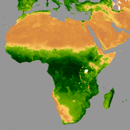
来自 AVHRR 传感器的 GIMMS NDVI(第 3 代)

GIMMS NDVI 是根据 NOAA 的多个 AVHRR 传感器生成的,适用于全球 1/12 度经纬度网格。GIMMS NDVI 数据集的最新版本名为 NDVI3g(来自 AVHRR 传感器的第三代 GIMMS NDVI)。 avhrr nasa ndvi noaa 植被 植被指数 -
Landsat Collection 2 Tier 1 Level 2 32 天 NDVI 复合数据

这些 Landsat Collection 2 Tier 1 Level 2 合成影像由 Tier 1 Level 2 正射校正后的场景构成。归一化差异植被指数是根据每个场景的近红外波段和红色波段计算得出的,计算公式为 (NIR - Red) / (NIR + Red),范围为 … 陆地卫星 陆地卫星合成 ndvi usgs 植被 植被指数 -
Landsat Collection 2 Tier 1 Level 2 8 天 NDVI 复合数据

这些 Landsat Collection 2 Tier 1 Level 2 合成影像由 Tier 1 Level 2 正射校正后的场景构成。归一化差异植被指数是根据每个场景的近红外波段和红色波段计算得出的,计算公式为 (NIR - Red) / (NIR + Red),范围为 … 陆地卫星 陆地卫星合成 ndvi usgs 植被 植被指数 -
Landsat Collection 2 Tier 1 Level 2 年度 NDVI 合成影像

这些 Landsat Collection 2 Tier 1 Level 2 合成影像由 Tier 1 Level 2 正射校正后的场景构成。归一化差异植被指数是根据每个场景的近红外波段和红色波段计算得出的,计算公式为 (NIR - Red) / (NIR + Red),范围为 … 陆地卫星 陆地卫星合成 ndvi usgs 植被 植被指数 -
MOD13A1.061 Terra 植被指数 16 天全球 500 米

MOD13A1 V6.1 产品以像素为基础提供植被指数 (VI) 值。主要有两层植被。第一个是归一化差值植被指数 (NDVI),它被称为现有美国国家海洋和大气管理局 (NOAA) … 16 天 evi global modis nasa ndvi -
MOD13A2.061 Terra 植被指数 16 天全球 1 公里

MOD13A2 V6.1 产品提供两种植被指数 (VI):归一化差值植被指数 (NDVI) 和增强型植被指数 (EVI)。NDVI 被称为连续性指数,可与现有的美国国家海洋和大气管理局-高级甚高分辨率辐射计 (NOAA-AVHRR) 派生的 NDVI 进行比较。… 16 天 evi global modis nasa ndvi -
MOD13A3.061 植被指数月度 L3 全球 1 公里 SIN 网格

MOD13A3 V6.1 产品数据以 1 公里 (km) 的空间分辨率按月提供。在生成此月度产品时,该算法会提取与相应月份重叠的所有 MOD13A2 产品,并采用加权时间平均值。植被指数用于在全球范围内监测植被… evi global modis monthly nasa ndvi -
MOD13Q1.061 Terra 植被指数 16 天全球 250 米

MOD13Q1 V6.1 产品以像素为单位提供植被指数 (VI) 值。主要有两层植被。第一个是归一化差值植被指数 (NDVI),它被称为现有美国国家海洋和大气管理局 (NOAA) … 16 天 evi global modis nasa ndvi -
MYD13A1.061 Aqua 植被指数 16 天全球 500 米

MYD13A1 V6.1 产品以每个像素为基础提供植被指数 (VI) 值。主要有两层植被。第一个是归一化差值植被指数 (NDVI),它被称为现有美国国家海洋和大气管理局 (NOAA) … 16 天 aqua evi global modis nasa -
MYD13A2.061 Aqua 植被指数 16 天全球 1 公里

MYD13A2 V6.1 产品提供两种植被指数 (VI):归一化差值植被指数 (NDVI) 和增强型植被指数 (EVI)。NDVI 被称为连续性指数,可与现有的美国国家海洋和大气管理局-高级甚高分辨率辐射计 (NOAA-AVHRR) 派生的 NDVI 进行比较。… 16 天 aqua evi global modis nasa -
MYD13A3.061 Aqua 植被指数月度 L3 全球 1 公里 SIN 网格

Aqua 中分辨率成像光谱辐射计 (MODIS) 植被指数 (MYD13A3) 版本 6.1 数据以网格化 3 级产品的形式按月提供,空间分辨率为 1 公里 (km),采用正弦投影。在生成此月度产品时,该算法会提取所有 MYD13A2 产品,这些产品… aqua evi global modis monthly nasa -
MYD13Q1.061 Aqua 植被指数 16 天全球 250 米

MYD13Q1 V6.1 产品以像素为单位提供植被指数 (VI) 值。主要有两层植被。第一个是归一化差值植被指数 (NDVI),它被称为现有美国国家海洋和大气管理局 (NOAA) … 16 天 aqua evi global modis nasa -
NOAA CDR AVHRR NDVI:归一化差值植被指数,版本 5

AVHRR 常态化差值植生指标 (NDVI) 的 NOAA 气候数据记录 (CDR) 包含从 NOAA AVHRR 地表反射率产品中得出的网格化日 NDVI。它提供了一种地表植被覆盖活动测量方法,以 0.05° 的分辨率进行网格化,并在全球陆地上进行计算… avhrr cdr daily land ndvi noaa -
NOAA CDR VIIRS NDVI:归一化差值植被指数,版本 1

此数据集包含网格化每日归一化差值植被指数 (NDVI),该指数源自 NOAA 可见光红外成像辐射计套件 (VIIRS) 地表反射率的气候数据记录 (CDR)。数据记录涵盖了 2014 年至今,使用的是 NOAA 极地轨道卫星的数据。这些数据是根据…预测的 cdr daily land ndvi noaa vegetation-indices -
VNP13A1.002:VIIRS 植被指数 16 天 500 米

苏奥米国家极地轨道合作伙伴计划 (S-NPP) NASA 可见光红外成像辐射仪套件 (VIIRS) 植被指数 (VNP13A1) 数据产品通过在 16 天的采集期内以 500 米的分辨率选择最佳可用像素来提供植被指数。VNP13 数据产品旨在… 16 天 evi nasa ndvi noaa npp -
VNP22Q2:陆地表面物候学年度 L3 全球 500 米 SIN 网格

Suomi 国家极地轨道合作伙伴计划 (Suomi NPP) NASA 可见光红外成像辐射仪套件 (VIIRS) 地表覆盖动态数据产品以年度间隔提供全球陆地表面物候 (GLSP) 指标。VNP22Q2 数据产品源自双波段增强型植被指数 (EVI2) 的时间序列… land landuse-landcover nasa ndvi noaa npp
Datasets tagged ndvi in Earth Engine
[null,null,[],[],[]]
