-
NEON 冠层高度模型 (CHM)
冠层顶部相对于裸露地面的高度(冠层高度模型;CHM)。CHM 派生自 NEON LiDAR 点云,通过在 LiDAR 调查的整个空间域内创建连续的冠层高度估算表面来生成。… airborne canopy forest forest-biomass lidar neon -
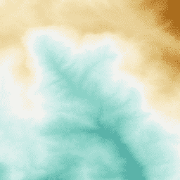
NEON 数字海拔模型 (DEM)
从 NEON LiDAR 数据派生的地表数字模型 (DSM) 和地形数字模型 (DTM)。DSM:地表地图项(包含植被和人工结构的地形信息)。DTM:裸地海拔(去除植被和人工结构的地形信息)。图片以海拔为单位… airborne dem elevation-topography forest lidar neon -
NEON RGB 摄像头图像
高分辨率红-绿-蓝 (RGB) 正射摄像头图像经过拼接,并使用最近邻重采样输出到固定的均匀空间网格;空间分辨率为 0.1 米。数码相机是 NEON 机载观测平台 (AOP) 上一系列仪器的一部分,该平台还包括… airborne forest highres neon neon-prod-earthengine orthophoto -
NEON Surface 双向反射
NEON AOP 地表双向反射率是一种高光谱 VSWIR(可见光到短波红外)数据产品,包含 426 个波段,波长范围介于 380 纳米到 2510 纳米之间。反射率按 10000 的比例缩放。将 1340-1445 nm 和 1790-1955 nm 之间的波长设置为… airborne forest hyperspectral neon neon-prod-earthengine publisher-dataset -
NEON Surface Directional Reflectance
NEON AOP 地表方向反射率是一种高光谱 VSWIR(可见光到短波红外)数据产品,包含 426 个波段,波长范围介于 380 纳米到 2510 纳米之间。反射率按 10000 的比例缩放。将 1340-1445 nm 和 1790-1955 nm 之间的波长设置为… airborne forest hyperspectral neon neon-prod-earthengine publisher-dataset
Datasets tagged neon in Earth Engine
[null,null,[],[[["\u003cp\u003eThe NEON datasets provide various remote sensing data, including Canopy Height Models (CHM), Digital Elevation Models (DEM), and surface reflectance data, collected using LiDAR and hyperspectral imaging.\u003c/p\u003e\n"],["\u003cp\u003eThe CHM represents canopy height above bare earth, while the DEM offers surface and terrain models derived from LiDAR data, including vegetation and man-made structures.\u003c/p\u003e\n"],["\u003cp\u003eNEON offers both directional and bidirectional surface reflectance data, covering visible to shortwave infrared wavelengths, ideal for vegetation analysis.\u003c/p\u003e\n"],["\u003cp\u003eHigh-resolution RGB camera imagery is also available, providing orthorectified images with a spatial resolution of 0.1 meters, captured by the NEON Airborne Observation Platform.\u003c/p\u003e\n"],["\u003cp\u003eThese datasets are valuable for ecological research, forest monitoring, and land cover analysis, offering detailed insights into ecosystem structure and function.\u003c/p\u003e\n"]]],["NEON data includes the Canopy Height Model (CHM), which estimates canopy height from LiDAR. Digital Elevation Models (DEM) provide surface and terrain information from LiDAR. Directional and Bidirectional Surface Reflectance data offer hyperspectral information across 426 bands, excluding water vapor absorption bands. RGB Camera Imagery provides high-resolution, orthorectified images at 0.1m resolution, collected using an airborne platform. All the data includes information about the forest.\n"],null,["# Datasets tagged neon in Earth Engine\n\n-\n\n |---------------------------------------------------------------------------------------------------------------------------------------------------------------------------------------------------------------------------------------------------------------------------------------------|\n | [### NEON Canopy Height Model (CHM)](/earth-engine/datasets/catalog/projects_neon-prod-earthengine_assets_CHM_001) |\n | Height of the top of canopy above bare earth (Canopy Height Model; CHM). The CHM is derived from the NEON LiDAR point cloud and is generated by creating a continuous surface of canopy height estimates across the entire spatial domain of the LiDAR survey. The ... |\n | [airborne](/earth-engine/datasets/tags/airborne) [canopy](/earth-engine/datasets/tags/canopy) [forest](/earth-engine/datasets/tags/forest) [forest-biomass](/earth-engine/datasets/tags/forest-biomass) [lidar](/earth-engine/datasets/tags/lidar) [neon](/earth-engine/datasets/tags/neon) |\n\n-\n\n |-----------------------------------------------------------------------------------------------------------------------------------------------------------------------------------------------------------------------------------------------------------------------------------------------------------------------------------------|\n | [### NEON Digital Elevation Model (DEM)](/earth-engine/datasets/catalog/projects_neon-prod-earthengine_assets_DEM_001) |\n | Digital models of the surface (DSM) and terrain (DTM) derived from NEON LiDAR data. DSM: Surface features (topographic information with vegetation and man-made structures present). DTM: Bare earth elevation (topographic information with vegetation and man-made structures removed). Images are given in meters above mean sea ... |\n | [airborne](/earth-engine/datasets/tags/airborne) [dem](/earth-engine/datasets/tags/dem) [elevation-topography](/earth-engine/datasets/tags/elevation-topography) [forest](/earth-engine/datasets/tags/forest) [lidar](/earth-engine/datasets/tags/lidar) [neon](/earth-engine/datasets/tags/neon) |\n\n-\n\n |-------------------------------------------------------------------------------------------------------------------------------------------------------------------------------------------------------------------------------------------------------------------------------------------------------------------------|\n | [### NEON RGB Camera Imagery](/earth-engine/datasets/catalog/projects_neon-prod-earthengine_assets_RGB_001) |\n | High resolution Red-Green-Blue (RGB) orthorectified camera images mosaicked and output onto a fixed, uniform spatial grid using nearest-neighbor resampling; spatial resolution is 0.1 m. The digital camera is part of a suite of instruments on the NEON Airborne Observation Platform (AOP) that also includes a ... |\n | [airborne](/earth-engine/datasets/tags/airborne) [forest](/earth-engine/datasets/tags/forest) [highres](/earth-engine/datasets/tags/highres) [neon](/earth-engine/datasets/tags/neon) [neon-prod-earthengine](/earth-engine/datasets/tags/neon-prod-earthengine) [orthophoto](/earth-engine/datasets/tags/orthophoto) |\n\n-\n\n |-------------------------------------------------------------------------------------------------------------------------------------------------------------------------------------------------------------------------------------------------------------------------------------------------------------------------------------------------|\n | [### NEON Surface Bidirectional Reflectance](/earth-engine/datasets/catalog/projects_neon-prod-earthengine_assets_HSI_REFL_002) |\n | The NEON AOP Surface Bidirectional Reflectance is a hyperspectral VSWIR (visible to shortwave infrared) data product, containing 426 bands spanning wavelengths from \\~380 nm to 2510 nm. Reflectance is scaled by a factor of 10000. Wavelengths between 1340-1445 nm and 1790-1955 nm are set to ... |\n | [airborne](/earth-engine/datasets/tags/airborne) [forest](/earth-engine/datasets/tags/forest) [hyperspectral](/earth-engine/datasets/tags/hyperspectral) [neon](/earth-engine/datasets/tags/neon) [neon-prod-earthengine](/earth-engine/datasets/tags/neon-prod-earthengine) [publisher-dataset](/earth-engine/datasets/tags/publisher-dataset) |\n\n-\n\n |-------------------------------------------------------------------------------------------------------------------------------------------------------------------------------------------------------------------------------------------------------------------------------------------------------------------------------------------------|\n | [### NEON Surface Directional Reflectance](/earth-engine/datasets/catalog/projects_neon-prod-earthengine_assets_HSI_REFL_001) |\n | The NEON AOP Surface Directional Reflectance is a hyperspectral VSWIR (visible to shortwave infrared) data product, containing 426 bands spanning wavelengths from \\~380 nm to 2510 nm. Reflectance is scaled by a factor of 10000. Wavelengths between 1340-1445 nm and 1790-1955 nm are set to ... |\n | [airborne](/earth-engine/datasets/tags/airborne) [forest](/earth-engine/datasets/tags/forest) [hyperspectral](/earth-engine/datasets/tags/hyperspectral) [neon](/earth-engine/datasets/tags/neon) [neon-prod-earthengine](/earth-engine/datasets/tags/neon-prod-earthengine) [publisher-dataset](/earth-engine/datasets/tags/publisher-dataset) |"]]