-
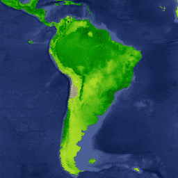
MOD17A3HGF.061: Terra Net Primary Production Gap-Filled Yearly Global 500m
The MOD17A3HGF V6.1 product provides information about annual Gross and Net Primary Productivity (GPP and NPP) at 500m pixel resolution. Annual NPP is derived from the sum of all 8-day Net Photosynthesis(PSN) products (MOD17A2H) from the given year. The PSN value is the difference of … global gpp nasa npp photosynthesis productivity -
MYD17A3HGF.061: Aqua Net Primary Production Gap-Filled Yearly Global 500m
The MYD17A3HGF V6.1 product provides information about annual Gross and Net Primary Productivity (GPP and NPP) at 500m pixel resolution. Annual NPP is derived from the sum of all 8-day Net Photosynthesis(PSN) products (MYD17A2H) from the given year. The PSN value is the difference of … aqua global gpp nasa npp photosynthesis -
VNP09GA: VIIRS Surface Reflectance Daily 500m and 1km
The Visible Infrared Imaging Radiometer Suite (VIIRS) daily surface reflectance (VNP09GA) product provides an estimate of land surface reflectance from the Suomi National Polar-Orbiting Partnership (S-NPP) VIIRS sensor. Data are provided for three imagery bands (I1, I2, I3) at nominal 500 meter resolution (~463 meter) … daily nasa noaa npp reflectance sr -
VNP09H1: VIIRS Surface Reflectance 8-Day L3 Global 500m
The 8-day Visible Infrared Imaging Radiometer Suite (VIIRS) Surface Reflectance (VNP09H1) Version 1 composite product provides an estimate of land surface reflectance from the Suomi National Polar-orbiting Partnership (Suomi NPP) VIIRS sensor for three imagery bands (I1, I2, I3) at nominal 500m resolution (~463m). The … daily nasa noaa npp reflectance sr -
VNP13A1.002: VIIRS Vegetation Indices 16-Day 500m
The Suomi National Polar-Orbiting Partnership (S-NPP) NASA Visible Infrared Imaging Radiometer Suite (VIIRS) Vegetation Indices (VNP13A1) data product provides vegetation indices by a process of selecting the best available pixel over a 16-day acquisition period at 500 meter resolution. The VNP13 data products are designed … 16-day evi nasa ndvi noaa npp -
VNP22Q2: Land Surface Phenology Yearly L3 Global 500m SIN Grid
The Suomi National Polar-Orbiting Partnership (Suomi NPP) NASA Visible Infrared Imaging Radiometer Suite (VIIRS) Land Cover Dynamics data product provides global land surface phenology (GLSP) metrics at yearly intervals. The VNP22Q2 data product is derived from time series of the two-band Enhanced Vegetation Index (EVI2) … land nasa ndvi noaa npp onset-greenness -
Landsat Net Primary Production CONUS
The Landsat Net Primary Production (NPP) CONUS dataset estimates NPP using Landsat Surface Reflectance for CONUS. NPP is the amount of carbon captured by plants in an ecosystem, after accounting for losses due to respiration. NPP is calculated using the MOD17 algorithm (see MOD17 User … conus gridmet-derived landsat mod17 nlcd-derived npp -
MODIS Net Primary Production CONUS
The MODIS Net Primary Production (NPP) CONUS dataset estimates NPP using MODIS Surface Reflectance for CONUS. NPP is the amount of carbon captured by plants in an ecosystem, after accounting for losses due to respiration. NPP is calculated using the MOD17 algorithm (see MOD17 User … conus gridmet-derived mod09q1 mod17 modis nlcd-derived
[null,null,[],[[["This collection of datasets provides various ways to assess vegetation productivity and land surface properties."],["Datasets include information about Gross Primary Productivity (GPP), Net Primary Productivity (NPP), and surface reflectance."],["Data is available at varying resolutions (500m, 1km) and temporal frequencies (daily, 8-day, 16-day, yearly)."],["Sources for the data include MODIS, VIIRS, and Landsat sensors, covering both global and CONUS regions."],["These datasets can be used to monitor vegetation health, land cover changes, and carbon dynamics."]]],[]]