-
NICFI 卫星数据计划:用于热带森林监测的基础地图 - 非洲
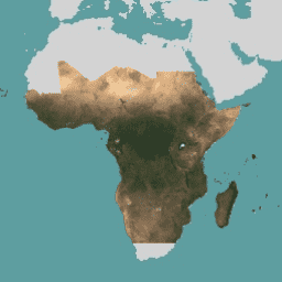
此图片集提供对热带地区的高分辨率卫星监测数据,主要目的是减少和扭转热带森林的损失,从而有助于应对气候变化、保护生物多样性、促进森林再生、恢复和增强,以及推动可持续发展,所有这些都… basemaps forest nicfi planet planet-nicfi publisher-dataset -
NICFI 卫星数据计划热带森林监测基本地图 - 美洲
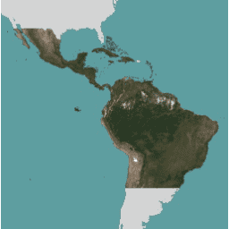
此图片集提供对热带地区的高分辨率卫星监测数据,主要目的是减少和扭转热带森林的损失,从而有助于应对气候变化、保护生物多样性、促进森林再生、恢复和增强,以及推动可持续发展,所有这些都… basemaps forest nicfi planet planet-nicfi publisher-dataset -
NICFI 卫星数据计划热带森林监测基本地图 - 亚洲
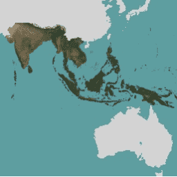
此图片集提供对热带地区的高分辨率卫星监测数据,主要目的是减少和扭转热带森林的损失,从而有助于应对气候变化、保护生物多样性、促进森林再生、恢复和增强,以及推动可持续发展,所有这些都… basemaps forest nicfi planet planet-nicfi publisher-dataset
Datasets tagged planet-nicfi in Earth Engine
[null,null,[],[],["High-resolution satellite imagery is available for monitoring tropical forests across Africa, the Americas, and Asia. The data is aimed at reducing tropical forest loss and combating climate change. It also aids in biodiversity conservation, forest regrowth, restoration, and sustainable development. This program, known as NICFI, provides access to satellite data from Planet, identified as planet-nicfi, to achieve these goals. These resources are considered as basemaps.\n"]]