-
Kakao-Wahrscheinlichkeitsmodell 2025a
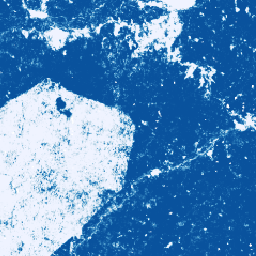
Hinweis: Dieser Datensatz wurde noch nicht von Experten geprüft. Weitere Informationen finden Sie in der GitHub-README-Datei. Diese Bildsammlung enthält eine geschätzte Pixelwahrscheinlichkeit dafür, dass die zugrunde liegende Fläche von der Ware belegt ist. Die Wahrscheinlichkeitsschätzungen werden mit einer Auflösung von 10 Metern bereitgestellt und wurden von … Landwirtschaft Biodiversität Erhaltung Ernte EUDR forestdatapartnership -
Kaffee-Wahrscheinlichkeitsmodell 2025a
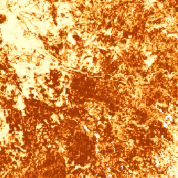
Hinweis: Dieser Datensatz wurde noch nicht von Experten geprüft. Weitere Informationen finden Sie in der GitHub-README-Datei. Diese Bildsammlung enthält eine geschätzte Pixelwahrscheinlichkeit dafür, dass die zugrunde liegende Fläche von der Ware belegt ist. Die Wahrscheinlichkeitsschätzungen werden mit einer Auflösung von 10 Metern bereitgestellt und wurden von … Landwirtschaft Biodiversität Erhaltung Ernte EUDR forestdatapartnership -
Globale Karte der Ölpalmenplantagen
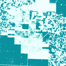
Der Datensatz ist eine globale Karte mit 10 Millionen Ölpalmenplantagen von Industrie- und Kleinbauern für 2019. Sie umfasst Gebiete, in denen Ölpalmenplantagen gefunden wurden. Die klassifizierten Bilder sind die Ausgabe eines Convolutional Neural Networks, das auf halbjährlichen Sentinel-1- und Sentinel-2-Kompositen basiert. Weitere Informationen finden Sie im Artikel… Landwirtschaft Biodiversität Erhaltung Ernte global Nutzung -
Palm Probability Model 2025a
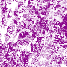
Hinweis: Dieser Datensatz wurde noch nicht von Experten geprüft. Weitere Informationen finden Sie in der GitHub-README-Datei. Diese Bildsammlung enthält eine geschätzte Pixelwahrscheinlichkeit dafür, dass die zugrunde liegende Fläche von der Ware belegt ist. Die Wahrscheinlichkeitsschätzungen werden mit einer Auflösung von 10 Metern bereitgestellt und wurden von … Landwirtschaft Biodiversität Erhaltung Ernte EUDR forestdatapartnership -
Gummibaum-Wahrscheinlichkeitsmodell 2025a
Hinweis: Dieser Datensatz wurde noch nicht von Experten geprüft. Weitere Informationen finden Sie in der GitHub-README-Datei. Diese Bildsammlung enthält eine geschätzte Pixelwahrscheinlichkeit dafür, dass die zugrunde liegende Fläche von der Ware belegt ist. Die Wahrscheinlichkeitsschätzungen werden mit einer Auflösung von 10 Metern bereitgestellt und wurden von … Landwirtschaft Biodiversität Erhaltung Ernte EUDR forestdatapartnership
Datasets tagged plantation in Earth Engine
[null,null,[],[[["\u003cp\u003eThis page features datasets with global coverage and 10-meter resolution on oil palm plantations, cocoa, palm, and rubber tree probability.\u003c/p\u003e\n"],["\u003cp\u003eThe oil palm plantation dataset provides a 2019 map of industrial and smallholder plantations, based on Sentinel-1 and Sentinel-2 imagery analysis.\u003c/p\u003e\n"],["\u003cp\u003eThe cocoa, palm, and rubber tree probability models offer per-pixel likelihood of these crops' presence but are not yet peer-reviewed, with users directed to the associated GitHub README for details.\u003c/p\u003e\n"],["\u003cp\u003eAll datasets are relevant for biodiversity, conservation, and land use analysis.\u003c/p\u003e\n"]]],["The information describes four datasets related to agricultural land use. The first is a 2019 global map of oil palm plantations at 10m resolution, created using a neural network on satellite imagery. The other three are per-pixel probability models, also at 10m resolution, for cocoa, palm, and rubber trees respectively, all labeled as \"2024a\" and not peer-reviewed. These models estimate the probability of each area being occupied by these specific crops. All datasets are tagged with biodiversity, conservation, crop, and landuse.\n"],null,["# Datasets tagged plantation in Earth Engine\n\n-\n\n |---------------------------------------------------------------------------------------------------------------------------------------------------------------------------------------------------------------------------------------------------------------------------------------------------------------------------------------|\n | [### Cocoa Probability model 2025a](/earth-engine/datasets/catalog/projects_forestdatapartnership_assets_cocoa_model_2025a) |\n | Note: This dataset is not yet peer-reviewed. Please see this GitHub README for more information. This image collection provides estimated per-pixel probability that the underlying area is occupied by the commodity. The probability estimates are provided at 10 meter resolution, and have been generated by ... |\n | [agriculture](/earth-engine/datasets/tags/agriculture) [biodiversity](/earth-engine/datasets/tags/biodiversity) [conservation](/earth-engine/datasets/tags/conservation) [crop](/earth-engine/datasets/tags/crop) [eudr](/earth-engine/datasets/tags/eudr) [forestdatapartnership](/earth-engine/datasets/tags/forestdatapartnership) |\n\n-\n\n |---------------------------------------------------------------------------------------------------------------------------------------------------------------------------------------------------------------------------------------------------------------------------------------------------------------------------------------|\n | [### Coffee Probability model 2025a](/earth-engine/datasets/catalog/projects_forestdatapartnership_assets_coffee_model_2025a) |\n | Note: This dataset is not yet peer-reviewed. Please see this GitHub README for more information. This image collection provides estimated per-pixel probability that the underlying area is occupied by the commodity. The probability estimates are provided at 10 meter resolution, and have been generated by ... |\n | [agriculture](/earth-engine/datasets/tags/agriculture) [biodiversity](/earth-engine/datasets/tags/biodiversity) [conservation](/earth-engine/datasets/tags/conservation) [crop](/earth-engine/datasets/tags/crop) [eudr](/earth-engine/datasets/tags/eudr) [forestdatapartnership](/earth-engine/datasets/tags/forestdatapartnership) |\n\n-\n\n |---------------------------------------------------------------------------------------------------------------------------------------------------------------------------------------------------------------------------------------------------------------------------------------------------------------|\n | [### Global Map of Oil Palm Plantations](/earth-engine/datasets/catalog/BIOPAMA_GlobalOilPalm_v1) |\n | The dataset is a 10m global industrial and smallholder oil palm map for 2019. It covers areas where oil palm plantations were detected. The classified images are the output of a convolutional neural network based on Sentinel-1 and Sentinel-2 half-year composites. See article for additional ... |\n | [agriculture](/earth-engine/datasets/tags/agriculture) [biodiversity](/earth-engine/datasets/tags/biodiversity) [conservation](/earth-engine/datasets/tags/conservation) [crop](/earth-engine/datasets/tags/crop) [global](/earth-engine/datasets/tags/global) [landuse](/earth-engine/datasets/tags/landuse) |\n\n-\n\n |---------------------------------------------------------------------------------------------------------------------------------------------------------------------------------------------------------------------------------------------------------------------------------------------------------------------------------------|\n | [### Palm Probability model 2025a](/earth-engine/datasets/catalog/projects_forestdatapartnership_assets_palm_model_2025a) |\n | Note: This dataset is not yet peer-reviewed. Please see this GitHub README for more information. This image collection provides estimated per-pixel probability that the underlying area is occupied by the commodity. The probability estimates are provided at 10 meter resolution, and have been generated by ... |\n | [agriculture](/earth-engine/datasets/tags/agriculture) [biodiversity](/earth-engine/datasets/tags/biodiversity) [conservation](/earth-engine/datasets/tags/conservation) [crop](/earth-engine/datasets/tags/crop) [eudr](/earth-engine/datasets/tags/eudr) [forestdatapartnership](/earth-engine/datasets/tags/forestdatapartnership) |\n\n-\n\n |---------------------------------------------------------------------------------------------------------------------------------------------------------------------------------------------------------------------------------------------------------------------------------------------------------------------------------------|\n | [### Rubber Tree Probability model 2025a](/earth-engine/datasets/catalog/projects_forestdatapartnership_assets_rubber_model_2025a) |\n | Note: This dataset is not yet peer-reviewed. Please see this GitHub README for more information. This image collection provides estimated per-pixel probability that the underlying area is occupied by the commodity. The probability estimates are provided at 10 meter resolution, and have been generated by ... |\n | [agriculture](/earth-engine/datasets/tags/agriculture) [biodiversity](/earth-engine/datasets/tags/biodiversity) [conservation](/earth-engine/datasets/tags/conservation) [crop](/earth-engine/datasets/tags/crop) [eudr](/earth-engine/datasets/tags/eudr) [forestdatapartnership](/earth-engine/datasets/tags/forestdatapartnership) |"]]