-
2000 年格陵兰镶嵌图 - 格陵兰冰层测绘项目 (GIMP)
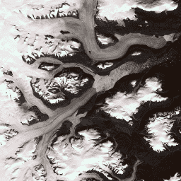
此数据集提供格陵兰冰盖的完整 15 米分辨率图像镶嵌,该镶嵌图源自 1999 年至 2002 年的 Landsat 7 ETM+ 和 RADARSAT-1 SAR 图像。这些方法包括图像云遮罩、全色锐化、图像采样和调整大小等技术的组合,… arctic gimp greenland imagery nasa polar -
CryoSat-2 南极洲 1 公里 DEM
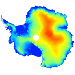
此数据集是南极冰盖和冰架的数字高程模型 (DEM),基于 CryoSat-2 卫星雷达高度计在 2010 年 7 月至 2016 年 7 月期间记录的观测数据。DEM 是根据在 1 天、2 天、3 天、4 天、5 天、6 天、7 天、8 天、9 天、10 天、11 天、12 天、13 天、14 天、15 天、16 天、17 天、18 天、19 天、20 天、21 天、22 天、23 天、24 天、25 天、26 天、27 天、28 天、29 天、30 天、31 天、32 天、33 天、34 天、35 天、36 天、37 天、38 天、39 天、40 天、41 天、42 天、43 天、44 天、45 天、46 天、47 天、48 天、49 南极洲 数字高程模型 海拔 海拔-地形 极地 -
格陵兰 DEM - 格陵兰地图绘制项目 (GIMP)
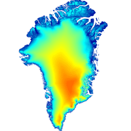
此数字高程模型 (DEM) 是由 ASTER 和 SPOT-5 DEM 组合而成,用于表示大约 82.5°N 以南的冰盖外围和边缘(即低于平衡线高程)以及冰盖内部和极北地区的 AVHRR 光度测斜术(Scambos 和 … 北极 海拔地形 GIMP 格陵兰 NASA 极地 -
格陵兰冰盖和海洋掩码 - 格陵兰测绘项目 (GIMP)

此数据集提供了格陵兰冰盖的完整陆地冰和海洋分类掩码(分辨率为 15 米)。冰盖是使用以下影像绘制的:USGS 分发的 Landsat 7 Enhanced Thematic Mapper Plus (ETM+) 的正射校正全色(波段 8)影像,以及… 北极 冰冻圈 gimp 格陵兰 冰 nasa -
MEaSUREs Greenland Ice Velocity: Selected Glacier Site Velocity Maps from Optical Images Version 2

此数据集是 NASA“在研究环境中制作地球系统数据记录”(MEaSUREs) 计划的一部分,包含所选冰川出口区域的平均月度速度地图。这些地图是通过跟踪 Landsat … 北极 冰冻圈 gimp 格陵兰 冰 nasa
Datasets tagged polar in Earth Engine
[null,null,[],[],[]]