-
ASTER L1T 辐射率

注意:由于 ASTER 仪器存在技术问题,2024 年 11 月 28 日至 2025 年 1 月 16 日期间的数据收集存在缺口。如需了解详情,请参阅美国地质调查局的公告。高级星载热发射和反射辐射计 (ASTER) 是一种多光谱成像仪,可… aster imagery nasa nir radiance satellite-imagery -
DMSP OLS:全球辐射校准夜间灯光版本 4,国防气象计划业务线扫描系统

国防气象计划 (DMSP) 运行线扫描系统 (OLS) 具有独特的夜间检测可见光和近红外 (VNIR) 发射源的能力。此集合包含未出现传感器饱和的全球夜间灯光图像。传感器通常在高增益设置下运行,以实现… dmsp eog imagery lights nighttime ols -
EMIT L1B 传感器处校准的辐射率和地理定位数据 60 米

EMIT 项目是 NASA 地球科学部 (ESD) 项目主管指导下的地球风险仪器 (EV-I) 计划的一部分。EMIT 包含一个 VSWIR 红外戴森成像光谱仪,该光谱仪经过改造,可安装在国际空间站 (ISS) 上。EMIT 测量的是辐射度… daily emit nasa radiance satellite-imagery -
Harmonized Sentinel-2 MSI:多光谱成像仪,Level-1C (TOA)

自 2022 年 1 月 25 日起,PROCESSING_BASELINE 为“04.00”或更高的 Sentinel-2 场景的 DN(值)范围已偏移 1000。HARMONIZED 集合会将新场景中的数据移至与旧场景相同的范围内。Sentinel-2 是一项宽幅、高分辨率、多光谱成像任务,可为哥白尼… copernicus esa eu msi radiance satellite-imagery -
1975 年 Landsat 全球土地调查

全球陆地调查 (GLS) 1975 是 Landsat 多光谱扫描仪 (MSS) 拍摄的全球图像集合。大多数场景都是由 Landsat 1-3 在 1972 年至 1983 年间拍摄的。Landsat 1-3 数据中的一些缺口已通过 Landsat 4-5 在 … 期间获取的场景填补 全球 gls 陆地卫星 辐射亮度 卫星图像 usgs -
Landsat 全球陆地调查 2005 年,Landsat 5 场景

GLS2005 数据集包含 9,500 幅经过正射校正的叶茂盛期中分辨率卫星图像,这些图像是在 2004 年至 2007 年间收集的,覆盖了地球的陆地。GLS2005 主要使用 Landsat 5 和经过缺口填充的 Landsat 7 数据,并使用 EO-1 ALI 和 Terra ASTER 数据填充任何… etm gls l5 陆地卫星 辐射亮度 卫星图像 -
Landsat 全球陆地调查 2005 年,Landsat 5+7 场景

GLS2005 数据集包含 9,500 幅经过正射校正的叶茂盛期中分辨率卫星图像,这些图像是在 2004 年至 2007 年间收集的,覆盖了地球的陆地。GLS2005 主要使用 Landsat 5 和经过缺口填充的 Landsat 7 数据,并使用 EO-1 ALI 和 Terra ASTER 数据填充任何… gls 陆地卫星 辐射亮度 卫星图像 usgs -
Landsat 全球陆地调查 2005 年,Landsat 7 场景

GLS2005 数据集包含 9,500 幅经过正射校正的叶茂盛期中分辨率卫星图像,这些图像是在 2004 年至 2007 年间收集的,覆盖了地球的陆地。GLS2005 主要使用 Landsat 5 和经过缺口填充的 Landsat 7 数据,并使用 EO-1 ALI 和 Terra ASTER 数据填充任何… etm gls l7 陆地卫星 辐射亮度 卫星图像 -
Sentinel-2:云概率

S2 云概率是使用 sentinel2-cloud-detector 库(使用 LightGBM)创建的。在应用梯度提升基础算法之前,所有波段都使用双线性插值上采样到 10 米分辨率。所得的 0..1 浮点概率会缩放到 0..100 并存储为 UINT8。… cloud copernicus esa eu msi radiance -
Sentinel-3 OLCI EFR:海洋和陆地色彩仪器地球观测全分辨率

海洋和陆地颜色仪器 (OLCI) 地球观测全分辨率 (EFR) 数据集包含 21 个光谱波段的大气层顶部辐射亮度,中心波长介于 0.4 微米和 1.02 微米之间,空间分辨率为 300 米,覆盖全球,每隔约 2 天更新一次。OLCI 是以下之一… copernicus esa eu radiance satellite-imagery sentinel -
USGS Landsat 1 MSS Collection 2 Tier 1 原始场景

Landsat 1 MSS Collection 2 Tier 1 DN 值,表示经过缩放、校准的传感器处辐射亮度。数据质量最高的 Landsat 场景会归入第 1 级,并被认为适合进行时间序列处理分析。第 1 级包括经过 Level-1 精确地形 (L1TP) 处理的数据,这些数据… c2 global l1 landsat lm1 mss -
USGS Landsat 1 MSS Collection 2 Tier 2 原始场景

Landsat 1 MSS Collection 2 Tier 2 DN 值,表示经过缩放和校准的传感器处辐射亮度。在处理过程中,不符合第 1 级条件的场景会被分配到第 2 级。这包括系统地形 (L1GT) 和系统 (L1GS) 处理后的场景,以及任何 L1TP 场景,只要这些场景… c2 global l1 landsat lm1 mss -
USGS Landsat 2 MSS Collection 2 Tier 1 原始场景

Landsat 2 MSS Collection 2 Tier 1 DN 值,表示经过缩放和校准的传感器处辐射率。数据质量最高的 Landsat 场景会归入第 1 级,并被认为适合进行时间序列处理分析。第 1 级包括经过 Level-1 精确地形 (L1TP) 处理的数据,这些数据… c2 global l2 landsat lm2 mss -
USGS Landsat 2 MSS Collection 2 Tier 2 原始场景

Landsat 2 MSS Collection 2 Tier 2 DN 值,表示经过缩放和校准的传感器处辐射率。在处理过程中,不符合第 1 级条件的场景会被分配到第 2 级。这包括系统地形 (L1GT) 和系统 (L1GS) 处理后的场景,以及任何 L1TP 场景,只要这些场景… c2 global l2 landsat lm2 mss -
USGS Landsat 3 MSS Collection 2 Tier 1 原始场景

Landsat 3 MSS Collection 2 Tier 1 DN 值,表示经过缩放和校准的传感器处辐射亮度。数据质量最高的 Landsat 场景会归入第 1 级,并被认为适合进行时间序列处理分析。第 1 级包括经过 Level-1 精确地形 (L1TP) 处理的数据,这些数据… c2 全球 l3 陆地卫星 lm3 mss -
USGS Landsat 3 MSS Collection 2 Tier 2 原始场景

Landsat 3 MSS Collection 2 Tier 2 DN 值,表示经过缩放和校准的传感器处辐射亮度。在处理过程中,不符合第 1 级条件的场景会被分配到第 2 级。这包括系统地形 (L1GT) 和系统 (L1GS) 处理后的场景,以及任何 L1TP 场景,只要这些场景… c2 全球 l3 陆地卫星 lm3 mss -
USGS Landsat 4 MSS Collection 2 Tier 1 原始场景

Landsat 4 MSS Collection 2 Tier 1 DN 值,表示经过缩放和校准的传感器处辐射亮度。数据质量最高的 Landsat 场景会归入第 1 级,并被认为适合进行时间序列处理分析。第 1 级包括经过 Level-1 精确地形 (L1TP) 处理的数据,这些数据… c2 全球 l4 陆地卫星 lm4 mss -
USGS Landsat 4 MSS Collection 2 Tier 2 原始场景
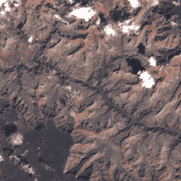
Landsat 4 MSS Collection 2 Tier 2 DN 值,表示经过缩放和校正的传感器处辐射度。在处理过程中,不符合第 1 级条件的场景会被分配到第 2 级。这包括系统地形 (L1GT) 和系统 (L1GS) 处理后的场景,以及任何 L1TP 场景,只要这些场景… c2 全球 l4 陆地卫星 lm4 mss -
USGS Landsat 4 TM Collection 2 Tier 1 原始场景

Landsat 4 TM Collection 2 Tier 1 DN 值,表示经过缩放和校准的传感器处辐射度。数据质量最高的 Landsat 场景会归入第 1 级,并被认为适合进行时间序列处理分析。第 1 级包括经过 Level-1 精确地形 (L1TP) 处理的数据,这些数据… c2 global l4 landsat lt4 radiance -
USGS Landsat 4 TM Collection 2 Tier 2 原始场景

Landsat 4 TM Collection 2 Tier 2 DN 值,表示经过缩放的校准传感器处辐射度。在处理过程中,不符合第 1 级条件的场景会被分配到第 2 级。这包括系统地形 (L1GT) 和系统 (L1GS) 处理后的场景,以及任何 L1TP 场景,只要这些场景… c2 global l4 landsat lt4 radiance -
USGS Landsat 5 MSS Collection 2 Tier 1 原始场景

Landsat 5 MSS Collection 2 Tier 1 DN 值,表示经过缩放和校正的传感器处辐射亮度。数据质量最高的 Landsat 场景会归入第 1 级,并被认为适合进行时间序列处理分析。第 1 级包括经过 Level-1 精确地形 (L1TP) 处理的数据,这些数据… c2 全球 l5 陆地卫星 lm5 mss -
USGS Landsat 5 MSS Collection 2 Tier 2 原始场景

Landsat 5 MSS Collection 2 Tier 2 DN 值,表示经过缩放和校正的传感器处辐射率。在处理过程中,不符合第 1 级条件的场景会被分配到第 2 级。这包括系统地形 (L1GT) 和系统 (L1GS) 处理后的场景,以及任何 L1TP 场景,只要这些场景… c2 全球 l5 陆地卫星 lm5 mss -
USGS Landsat 5 TM Collection 2 Tier 1 原始场景

Landsat 5 TM Collection 2 Tier 1 DN 值,表示经过缩放和校准的传感器处辐射率。数据质量最高的 Landsat 场景会归入第 1 级,并被认为适合进行时间序列处理分析。第 1 级包括经过 Level-1 精确地形 (L1TP) 处理的数据,这些数据… c2 全球 l5 陆地卫星 lt5 辐射 -
USGS Landsat 5 TM Collection 2 Tier 2 原始场景

Landsat 5 TM Collection 2 Tier 2 DN 值,表示经过缩放和校准的传感器处辐射亮度。在处理过程中,不符合第 1 级条件的场景会被分配到第 2 级。这包括系统地形 (L1GT) 和系统 (L1GS) 处理后的场景,以及任何 L1TP 场景,只要这些场景… c2 全球 l5 陆地卫星 lt5 辐射 -
USGS Landsat 7 Collection 2 Tier 1 原始场景

Landsat 7 Collection 2 Tier 1 DN 值,表示经过缩放和校准的传感器处辐射度。数据质量最高的 Landsat 场景会归入第 1 级,并被认为适合进行时间序列处理分析。第 1 级包括经过 L1TP 处理的数据,这些数据具有… c2 etm 全球 l7 陆地卫星 le7 -
USGS Landsat 7 Collection 2 Tier 1 和实时数据原始场景
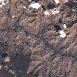
Landsat 7 Collection 2 Tier 1 和实时数据 DN 值,表示经过缩放和校准的传感器处辐射亮度。数据质量最高的 Landsat 场景会归入第 1 级,并被认为适合进行时间序列处理分析。第 1 级包括经过 Level-1 精确地形 (L1TP) 处理的… c2 etm 全球 l7 陆地卫星 le7 -
USGS Landsat 7 Collection 2 Tier 2 原始场景
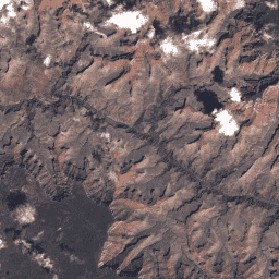
Landsat 7 Collection 2 Tier 2 DN 值,表示经过缩放和校正的传感器处辐射率。在处理过程中,不符合第 1 级条件的场景会被分配到第 2 级。这包括系统性地形 (L1GT) 和系统性 (L1GS) 处理后的场景,以及任何不…的 L1TP 场景 c2 etm 全球 l7 陆地卫星 le7 -
USGS Landsat 8 Collection 2 Tier 1 原始场景

Landsat 8 Collection 2 Tier 1 DN 值,表示经过缩放和校准的传感器处辐射率。数据质量最高的 Landsat 场景会归入第 1 级,并被认为适合进行时间序列处理分析。第 1 级包括经过 L1TP 处理的数据,这些数据具有… c2 全球 l8 陆地卫星 lc8 oli-tirs -
USGS Landsat 8 Collection 2 Tier 1 和实时数据原始场景
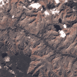
Landsat 8 Collection 2 Tier 1 和实时数据 DN 值,表示经过缩放和校正的传感器处辐射亮度。数据质量最高的 Landsat 场景会归入第 1 级,并被认为适合进行时间序列处理分析。第 1 级包括经过 Level-1 精确地形 (L1TP) 处理的… c2 global l8 landsat lc8 nrt -
USGS Landsat 8 Collection 2 Tier 2 原始场景

Landsat 8 Collection 2 Tier 2 DN 值,表示经过缩放和校准的传感器处辐射率。在处理过程中,不符合第 1 级条件的场景会被分配到第 2 级。这包括系统性地形 (L1GT) 和系统性 (L1GS) 处理后的场景,以及任何不…的 L1TP 场景 c2 全球 l8 陆地卫星 lc8 oli-tirs -
USGS Landsat 9 Collection 2 Tier 1 原始场景
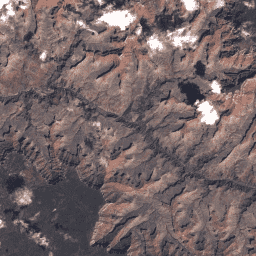
Landsat 9 Collection 2 Tier 1 DN 值,表示经过缩放的、校准后的传感器处辐射度。数据质量最高的 Landsat 场景会归入第 1 级,并被认为适合进行时间序列处理分析。第 1 级包括经过 L1TP 处理的数据,这些数据具有… c2 全球 l9 陆地卫星 lc9 oli-tirs -
USGS Landsat 9 Collection 2 Tier 2 原始场景
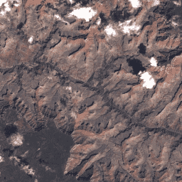
Landsat 9 Collection 2 Tier 2 DN 值,表示缩放后的校准传感器处辐射率。在处理过程中,不符合第 1 级条件的场景会被分配到第 2 级。这包括系统性地形 (L1GT) 和系统性 (L1GS) 处理后的场景,以及任何不…的 L1TP 场景 c2 全球 l9 陆地卫星 lc9 oli-tirs
Datasets tagged radiance in Earth Engine
[null,null,[],[],[]]
