-
GLOBathy 全球湖泊水深测量数据集
全球海底地形 (GLOBathy) 数据集包含全球超过 140 万个水体的相关数据,经过精心开发,可与广为认可的 HydroLAKES 数据集保持一致。GLOBathy 利用基于地理信息系统 (GIS) 的复杂框架,通过整合最大深度估算值和几何/地球物理 … community-dataset hydrology sat-io surface-ground-water -
LandScan 人口数据(全球,1 公里)
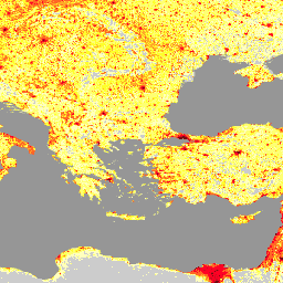
LandScan 数据集由橡树岭国家实验室 (ORNL) 提供,是一个全面且高分辨率的全球人口分布数据集,可作为各种应用的宝贵资源。LandScan 利用最先进的空间建模技术和高级地理空间数据源,提供详细的… community-dataset demography landscan population sat-io -
美国干旱监测中心
“美国干旱监测”地图每周四发布一次,显示美国部分地区的干旱情况。该地图使用五种分类:异常干旱 (D0),表示可能即将进入或刚刚摆脱干旱的区域,以及四种干旱级别:… community-dataset drought noaa precipitation sat-io usda
Datasets tagged sat-io in Earth Engine
[null,null,[],[[["\u003cp\u003eGLOBathy provides bathymetric data for over 1.4 million global waterbodies, harmonized with the HydroLAKES dataset, by integrating maximum depth estimates and geometric/geophysical properties.\u003c/p\u003e\n"],["\u003cp\u003eLandScan, developed by Oak Ridge National Laboratory, offers a high-resolution global population distribution dataset using spatial modeling and advanced geospatial data sources.\u003c/p\u003e\n"],["\u003cp\u003eThe U.S. Drought Monitor is a weekly map that classifies drought conditions across the United States using five levels, ranging from abnormally dry to exceptional drought.\u003c/p\u003e\n"]]],[],null,["# Datasets tagged sat-io in Earth Engine\n\n-\n\n |----------------------------------------------------------------------------------------------------------------------------------------------------------------------------------------------------------------------------------------------------------------------------------------------------------------------------------------------------------------------------------------------------|\n | [### GLOBathy Global lakes bathymetry dataset](/earth-engine/datasets/catalog/projects_sat-io_open-datasets_GLOBathy_GLOBathy_bathymetry) |\n | The GLObal Bathymetric (GLOBathy) dataset, comprising data on over 1.4 million waterbodies globally, has been meticulously developed to harmonize with the widely recognized HydroLAKES dataset. Utilizing a sophisticated Geographic Information System (GIS)-based framework, GLOBathy constructs detailed bathymetric maps by integrating maximum depth estimates and geometric/geophysical ... |\n | [community-dataset](/earth-engine/datasets/tags/community-dataset) [hydrology](/earth-engine/datasets/tags/hydrology) [sat-io](/earth-engine/datasets/tags/sat-io) [surface-ground-water](/earth-engine/datasets/tags/surface-ground-water) |\n\n-\n\n |-----------------------------------------------------------------------------------------------------------------------------------------------------------------------------------------------------------------------------------------------------------------------------------------------------------------------------------------------------------------|\n | [### LandScan Population Data Global 1km](/earth-engine/datasets/catalog/projects_sat-io_open-datasets_ORNL_LANDSCAN_GLOBAL) |\n | The LandScan dataset, provided by the Oak Ridge National Laboratory (ORNL), offers a comprehensive and high-resolution global population distribution dataset that serves as a valuable resource for a wide range of applications. Leveraging state-of-the-art spatial modeling techniques and advanced geospatial data sources, LandScan provides detailed ... |\n | [community-dataset](/earth-engine/datasets/tags/community-dataset) [demography](/earth-engine/datasets/tags/demography) [landscan](/earth-engine/datasets/tags/landscan) [population](/earth-engine/datasets/tags/population) [sat-io](/earth-engine/datasets/tags/sat-io) |\n\n-\n\n |-------------------------------------------------------------------------------------------------------------------------------------------------------------------------------------------------------------------------------------------------------------------------------------------------------------|\n | [### United States Drought Monitor](/earth-engine/datasets/catalog/projects_sat-io_open-datasets_us-drought-monitor) |\n | The U.S. Drought Monitor is a map released every Thursday, showing parts of the U.S. that are in drought. The map uses five classifications: abnormally dry (D0), showing areas that may be going into or are coming out of drought, and four levels of drought: ... |\n | [community-dataset](/earth-engine/datasets/tags/community-dataset) [drought](/earth-engine/datasets/tags/drought) [noaa](/earth-engine/datasets/tags/noaa) [precipitation](/earth-engine/datasets/tags/precipitation) [sat-io](/earth-engine/datasets/tags/sat-io) [usda](/earth-engine/datasets/tags/usda) |"]]