-
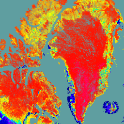
NOAA CDR VIIRS LAI FAPAR:叶面积指数和光合有效辐射吸收分数,版本 1

此气候数据记录 (CDR) 结合了叶面积指数 (LAI) 和光合有效辐射吸收分数 (FAPAR) 的数据集,这两个生物物理变量可用于评估植被压力、预测农业产量以及其他建模和资源管理应用。LAI 跟踪单侧… cdr daily fapar lai land noaa -
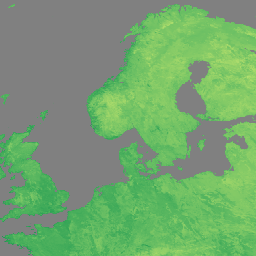
NOAA CDR VIIRS NDVI:归一化差值植被指数,版本 1

此数据集包含网格化日归一化差值植被指数 (NDVI),该指数源自 NOAA 可见光红外成像辐射计套件 (VIIRS) 地表反射率的气候数据记录 (CDR)。数据记录涵盖了 2014 年至今,使用的是 NOAA 极地轨道卫星的数据。这些数据是根据…预测的 cdr daily land ndvi noaa vegetation-indices -
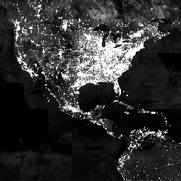
VIIRS 夜间日间/夜间年度波段合成 V2.1

年度全球 VIIRS 夜间灯光数据集是一个时间序列,由 2013 年至 2021 年的月度无云平均辐射网格生成。2022 年的数据可在 NOAA/VIIRS/DNB/ANNUAL_V22 数据集中找到。初始过滤步骤移除了阳光照射、月光照射和多云的像素,从而生成粗略的合成图像,… annual dnb eog lights nighttime noaa -
VIIRS 夜间日间年度波段合成影像 V2.2

年度全球 VIIRS 夜间灯光数据集是一个时间序列,由 2022 年的月度无云平均辐射网格生成。如需查看更早年份的数据,请参阅 NOAA/VIIRS/DNB/ANNUAL_V21 数据集。初始过滤步骤移除了阳光照射、月光照射和多云的像素,从而生成包含以下内容的粗略合成图像… annual dnb eog lights nighttime noaa -
VIIRS 夜间昼夜波段合成图版本 1

使用可见光红外成像辐射计套件 (VIIRS) 日/夜波段 (DNB) 的夜间数据生成的月平均辐射合成图像。由于这些数据是按月合成的,因此全球许多地区都无法获得当月的高质量数据覆盖。… dnb eog lights monthly nighttime noaa -
VIIRS 杂散光校正夜间昼夜波段合成影像版本 1

使用可见光红外成像辐射计套件 (VIIRS) 日/夜波段 (DNB) 的夜间数据生成的月平均辐射合成图像。由于这些数据是按月合成的,因此全球许多地区都无法获得当月的高质量数据覆盖。… dnb eog lights monthly nighttime noaa -
VJ114IMGTDL_NRT 日常栅格:VIIRS (NOAA-20) 375 米波段活动火情

NOAA-20 (JPSS-1) 可见红外成像辐射计套件 (VIIRS) 主动火点探测产品基于该仪器的 375 米标称分辨率数据。与其他粗分辨率(≥ 1 公里)卫星火灾探测产品相比,改进后的 375 米数据在探测相对较小的火灾时具有更高的响应能力… eosdis 火灾 firms 地球物理 热点 lance -
VNP09GA:VIIRS 地表反射率每日 500 米和 1 公里

可见光红外成像辐射仪套件 (VIIRS) 每日地表反射率 (VNP09GA) 产品可根据 Suomi 国家极地轨道合作伙伴计划 (S-NPP) VIIRS 传感器提供陆地表面反射率估计值。提供三个影像波段(I1、I2、I3)的数据,名义分辨率为 500 米(约 463 米)… daily nasa noaa npp reflectance satellite-imagery -
VNP09H1:VIIRS 地表反射率 8 天 L3 全球 500 米

8 天可见光红外成像辐射仪套件 (VIIRS) 地表反射率 (VNP09H1) 第 1 版合成产品可提供 Suomi 国家极轨伙伴卫星 (Suomi NPP) VIIRS 传感器在标称分辨率 500 米(约 463 米)的三个影像波段(I1、I2、I3)的地表反射率估计值。… daily nasa noaa npp reflectance satellite-imagery -
VNP13A1.002:VIIRS 植被指数 16 天 500 米

苏奥米国家极地轨道合作伙伴计划 (S-NPP) NASA 可见光红外成像辐射仪套件 (VIIRS) 植被指数 (VNP13A1) 数据产品通过在 16 天的采集期内以 500 米的分辨率选择最佳可用像素来提供植被指数。VNP13 数据产品的设计目标是… 16 天 evi nasa ndvi noaa npp -
VNP14A1.002:热异常/火灾每日 L3 全球 1km SIN 网格

Suomi 国家极地轨道合作伙伴关系 NASA 可见红外成像辐射计套件 (VIIRS) 热异常/火点 (VNP14A1) 版本 1 数据产品提供有关活跃火点和其他热异常的每日信息。VNP14A1 数据产品是全球 1 公里网格化合成数据,包含从 … 检测到的火灾像素 火灾 陆地 nasa noaa 表面 viirs -
VNP14IMGTDL_NRT 日光栅:VIIRS (S-NPP) 375 米波段活动火点

Suomi NPP 可见红外成像辐射计套件 (VIIRS) 主动火点探测产品基于该仪器的 375 米标称分辨率数据。与其他粗分辨率(≥ 1 公里)卫星火灾探测产品相比,改进后的 375 米数据在探测相对较小的火灾时具有更高的响应能力… eosdis 火灾 firms 地球物理 热点 lance -
VNP15A2H:LAI/FPAR 8 天 L4 全球 500 米 SIN 网格

可见光红外成像辐射计套件 (VIIRS) 叶面积指数 (LAI) 和光合有效辐射分数 (FPAR) 第 1 版数据产品以 500 米分辨率 (VNP15A2H) 提供有关植被冠层的信息。VIIRS 传感器位于 NOAA/NASA 联合 Suomi 国家极轨轨道卫星上,… land nasa noaa surface vegetation-indices viirs -
VNP21A1D.002:每日 1 公里白天陆地表面温度和发射率

NASA Suomi 国家极地轨道合作伙伴计划 (Suomi NPP) 可见光红外成像辐射仪套件 (VIIRS) 地表温度和发射率 (LST&E) 日间版本 1 产品 (VNP21A1D) 每天根据白天 2 级网格化 (L2G) 中间产品编译而成。L2G 流程可将每日 VNP21 轨道粒度数据映射到 … 气候 每日 天 陆地 nasa noaa -
VNP21A1N.002:夜间地表温度和发射率每日 1 公里

NASA Suomi 国家极地轨道合作伙伴计划 (Suomi NPP) 可见光红外成像辐射仪套件 (VIIRS) 地表温度和发射率 (LST&E) 夜间版本 1 产品 (VNP21A1N) 每天从夜间 2 级网格化 (L2G) 中间产品编译而成。L2G 流程可将每日 VNP21 轨道粒度数据映射到 … 气候 每日 陆地 美国宇航局 (NASA) 夜间 美国国家海洋和大气管理局 (NOAA) -
VNP22Q2:陆地表面物候年度 L3 全球 500 米 SIN 网格

Suomi 国家极地轨道合作伙伴计划 (Suomi NPP) NASA 可见光红外成像辐射仪套件 (VIIRS) 地表覆盖动态数据产品以年度间隔提供全球陆地表面物候 (GLSP) 指标。VNP22Q2 数据产品源自双波段增强型植被指数 (EVI2) 的时间序列… land landuse-landcover nasa ndvi noaa npp -
VNP43IA1:BRDF/反照率模型参数每日 L3 全球 500 米 SIN 网格

Suomi 国家极地轨道合作伙伴计划 (Suomi NPP) NASA 可见光红外成像辐射仪套件 (VIIRS) 双向反射率分布函数 (BRDF) 和反照率模型参数 (VNP43IA1) 版本 1 产品以 500 分辨率提供核权重(参数)。VNP43IA1 产品每天使用 16 天的 VIIRS 数据生成… 陆地 nasa noaa 卫星图像 表面 viirs -
VNP43IA2:BRDF/反照率质量每日 L3 全球 500 米 SIN 网格

Suomi 国家极地轨道合作伙伴计划 (Suomi NPP) NASA 可见红外成像辐射计套件 (VIIRS) 双向反射率分布函数 (BRDF) 和反照率质量 (VNP43IA2) 第 1 版产品以 500 米分辨率提供 BRDF 和反照率质量。VNP43IA2 产品每天使用 16 天的 VIIRS 数据生成… 陆地 nasa noaa 卫星图像 表面 viirs -
VNP43IA4:BRDF/反照率质量每日 L3 全球 500 米 SIN 网格

NASA/NOAA Suomi 国家极地轨道合作伙伴关系 (Suomi NPP) 可见光红外成像辐射仪套件 (VIIRS) 天底双向反射率分布函数 (BRDF) 调整后的反射率 (NBAR) 版本 2 产品提供 500 米分辨率的 NBAR 估计值。VNP43IA4 产品每天使用 16 天的 VIIRS 数据生成… brdf land nasa noaa satellite-imagery surface -
VNP46A1:VIIRS 日常网格化日夜波段 500 米线性纬度/经度网格夜间

Suomi 国家极地轨道合作伙伴计划 (SNPP) 可见光红外成像辐射仪套件 (VIIRS) 支持一种昼夜频段 (DNB) 传感器,可提供全球每日夜间可见光和近红外 (NIR) 光测量数据,这些数据适用于地球系统科学和应用。VIIRS DNB 在低光照条件下的超高灵敏度… daily dnb nasa noaa population viirs -
VNP46A2:VIIRS 经过月球间隙填充的 BRDF 夜间灯光每日 L3 全球 500 米数据

Suomi 国家极地轨道合作伙伴计划 (SNPP) 可见光红外成像辐射仪套件 (VIIRS) 支持昼夜频段 (DNB) 传感器,该传感器可提供夜间可见光和近红外(NIR) 光的全球每日测量数据,适用于地球系统科学和应用。VIIRS DNB 在弱光条件下的超高灵敏度… brdf daily nasa nighttime noaa population -
VNP64A1:月度 L4 全球 500 米 SIN 网格中的烧毁区域

Suomi 国家极地轨道合作伙伴计划 (Suomi NPP) NASA 可见红外成像辐射计套件 (VIIRS) 每日烧毁面积 (VNP64A1) 版本 1 数据产品是一种每月更新的全球网格化 500 米产品,包含每个像素的烧毁面积和质量信息。VNP64 烧毁区域测绘方法采用 750 米 VIIRS … 烧毁 变化检测 火灾 土地 nasa noaa
Datasets tagged viirs in Earth Engine
[null,null,[],[],[]]
