
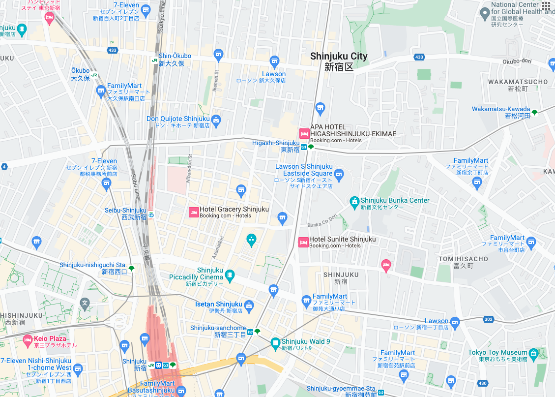
 شاشات عرض الخرائط هي شاشات عرض صور تستند إلى بيانات طبوغرافية متّجهة
مع تصميم الخرائط من Google. ويشمل ذلك الطرق والمباني والأماكن
المهمة والحدود السياسية.
شاشات عرض الخرائط هي شاشات عرض صور تستند إلى بيانات طبوغرافية متّجهة
مع تصميم الخرائط من Google. ويشمل ذلك الطرق والمباني والأماكن
المهمة والحدود السياسية.
الحصول على شاشات عرض الخرائط
يمكنك البدء في إرسال طلبات مربعات الخرائط بعد الحصول على الرمز المميز للجلسة. بما أنّ الرمز المميز للجلسة ينطبق على الجلسة بأكملها، ليس عليك تحديد خيارات الخريطة مع طلبات مربّعات العرض.
تعرض عيّنة التعليمات البرمجية التالية طلبًا نموذجيًا لرمز الجلسة من أجل شاشات عرض الخرائط.
curl -X POST -d '{
  "mapType": "roadmap",
  "language": "en-US",
  "region": "US"
}' \
-H 'Content-Type: application/json' \
"https://tile.googleapis.com/v1/createSession?key=YOUR_API_KEY"
يمكنك الحصول على مربّعات الخرائط من خلال إرسال طلب استرداد بيانات باستخدام GET عبر HTTPS، كما هو موضّح في المثال التالي.
curl "https://tile.googleapis.com/v1/2dtiles/z/x/y?session=YOUR_SESSION_TOKEN &key=YOUR_API_KEY &orientation=0_or_90_or_180_or_270"
في طلب استرداد البيانات باستخدام HTTPS هذا، يمثّل z مستوى التكبير/التصغير
(يتراوح بين 0 و22)، ويمثّل x و
y إحداثيات
شاشة العرض
التي تريد استردادها.
المَعلمة orientation اختيارية. تحدّد قيمتها عدد درجات تدوير صورة شاشة العرض بعكس اتجاه عقارب الساعة. orientation تتوفّر لـ roadmap، كما تتوفّر لطلبات الصور من الأقمار الصناعية والتضاريس مع إزالة الصور الأساسية باستخدام "overlay": true وضبط layerTypes. القيم الصالحة للمَعلمة orientation هي 0 (القيمة التلقائية) و90 و180 و270.
لا يتم تدوير شبكة إحداثيات شاشة العرض إذا تضمّنت قيمة orientation. على سبيل المثال، إذا ضبطت orientation على 90، سيظل الإحداثي x يحدّد موضع شاشة العرض من اليسار إلى اليمين، وهو في هذه الحالة من الشمال إلى الجنوب على الخريطة.
| الاتجاه صفر درجة | الاتجاه 90 درجة |
|---|---|
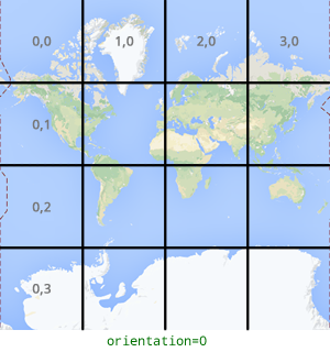 |
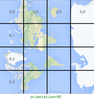 |
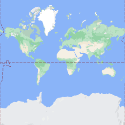
مثال على طلب شاشة عرض
انظر إلى المثال التالي الذي يطلب شاشة عرض واحدة تحتوي على العالم بأكمله. في هذا المثال، مستوى التكبير/التصغير هو 0، والإحداثيات x وy هما 0 و0.
curl "https://tile.googleapis.com/v1/2dtiles/0/0/0?session=YOUR_SESSION_TOKEN&key=YOUR_API_KEY" --output /tmp/example_tile.png
ما مِن رسالة رد من الخادم في هذا المثال. بدلاً من ذلك، يتم تنزيل شاشة العرض إلى ملف محلي، مع الإحصاءات التالية.
  % Total    % Received % Xferd  Average Speed   Time    Time     Time  Current
                                 Dload  Upload   Total   Spent    Left  Speed
100  8335  100  8335    0     0  51471      0 --:--:-- --:--:-- --:--:-- 54835
للحصول على معلومات عن رؤوس رسائل الرد، اطّلِع على المقالة الجلب المسبق للمحتوى أو تخزينه مؤقتًا أو تخزينه.