Tetap teratur dengan koleksi
Simpan dan kategorikan konten berdasarkan preferensi Anda.
Developer Wilayah Ekonomi Eropa (EEA)
Token sesi adalah bagian data (UUID)
yang digunakan dalam panggilan REST untuk mengidentifikasi
sesi—serangkaian
pertukaran pesan terkait. Anda harus menyertakan token sesi di semua permintaan
untuk Petak 2D dan gambar Street View.
Anda menyertakannya sebagai nilai parameter session yang ditambahkan ke semua URL permintaan.
Di Map Tiles API, token sesi mewakili serangkaian opsi tampilan yang ditentukan. Artinya, Anda tidak perlu meneruskan serangkaian opsi tampilan dengan
setiap permintaan kartu. Anda dapat menggunakan token sesi yang sama di beberapa klien.
Token sesi saat ini berlaku selama dua minggu sejak waktu penerbitannya, tetapi hal ini dapat berubah. Anda dapat memeriksa waktu habis masa berlaku token sesi kapan saja dengan melihat kolom expiry dalam pesan respons.
Permintaan token sesi
Untuk meminta token sesi, kirim permintaan POST HTTPS ke endpoint createSession, seperti yang ditunjukkan pada contoh berikut. Anda harus mengirim permintaan dengan header
Content-Type: application/json.
Tipe peta dasar. Nilai ini dapat berupa salah satu dari berikut:
roadmap
Petak peta standar Google Maps yang digambar.
satellite
Citra satelit.
terrain
Gambar medan. Saat memilih terrain sebagai jenis peta, Anda juga harus menyertakan jenis lapisan layerRoadmap (dijelaskan di bagian Kolom opsional).
streetview
Panorama Street View. Untuk mengetahui informasi selengkapnya, lihat
Kartu Street View.
language
Tag bahasa IETF yang menentukan bahasa yang digunakan untuk menampilkan informasi di kartu. Misalnya, en-US menentukan bahasa Inggris yang digunakan di Amerika Serikat.
region
ID region
Common Locale Data Repository (dua huruf kapital) yang merepresentasikan lokasi fisik
pengguna. Misalnya, US.
Kolom opsional
imageFormat
Menentukan format file yang akan ditampilkan. Nilai yang valid adalah jpeg atau png.
File JPEG tidak mendukung transparansi, sehingga tidak direkomendasikan untuk petak overlay. Jika Anda tidak menentukan imageFormat, format terbaik untuk
petak akan dipilih secara otomatis.
scale
Meningkatkan ukuran elemen peta (seperti label jalan), sambil mempertahankan ukuran petak dan area cakupan petak default. Meningkatkan skala juga
akan mengurangi jumlah label di peta, sehingga mengurangi kekacauan. Nilai berikut adalah nilai scale yang valid:
scaleFactor1x: Default.
scaleFactor2x: Menggandakan ukuran label dan menghapus label fitur kecil.
scaleFactor4x: Melipatgandakan ukuran label dan menghapus label fitur kecil.
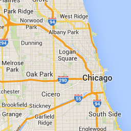
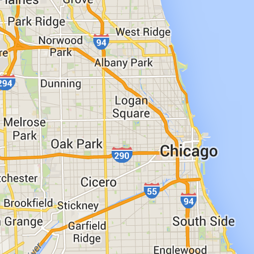
Contoh berikut menunjukkan efek penskalaan elemen peta.
Faktor Skala 1x
Faktor Skala 2x
highDpi
Menentukan apakah akan menampilkan ubin resolusi tinggi. Jika faktor skala ditingkatkan, highDpi akan digunakan untuk meningkatkan ukuran petak. Biasanya,
meningkatkan faktor skala akan memperbesar petak yang dihasilkan menjadi gambar dengan
ukuran yang sama, sehingga menurunkan kualitas. Dengan highDpi, ukuran yang dihasilkan juga
ditingkatkan, sehingga kualitas tetap terjaga. DPI adalah singkatan dari Dots per Inci, dan DPI Tinggi berarti
petak dirender menggunakan lebih banyak titik per inci daripada biasanya. Jika true, maka
jumlah piksel dalam setiap dimensi x dan y dikalikan dengan faktor
skala (yaitu , 2x atau 4x). Area cakupan kartu tidak berubah.
Parameter ini hanya berfungsi dengan nilai scale 2x atau 4x. Tindakan ini tidak berpengaruh pada petak skala 1x.
Faktor Skala 1x
Faktor Skala DPI Tinggi 2x
layerTypes
Array nilai yang menentukan jenis lapisan yang ditambahkan ke peta. Nilai
yang valid adalah:
layerRoadmap
Wajib jika Anda menentukan terrain sebagai jenis peta. Juga dapat ditumpuk secara opsional
pada jenis peta satellite. Tidak berpengaruh pada kartu peta jalan.
layerStreetview
Menampilkan jalan dan lokasi yang mendukung Street View menggunakan garis biru di
peta.
layerTraffic
Menampilkan kondisi lalu lintas saat ini.
styles
Array objek gaya JSON yang menentukan tampilan dan tingkat detail fitur peta seperti jalan, taman, dan area terbangun. Gaya visual digunakan untuk menyesuaikan peta dasar Google standar. Parameter styles hanya valid jika
jenis peta adalah roadmap. Untuk mengetahui sintaksis gaya lengkap, lihat
Referensi Gaya.
overlay
Nilai boolean yang menentukan apakah layerTypes harus dirender sebagai overlay terpisah, atau digabungkan dengan gambar dasar. Saat
true, peta dasar tidak ditampilkan. Jika Anda belum menentukan layerTypes, nilai ini akan diabaikan.
Misalnya, meminta jenis peta satellite dengan lapisan layerRoadmap, dan
overlay disetel ke false akan menghasilkan ubin yang setara dengan jenis peta hybrid
yang digunakan di Maps JavaScript API (gambar kiri). Jenis peta dan lapisan yang sama dengan overlay yang ditetapkan ke true akan menghasilkan ubin transparan dengan overlay peta, yang diberi gaya dengan tepat untuk di-overlay di atas gambar satelit (gambar kanan).
overlay: salah (false)
overlay: benar (true)
JSON berikut adalah contoh isi permintaan umum yang berisi kolom wajib dan opsional.
Contoh ini menyediakan overlay yang cocok untuk digabungkan dengan gambar satelit. Contoh ini berisi peta jalan dan overlay tampilan jalan. Peta yang dihasilkan dirender dengan nama dan data dalam bahasa Inggris, sebagaimana digunakan di Amerika Serikat.
Daftar berikut berisi definisi kolom dalam isi respons.
session
Nilai token sesi yang harus Anda sertakan dalam semua permintaan Map Tiles API.
expiry
String yang berisi waktu (dalam detik sejak epoch) saat token
berakhir. Token sesi berlaku selama dua minggu sejak waktu pembuatannya, tetapi kebijakan ini dapat berubah tanpa pemberitahuan.
[null,null,["Terakhir diperbarui pada 2025-08-29 UTC."],[[["\u003cp\u003eSession tokens, represented as UUIDs, are required for accessing 2D Tiles and Street View imagery through the Map Tiles API but not for 3D Tiles.\u003c/p\u003e\n"],["\u003cp\u003eThey define display options for a session, eliminating the need to send them with each tile request and can be used across multiple clients.\u003c/p\u003e\n"],["\u003cp\u003eTo obtain a session token, an HTTPS POST request is sent to the \u003ccode\u003ecreateSession\u003c/code\u003e endpoint with parameters defining the map type, language, region, and optional display settings.\u003c/p\u003e\n"],["\u003cp\u003eThe response includes the session token, its expiration time, and tile dimensions, with the token remaining valid for approximately two weeks.\u003c/p\u003e\n"]]],[],null,["# Use session tokens with Map Tiles API\n\n**European Economic Area (EEA) developers** If your billing address is in the European Economic Area, effective on 8 July 2025, the [Google\n| Maps Platform EEA Terms of Service](https://cloud.google.com/terms/maps-platform/eea) will apply to your use of the Services. [Learn more](/maps/comms/eea/faq). In addition, certain content from the Map Tiles API will no longer be returned. [Learn more](/maps/comms/eea/map-tiles).\n\nA session token is a piece of data (a\n[UUID](https://en.wikipedia.org/wiki/Universally_unique_identifier))\nthat is used in REST calls to identify a\n[session](https://en.wikipedia.org/wiki/Session_(computer_science))---a\nseries of related message exchanges. You must include a session token in all\nrequests for 2D Tiles and Street View imagery.\nYou include it as the value of a `session` parameter appended to all request\nURLs.\n\nIn the Map Tiles API, a session token represents a defined set of\ndisplay options. It means you don't have to pass a set of display options with\neach tile request. You can use the same session token across multiple clients.\nA session token is currently valid for two weeks from its\nissue time, but this might change. You can always check the expiration time of a\nsession token by looking at the `expiry` field in the response message.\n| **Note:** You need to use session tokens for getting 2D Tiles and Street View Tiles, but not for getting 3D Tiles.\n\nSession token request\n---------------------\n\nTo request a session token, send an HTTPS POST request to the `createSession`\nendpoint, as shown in the following example. You must send the request with a\n`Content-Type: application/json` header. \n\n```json\ncurl -X POST -d '{\n \"mapType\": \"streetview\",\n \"language\": \"en-US\",\n \"region\": \"US\"\n}' \\\n-H 'Content-Type: application/json' \\\n\"https://tile.googleapis.com/v1/createSession?key=YOUR_API_KEY\"\n```\n\n### Required fields\n\n`mapType`\n\n: The type of base map. This value can be one of the following:\n\n `roadmap`\n : The standard Google Maps painted map tiles.\n\n `satellite`\n : Satellite imagery.\n\n `terrain`\n : Terrain imagery. When selecting `terrain` as the map type, you must also\n include the `layerRoadmap` layer type (described in the\n [Optional fields](/maps/documentation/tile/session_tokens#optional_fields)\n section).\n\n `streetview`\n : Street View panoramas. For more information, see\n [Street View Tiles](/maps/documentation/tile/streetview).\n\n`language`\n\n: An\n [IETF language tag](https://en.wikipedia.org/wiki/IETF_language_tag)\n that specifies the language used to display information on the tiles. For\n example, `en-US` specifies the English language as spoken in the United States.\n\n`region`\n\n: A\n [Common Locale Data Repository](https://cldr.unicode.org/)\n region identifier (two uppercase letters) that represents the physical location\n of the user. For example, `US`.\n\n### Optional fields\n\n`imageFormat`\n: Specifies the file format to return. Valid values are either `jpeg` or `png`.\n JPEG files don't support transparency, therefore they aren't recommended for\n overlay tiles. If you don't specify an `imageFormat`, then the best format for\n the tile is chosen automatically.\n\n`scale`\n\n: Scales-up the size of map elements (such as road labels), while retaining the\n tile size and coverage area of the default tile. Increasing the scale also\n reduces the number of labels on the map, which reduces clutter. The following\n values are valid `scale` values:\n\n - `scaleFactor1x`: The default.\n - `scaleFactor2x`: Doubles label size and removes minor feature labels.\n - `scaleFactor4x`: Quadruples label size and removes minor feature labels.\n\nThe following examples demonstrate the effect of scaling map elements.\n\n| Scale Factor 1x | Scale Factor 2x |\n|-----------------|-----------------|\n| | |\n\n`highDpi`\n: Specifies whether to return high-resolution tiles. If the scale-factor is\n increased, `highDpi` is used to increase the size of the tile. Normally,\n increasing the scale factor enlarges the resulting tile into an image of the\n same size, which lowers quality. With `highDpi`, the resulting size is also\n increased, preserving quality. DPI stands for Dots per Inch, and High DPI means\n the tile renders using more dots per inch than normal. If `true`, then the\n number of pixels in each of the x and y dimensions is multiplied by the scale\n factor (that is , 2x or 4x). The coverage area of the tile remains unchanged.\n This parameter works only with `scale` values of 2x or 4x. It has no effect on\n 1x scale tiles.\n\n| Scale Factor 1x | Scale Factor 2x High DPI |\n|-----------------|--------------------------|\n| | |\n\n`layerTypes`\n\n: An array of values that specifies the layer types added to the map. Valid\n values are:\n\n `layerRoadmap`\n : Required if you specify `terrain` as the map type. Can also be optionally\n overlaid on the `satellite` map type. Has no effect on roadmap tiles.\n\n `layerStreetview`\n : Shows Street View-enabled streets and locations using blue outlines on the\n map.\n\n `layerTraffic`\n : Displays current traffic conditions.\n\n`styles`\n\n: An array of JSON style objects that specify the appearance and detail level of\n map features such as roads, parks, and built-up areas. Styling is used to\n customize the standard Google base map. The `styles` parameter is valid only if\n the map type is `roadmap`. For the complete style syntax, see the\n [Style Reference](/maps/documentation/tile/style-reference).\n\n`overlay`\n\n: A boolean value that specifies whether `layerTypes` should be\n rendered as a separate overlay, or combined with the base imagery. When\n `true`, the base map isn't displayed. If you haven't defined any `layerTypes`,\n then this value is ignored.\n\nFor example, requesting a `satellite` map type with a `layerRoadmap` layer, and\n`overlay` set to `false` results in tiles equivalent to the `hybrid` map type\nused in the Maps JavaScript API (left image). The same\nmap and layer types with `overlay` set to `true` results in a transparent tile\nwith a map overlay, styled appropriately for overlaying over satellite imagery\n(right image).\n\n| `overlay`: false | `overlay`: true |\n|------------------|-----------------|\n| | |\n\nThe following JSON is an example of a typical request body that contains both\nrequired and optional fields. \n\n {\n \"mapType\": \"satellite\",\n \"language\": \"en-US\",\n \"region\": \"us\",\n \"layerTypes\": [ \"layerRoadmap\", \"layerStreetview\" ],\n \"overlay\": true,\n \"scale\": \"scaleFactor1x\",\n \"styles\": [\n {\n \"stylers\": [\n { \"hue\": \"#00ffe6\" },\n { \"saturation\": -20 }\n ]\n },{\n \"featureType\": \"road\",\n \"elementType\": \"geometry\",\n \"stylers\": [\n { \"lightness\": 100 },\n { \"visibility\": \"simplified\" }\n ]\n }\n ]\n }\n\nThis example provides an overlay that's suitable for combining with satellite\nimagery. The example contains both a roadmap and street view overlay. The\nresulting map is rendered with names and data in the English language, as it's\nspoken in the United States.\n\nSession token response\n----------------------\n\nThe following JSON is an example response body. \n\n {\n \"session\": \"IgAAAHGU9jnAU4KOAfwY3Bcd6eH_WxQsyocSBAdUnAr9pnvTTNXtF9c_27RBo94ytEXTDg\",\n \"expiry\": \"1361828036\",\n \"tileWidth\": 256,\n \"tileHeight\": 256,\n \"imageFormat\": \"png\"\n }\n\nThe following list contains definitions of the fields in the response body.\n\n`session`\n: A session token value that you must include in all of your Map Tiles API\n requests.\n\n`expiry`\n: A string that contains the time (in seconds since the epoch) at which the token\n expires. A session token is valid for two weeks from its creation\n time, but this policy might change without notice.\n\n`tileWidth`\n: The width of the tiles measured in pixels.\n\n`tileHeight`\n: The height of the tiles measured in pixels.\n\n`imageFormat`\n: The image format, which can be either `png` or `jpeg`."]]