
세션 토큰은 세션(일련의 관련 메시지 교환)을 식별하기 위해 REST 호출에 사용되는 데이터 조각(a
UUID)
입니다. 2D 타일 및 스트리트 뷰 이미지에 대한 모든 요청에 세션 토큰을 포함해야 합니다.
모든 요청 URL에 추가된 session 매개변수의 값으로 포함합니다.
지도 타일 API에서 세션 토큰은 정의된 디스플레이 옵션 집합을 나타냅니다. 즉, 각 타일 요청과 함께 디스플레이 옵션 집합을 전달할 필요가 없습니다. 여러 클라이언트에서 동일한 세션 토큰을 사용할 수 있습니다.
세션 토큰은 현재 발급 시점부터 2주 동안 유효하지만 변경될 수 있습니다. 응답 메시지의 expiry 필드를 확인하여 언제든지 세션 토큰의 만료 시간을 확인할 수 있습니다.
세션 토큰 요청
세션 토큰을 요청하려면 다음 예와 같이 createSession 엔드포인트에 HTTPS POST 요청을 보냅니다. Content-Type: application/json 헤더와 함께 요청을 보내야 합니다.
curl -X POST -d '{
  "mapType": "streetview",
  "language": "en-US",
  "region": "US"
}' \
-H 'Content-Type: application/json' \
"https://tile.googleapis.com/v1/createSession?key=YOUR_API_KEY"
필수 입력란
mapType기본 지도 유형입니다. 이 값은 다음 중 하나일 수 있습니다.
roadmap- 표준 Google 지도 페인트 지도 타일입니다.
satellite- 위성 이미지입니다.
terrain- 지형 이미지입니다. 지도 유형으로
terrain을 선택할 때는layerRoadmap레이어 유형 (선택적 필드 섹션에 설명됨)도 포함해야 합니다. streetview- 스트리트 뷰 파노라마입니다. 자세한 내용은 스트리트 뷰 타일을 참고하세요.
language타일에 정보를 표시하는 데 사용되는 언어를 지정하는 IETF 언어 태그 입니다. 예를 들어
en-US는 미국에서 사용되는 영어 언어를 지정합니다.region사용자의 실제 위치를 나타내는 공통 로케일 데이터 저장소 리전 식별자 (대문자 2개)입니다. 예를 들어
US입니다.
선택적 필드
imageFormat- 반환할 파일 형식을 지정합니다. 유효한 값은
jpeg또는png입니다. JPEG 파일은 투명도를 지원하지 않으므로 오버레이 타일에는 권장되지 않습니다.imageFormat을 지정하지 않으면 타일에 가장 적합한 형식이 자동으로 선택됩니다. scale기본 타일의 타일 크기와 적용 범위를 유지하면서 도로 라벨과 같은 지도 요소의 크기를 확대합니다. 배율을 높이면 지도에 표시되는 라벨 수도 줄어들어 지도가 깔끔해집니다. 유효한
scale값은 다음과 같습니다.scaleFactor1x: 기본값입니다.scaleFactor2x: 라벨 크기를 두 배로 늘리고 작은 기능 라벨을 삭제합니다.scaleFactor4x: 라벨 크기를 4배로 늘리고 작은 기능 라벨을 삭제합니다.
다음 예는 지도 요소의 배율 조정 효과를 보여줍니다.
| 배율 인수 1x | 배율 인수 2x |
|---|---|
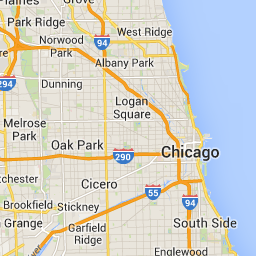 |
 |
highDpi- 고해상도 타일을 반환할지 여부를 지정합니다. 배율 인수가 증가하면
highDpi가 타일 크기를 늘리는 데 사용됩니다. 일반적으로 배율 인수를 늘리면 결과 타일이 동일한 크기의 이미지로 확대되어 품질이 저하됩니다.highDpi를 사용하면 결과 크기도 증가하여 품질이 유지됩니다. DPI는 인치당 도트 수를 나타내며 High DPI는 타일이 일반보다 인치당 더 많은 도트를 사용하여 렌더링됨을 의미합니다.true이면 각 x 및 y 측정기준의 픽셀 수가 배율 인수 (즉, 2x 또는 4x)로 곱해집니다. 타일의 적용 범위는 변경되지 않습니다. 이 매개변수는 2x 또는 4x의scale값에서만 작동합니다. 1x 배율 타일에는 영향을 미치지 않습니다.
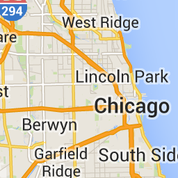
| 배율 인수 1x | 배율 인수 2x High DPI |
|---|---|
|
 |
layerTypes지도에 추가된 레이어 유형을 지정하는 값의 배열입니다. 유효한 값은 다음과 같습니다.
layerRoadmap- 지도 유형으로
terrain을 지정하는 경우 필수입니다. 선택적으로satellite지도 유형에 오버레이할 수도 있습니다. 로드맵 타일에는 영향을 미치지 않습니다. layerStreetview- 지도에서 파란색 윤곽선을 사용하여 스트리트 뷰가 사용 설정된 거리와 위치를 표시합니다.
layerTraffic- 현재 교통상황을 표시합니다.
styles도로, 공원, 개발 지역과 같은 지도 기능의 모양과 세부정보 수준을 지정하는 JSON 스타일 객체의 배열입니다. 스타일 지정은 표준 Google 기본 지도를 맞춤설정하는 데 사용됩니다.
styles매개변수는 지도 유형이roadmap인 경우에만 유효합니다. 전체 스타일 구문은 스타일 참조를 참고하세요.overlaylayerTypes를 별도의 오버레이로 렌더링할지 아니면 기본 이미지와 결합할지 여부를 지정하는 불리언 값입니다.true이면 기본 지도가 표시되지 않습니다.layerTypes를 정의하지 않은 경우 이 값은 무시됩니다.
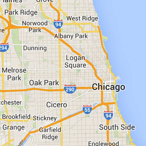
예를 들어 layerRoadmap 레이어가 있는 satellite 지도 유형을 요청하고 overlay를 false로 설정하면 Maps JavaScript API에서 사용되는 hybrid 지도 유형과 동일한 타일이 생성됩니다 (왼쪽 이미지). overlay가 true로 설정된 동일한 지도 및 레이어 유형은 지도 오버레이가 있는 투명한 타일을 생성하며, 위성 이미지 위에 오버레이하기에 적합하게 스타일이 지정됩니다(오른쪽 이미지).
overlay: false |
overlay: true |
|---|---|
 |
 |
다음 JSON은 필수 필드와 선택적 필드를 모두 포함하는 일반적인 요청 본문의 예입니다.
{
  "mapType": "satellite",
  "language": "en-US",
  "region": "us",
  "layerTypes": [ "layerRoadmap", "layerStreetview" ],
  "overlay":  true,
  "scale": "scaleFactor1x",
  "styles": [
    {
      "stylers": [
        { "hue": "#00ffe6" },
        { "saturation": -20 }
      ]
    },{
      "featureType": "road",
      "elementType": "geometry",
      "stylers": [
        { "lightness": 100 },
        { "visibility": "simplified" }
      ]
    }
  ]
}
이 예에서는 위성 이미지와 결합하기에 적합한 오버레이를 제공합니다. 이 예에는 로드맵과 스트리트 뷰 오버레이가 모두 포함되어 있습니다. 결과 지도는 미국에서 사용되는 영어로 이름과 데이터가 렌더링됩니다.
세션 토큰 응답
다음 JSON은 응답 본문의 예입니다.
{
  "session": "IgAAAHGU9jnAU4KOAfwY3Bcd6eH_WxQsyocSBAdUnAr9pnvTTNXtF9c_27RBo94ytEXTDg",
  "expiry": "1361828036",
  "tileWidth": 256,
  "tileHeight": 256,
  "imageFormat": "png"
}
다음 목록에는 응답 본문의 필드 정의가 포함되어 있습니다.
session- 모든 지도 타일 API 요청에 포함해야 하는 세션 토큰 값입니다.
expiry- 토큰이 만료되는 시간(에포크 이후의 경과 시간(초))을 포함하는 문자열입니다. 세션 토큰은 생성 시점부터 2주 동안 유효하지만 이 정책은 사전 통지 없이 변경될 수 있습니다.
tileWidth- 픽셀 단위로 측정된 타일의 너비입니다.
tileHeight- 픽셀 단위로 측정된 타일의 높이입니다.
imageFormat- 이미지 형식으로
png또는jpeg일 수 있습니다.