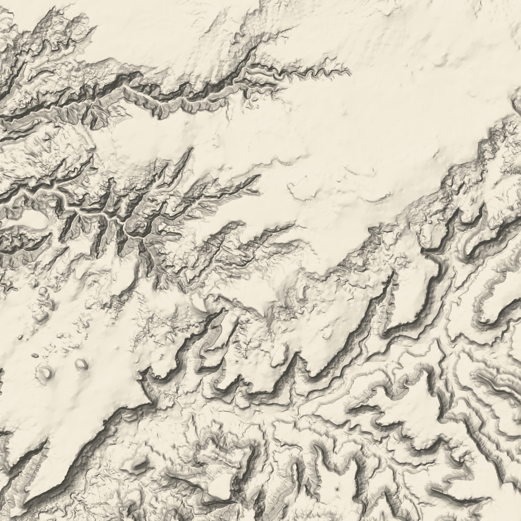
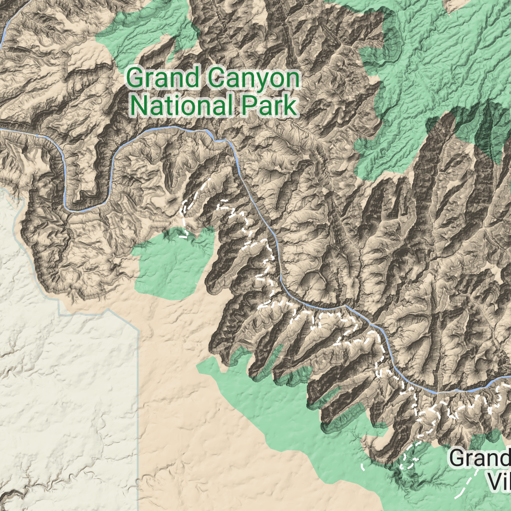
Плитки местности
Оптимизируйте свои подборки
Сохраняйте и классифицируйте контент в соответствии со своими настройками.
Разработчики Европейской экономической зоны (ЕЭЗ)
Фрагменты рельефа — это фрагменты изображений, содержащие оттенение рельефа и контурные линии. Они включают в себя природные объекты, такие как растительность.
Получение плиток ландшафта
Вы можете начать запрашивать фрагменты ландшафта после получения токена сеанса. Поскольку токен сеанса применяется ко всему сеансу, вам не нужно указывать параметры карты в запросах фрагментов.
В следующем примере кода показан типичный запрос токена сеанса для фрагментов ландшафта.
curl -X POST -d '{
"mapType": "terrain",
"language": "en-US",
"region": "US",
"layerTypes": ["layerRoadmap"]
}' \
-H 'Content-Type: application/json' \
"https://tile.googleapis.com/v1/createSession?key=YOUR_API_KEY"
Вы можете получить фрагменты ландшафта, выполнив HTTPS-запрос GET, как показано в следующем примере.
curl "https://tile.googleapis.com/v1/2dtiles/z/x/y?session=YOUR_SESSION_TOKEN&key=YOUR_API_KEY"
Пример запроса плитки
Рассмотрим следующий пример, в котором запрашивается один фрагмент ландшафта с уровнем масштабирования 10 и координатами x и y (192, 401).
curl "https://tile.googleapis.com/v1/2dtiles/10/192/401?session=YOUR_SESSION_TOKEN&key=YOUR_API_KEY" --output /tmp/example_tile.png
В этом примере ответное сообщение от сервера не отправляется. Вместо этого плитка просто загружается в локальный файл.

Информацию о заголовках ответных сообщений см. в разделе Предварительная выборка, кэширование или хранение содержимого .
Если не указано иное, контент на этой странице предоставляется по лицензии Creative Commons "С указанием авторства 4.0", а примеры кода – по лицензии Apache 2.0. Подробнее об этом написано в правилах сайта. Java – это зарегистрированный товарный знак корпорации Oracle и ее аффилированных лиц.
Последнее обновление: 2025-08-29 UTC.
[null,null,["Последнее обновление: 2025-08-29 UTC."],[[["\u003cp\u003eTerrain tiles are image tiles that visually represent geographical features like hills, contours, and vegetation.\u003c/p\u003e\n"],["\u003cp\u003eTo request terrain tiles, you first need to obtain a session token using your API key and specifying map parameters.\u003c/p\u003e\n"],["\u003cp\u003eYou can then retrieve individual terrain tiles using an HTTPS GET request, providing the session token, API key, and desired tile coordinates (zoom level, x, and y).\u003c/p\u003e\n"],["\u003cp\u003eTerrain tiles are downloaded directly as image files without a server response message, allowing easy integration into mapping applications.\u003c/p\u003e\n"]]],["Terrain tiles, which include hillshade mapping, contour lines, and natural features, are accessed by first obtaining a session token via a POST request specifying the map type, language, region, and layer types. Subsequently, tiles are retrieved with HTTPS GET requests, providing the zoom level (z), x and y coordinates, and the session token. An example demonstrates requesting a tile at zoom level 10, with coordinates (192, 401). The tile data downloads to a local file, without a server response message.\n"],null,["# Terrain tiles\n\n**European Economic Area (EEA) developers** If your billing address is in the European Economic Area, effective on 8 July 2025, the [Google\n| Maps Platform EEA Terms of Service](https://cloud.google.com/terms/maps-platform/eea) will apply to your use of the Services. [Learn more](/maps/comms/eea/faq). In addition, certain content from the Map Tiles API will no longer be returned. [Learn more](/maps/comms/eea/map-tiles).\n\nTerrain tiles are image tiles that contain hillshade mapping\nand contour lines. They include natural features such as vegetation.\n\nGetting terrain tiles\n---------------------\n\nYou can begin making terrain tile requests after you get a session token.\nBecause a session token applies to the entire session, you don't have to specify\nthe map options with your tile requests.\n\nThe following code sample demonstrates a typical session token request for\nterrain tiles. \n\n```json\ncurl -X POST -d '{\n \"mapType\": \"terrain\",\n \"language\": \"en-US\",\n \"region\": \"US\",\n \"layerTypes\": [\"layerRoadmap\"]\n}' \\\n-H 'Content-Type: application/json' \\\n\"https://tile.googleapis.com/v1/createSession?key=YOUR_API_KEY\"\n```\n\nYou get terrain tiles by making an HTTPS GET request, as shown in the following\nexample. \n\n```json\ncurl \"https://tile.googleapis.com/v1/2dtiles/\u003cvar class=\"apiparam\" translate=\"no\"\u003ez\u003c/var\u003e/\u003cvar class=\"apiparam\" translate=\"no\"\u003ex\u003c/var\u003e/\u003cvar class=\"apiparam\" translate=\"no\"\u003ey\u003c/var\u003e?session=\u003cvar class=\"apiparam\" translate=\"no\"\u003eYOUR_SESSION_TOKEN\u003c/var\u003e&key=YOUR_API_KEY\"\n```\n\nExample tile request\n--------------------\n\nConsider the following example, which requests a single terrain tile with zoom\nlevel 10, with x and y coordinates of (192, 401). \n\n```json\ncurl \"https://tile.googleapis.com/v1/2dtiles/10/192/401?session=\u003cvar class=\"apiparam\" translate=\"no\"\u003eYOUR_SESSION_TOKEN\u003c/var\u003e&key=YOUR_API_KEY\" --output /tmp/example_tile.png\n```\n\nThere is no response message from the server in this example. Instead, the tile\njust downloads to a local file.\n\nFor information about response message headers, see\n[Pre-Fetching, Caching, or Storage of Content](/maps/documentation/tile/policies#pre-fetching,-caching,-or-storage-of-content)."]]