- Доступность набора данных
- 2013-04-16T00:00:00Z–2013-04-17T00:00:00Z
- Поставщик наборов данных
- Агентство по охране окружающей среды США
- Теги
Описание
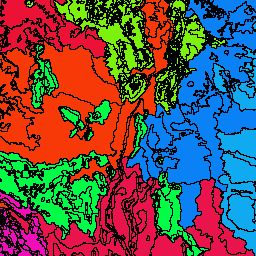
Агентство по охране окружающей среды США (USEPA) предоставляет набор данных «Экорегионы», который служит пространственной основой для исследования, оценки, управления и мониторинга экосистем и их компонентов. Экорегионы обозначают области общего сходства экосистем, а также типов, качества и количества природных ресурсов. Эти регионы общего назначения имеют решающее значение для структурирования и реализации стратегий управления экосистемами федеральными и государственными ведомствами, а также неправительственными организациями, отвечающими за различные типы ресурсов в пределах одних и тех же географических территорий.
Подход, использованный при составлении этой карты, основан на предположении, что экологические регионы можно определить, анализируя закономерности биотических и абиотических явлений, включая геологию, физиографию, растительность, климат, почвы, землепользование, животный мир и гидрологию. Относительная значимость каждой характеристики варьируется от одного экологического региона к другому.
Этот набор данных включает схему классификации экорегионов USEPA, а также схему Комиссии по экологическому сотрудничеству (CEC). Экорегионы являются иерархическими, причем уровень IV является наиболее подробным, а уровень I определяет самую широкую классификацию. Из-за этой иерархии, признаки уровня III сохраняют информацию с уровней I и II. CEC разделила всю Северную Америку на отдельные экорегионы для уровней I, II и III, в то время как USEPA сделало это только для Соединенных Штатов на уровнях III и IV. Столбцы, начинающиеся с «us », принадлежат схеме USEPA, а столбцы, начинающиеся с «na », принадлежат схеме CEC. Включенная версия этого набора данных содержит признаки только для смежных Соединенных Штатов (то есть Аляска и Гавайи не включены). Методы, используемые для определения экорегионов, объясняются в работах Omernik (1995, 2004), Omernik и др. (2000), и Gallant и др. (1989).
*Рассчитано поставщиком данных.
Схема таблицы
Схема таблицы
| Имя | Тип | Описание |
|---|---|---|
| l1_key | НИТЬ | Код и название NA Level I |
| l2_key | НИТЬ | Код и название NA Level II |
| l3_key | НИТЬ | Код и название уровня III США |
| na_l1code | НИТЬ | Код для экорегиона уровня I (Северная Америка/CEC) |
| na_l1name | НИТЬ | Название экорегиона уровня I (Северная Америка/CEC) |
| na_l2code | НИТЬ | Код для экорегиона уровня II (Северная Америка/CEC) |
| na_l2name | НИТЬ | Название экорегиона уровня II (Северная Америка/CEC) |
| na_l3code | НИТЬ | Код для экорегиона уровня III (Северная Америка/CEC) |
| na_l3name | НИТЬ | Название экорегиона уровня III (Северная Америка/CEC) |
| shape_area | ДВОЙНОЙ | Площадь геометрии объекта в исходном формате |
| shape_leng | ДВОЙНОЙ | Длина ребер в геометрии объекта в исходном формате |
| us_l3code | НИТЬ | Код для экорегиона уровня III (США/USEPA) |
| us_l3name | НИТЬ | Название экорегиона уровня III (США/USEPA) |
| l4_key | НИТЬ | Код и название уровня IV США |
| us_l4code | НИТЬ | Код для экорегиона уровня IV (США/USEPA) |
| us_l4name | НИТЬ | Название экорегиона уровня IV (США/USEPA) |
Условия эксплуатации
Условия эксплуатации
Ограничений на использование этих общедоступных данных США нет.
Цитаты
Комиссия по экологическому сотрудничеству. 1997. Экологические регионы Северной Америки: к общей перспективе. Комиссия по экологическому сотрудничеству, Монреаль, Квебек, Канада. 71 стр. Карта (масштаб 1:12 500 000). Пересмотрена в 2006 году.
Макмахон, Г., С.М. Грегонис, С.В. Уолтман, Дж.М. Омерник, Т.Д. Торсон, Дж.А. Фриуф, А.Х. Рорик и Дж.Э. Кейс. 2001. Разработка пространственной структуры общих экологических регионов для смежных Соединенных Штатов. Environmental Management 28(3):293-316.
Омерник, Дж. М. 1987. Экорегионы континентальной части США. Карта (масштаб 1:7 500 000). Анналы Ассоциации американских географов 77(1):118-125.
Омерник, Дж. М. 1995. Экорегионы: пространственная структура управления окружающей средой. В кн.: Биологическая оценка и критерии: инструменты для планирования и принятия решений в области водных ресурсов. Дэвис, У. С. и Т. П. Саймон (ред.), Lewis Publishers, Бока-Ратон, Флорида. С. 49–62.
Омерник, Дж. М. 2004. Взгляды на природу и определение экологических регионов. Environmental Management 34 (Приложение 1): S27–S38.
Омерник, Дж. М. и Г. Е. Гриффит. 2014. Экорегионы прилегающих территорий США: эволюция иерархической пространственной структуры. Environmental Management 54(6):1249-1266.
Исследуйте с Earth Engine
Редактор кода (JavaScript)
var dataset = ee.FeatureCollection('EPA/Ecoregions/2013/L4');
var visParams = {
  palette: ['0a3b04', '1a9924', '15d812'],
  min: 0.0,
  max: 67800000000.0,
  opacity: 0.8,
};
var image = ee.Image().float().paint(dataset, 'shape_area');
Map.setCenter(-99.814, 40.166, 5);
Map.addLayer(image, visParams, 'EPA/Ecoregions/2013/L4');
Map.addLayer(dataset, null, 'for Inspector', false);
Визуализировать как FeatureView
FeatureView — это ускоренное представление FeatureCollection , доступное только для просмотра. Подробнее см. в документации FeatureView .
Редактор кода (JavaScript)
var fvLayer = ui.Map.FeatureViewLayer('EPA/Ecoregions/2013/L4_FeatureView');

var visParams = {
  color: {
    property: 'shape_area',
    mode: 'linear',
    palette: ['0a3b04', '1a9924', '15d812'],
    min: 0.0,
    max: 67800000000.0
  },
  opacity: 0.8,
  polygonStrokeOpacity: 0
};

fvLayer.setVisParams(visParams);
fvLayer.setName('EPA/Ecoregions/2013/L4');

Map.setCenter(-99.814, 40.166, 5);
Map.add(fvLayer);