Page Summary
-
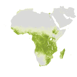
Net primary production (NPP) expresses the conversion of carbon dioxide into biomass driven by photosynthesis, with pixel values representing the mean daily NPP for a specific dekad.
-
This dataset, provided by FAO UN, offers dekadal NPP data from 2009-01-01 to 2023-03-01 at a pixel size of 248.2 meters.
-
The data is available through the Water Productivity Open Access Portal (WaPOR) and can be used for scientific and research purposes under open data licensing.
- Dataset Availability
- 2009-01-01T00:00:00Z–2023-03-01T00:00:00Z
- Dataset Producer
- FAO UN
- Cadence
- 10 Days
- Tags
Description
Net primary production (NPP) is a fundamental characteristic of an ecosystem, expressing the conversion of carbon dioxide into biomass driven by photosynthesis. The pixel value represents the mean daily NPP for that specific dekad.
Bands
Bands
Pixel size: 248.2 meters (all bands)
| Name | Units | Scale | Pixel Size | Description |
|---|---|---|---|---|
L1_NPP_D |
g/m^2 | 0.001 | 248.2 meters | Net Primary Production |
Terms of Use
Terms of Use
The Food and Agriculture Organization of the United Nations (FAO) is mandated to collect, analyze, interpret, and disseminate information related to nutrition, food, and agriculture. In this regard, it publishes a number of databases on topics related to FAO's mandate, and encourages the use of them for scientific and research purposes. Consistent with the principles of openness and sharing envisioned under the Open Data Licensing For Statistical Databases, and consistent with the mandate of FAO, data from the Water Productivity Open Access Portal (WaPOR), as part of AQUASTAT - FAO's Global Information System on Water and Agriculture, is available free to the user community.
Citations
FAO 2018. WaPOR Database Methodology: Level 1. Remote Sensing for Water Productivity Technical Report: Methodology Series. Rome, FAO. 72 pages.
FAO 2020. WaPOR V2 Database Methodology. Remote Sensing for Water Productivity Technical Report: Methodology Series. Rome, FAO. https://www.fao.org/3/ca9894en/CA9894EN.pdf
Explore with Earth Engine
Code Editor (JavaScript)
var coll = ee.ImageCollection('FAO/WAPOR/2/L1_NPP_D');
var image = coll.first();
Map.setCenter(17.5, 20, 3);
Map.addLayer(image, {min: 0, max: 5000});