-
澳大利亚的实际蒸散量(CMRSET Landsat V2.2)

此数据集使用 CMRSET 算法提供澳大利亚的准确实际蒸散量(AET 或 ETa)。AET 波段(命名为“ETa”)包含 CMRSET 模型在该月的所有无云 Landsat 观测的平均每日值(在 AET 数据中以值 3 表示)。 农业 澳大利亚 csiro 蒸发 蒸发蒸腾 landsat-derived -
加拿大 AAFC 年度作物库存

自 2009 年起,加拿大农业及农业食品部 (AAFC) 科学技术分部 (STB) 的地球观测团队开始生成年度作物类型数字地图。以 2009 年和 2010 年的草原省份为重点,一种基于决策树 (DT) 的方法… 农业 加拿大 农作物 地表覆盖 -
可可概率模型 2025a

注意:此数据集尚未经过同行评审。如需了解详情,请参阅此 GitHub README。此影像集提供估计的每像素概率,表示相应区域被相应商品占据的可能性。概率估计值以 10 米为单位提供,由…生成 农业 生物多样性 保护 作物 eudr forestdatapartnership -
Coffee Probability 模型 2025a

注意:此数据集尚未经过同行评审。如需了解详情,请参阅此 GitHub README。此影像集提供估计的每像素概率,表示相应区域被相应商品占据的可能性。概率估计值以 10 米为单位提供,由…生成 农业 生物多样性 保护 作物 eudr forestdatapartnership -
DESS China Terrace Map v1

此数据集是 2018 年中国梯田地图,分辨率为 30 米。该模型是通过基于 Google Earth Engine 平台使用多源和多时相数据进行监督像素级分类而开发的。总体准确率和 Kappa 系数分别达到 94% 和 0.72。这第一个… 农业 土地覆盖 土地利用 土地利用和土地覆盖 清华 -
排水有机土壤排放量(年)1.0
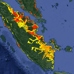
以下是两个相关的 FAO 排水有机土壤数据集,其中提供了以下估计值:DROSA-A:为农业活动(耕地和放牧草地)而排水的有机土壤面积(以公顷为单位)DROSE-A:有机土壤的农业排水产生的碳 (C) 和一氧化二氮 (N2O) 估计值(以千兆克为单位),… 农业 气候 气候变化 排放 fao ghg -
ESA WorldCereal 10 m v100

欧洲空间局 (ESA) WorldCereal 10 m 2021 产品套件包含全球范围的年度和季节性作物地图及其相关置信度。这些数据是作为 ESA-WorldCereal 项目的一部分生成的。如需详细了解这些产品的内容以及用于…的方法,请参阅… 农业 哥白尼计划 农作物 欧洲航天局 全球 土地覆盖 -
ESA WorldCereal AEZ v100

欧洲航天局 (ESA) WorldCereal 分类系统的目标是在特定生长季结束后一个月内生成产品。由于全球各地生长季的动态特性,我们根据… 农业 边界 农作物 esa 全球 表格 -
ESA WorldCereal Active Cropland 10 m v100

欧洲空间局 (ESA) WorldCereal Active Cropland 10 m 2021 产品套件包含全球范围的季节性活跃农田标记。这些数据是作为 ESA-WorldCereal 项目的一部分生成的。有效农田产品表示被识别为临时作物的像素是否已积极… 农业 哥白尼计划 农作物 欧洲航天局 全球 土地覆盖 -
EUCROPMAP

基于 Sentinel-1 和 LUCAS Copernicus 2018 年实地观测结果的 2018 年欧洲作物类型地图,以及基于 Sentinel-1、Sentinel-2 和辅助数据与 LUCAS Copernicus 2022 年观测结果的 2022 年欧洲作物类型地图。该数据集基于独特的 LUCAS 2018 Copernicus 实地调查,是首个… 农业 作物 欧盟 jrc LUCAS Sentinel1 衍生 -
森林邻近人群 (FPP) 1.0

“森林附近居民”(FPP) 数据集是促成森林合作伙伴关系 (CPF) 全球核心森林相关指标集 (GCS) 中指标 13“极度贫困的森林依赖人口数量”的开发的数据层之一。FPP 数据集提供了一个… 农业 粮农组织 森林 全球 植物生产力 人口 -
GFSAD1000:农田范围 1 公里多研究作物掩码,全球粮食支持分析数据

GFSAD 是 NASA 资助的项目,旨在提供高分辨率的全球农田数据及其用水量,以促进 21 世纪的全球粮食安全。GFSAD 产品是通过多传感器遥感数据(例如,Landsat、MODIS、AVHRR)、次级数据和实地试验区数据… 农业 农作物 地表覆盖 usgs -
全球油棕榈种植园地图

该数据集是 2019 年全球 10 米工业和小农油棕榈地图。它涵盖了检测到油棕榈种植园的区域。分类后的图像是基于 Sentinel-1 和 Sentinel-2 半年合成数据的卷积神经网络的输出。如需了解更多…,请参阅相关文章 农业 生物多样性 保护 作物 全球 土地利用 -
IrrMapper 灌溉土地,版本 1.2
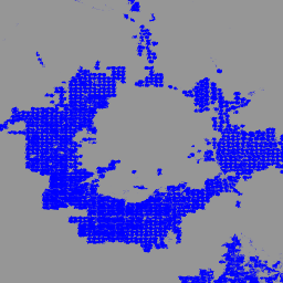
IrrMapper 是一项年度分类,用于确定美国西部 11 个州的灌溉状况,以 Landsat 规模(即 30 米分辨率)进行。30 米)使用随机森林算法,涵盖 1986 年至今。虽然 IrrMapper 论文描述了四类分类(即灌溉地、旱地、未耕地、湿地),但… 农业 基于 Landsat 的 -
NAIP:美国国家农业影像计划

美国国家农业影像计划 (NAIP) 在美国本土的农业生长季期间采集航空影像。NAIP 项目每年都会根据可用资金和影像采集周期签订合同。自 2003 年起,NAIP 以 5 年为周期进行采集。2008 年是… 农业 高分辨率 影像 正射影像 美国农业部 -
Palm 概率模型 2025a

注意:此数据集尚未经过同行评审。如需了解详情,请参阅此 GitHub README。此影像集提供估计的每像素概率,表示相应区域被相应商品占据的可能性。概率估计值以 10 米为单位提供,由…生成 农业 生物多样性 保护 作物 eudr forestdatapartnership -
Rubber Tree Probability 模型 2025a

注意:此数据集尚未经过同行评审。如需了解详情,请参阅此 GitHub README。此影像集提供估计的每像素概率,表示相应区域被相应商品占据的可能性。概率估计值以 10 米为单位提供,由…生成 农业 生物多样性 保护 作物 eudr forestdatapartnership -
树木邻近人群 (TPP) 1.0

“Tree Proximate People”(TPP) 是有助于开发森林合作伙伴关系 (CPF) 全球核心森林相关指标集 (GCS) 中指标 13(极度贫困的森林依赖人口数量)的数据集之一。TPP 数据集提供了 4 种不同的估计值… 农业 粮农组织 森林 全球 植物生产力 人口 -
联合国粮农组织排水有机土壤面积(年度)1.0

以下是两个相关的 FAO 排水有机土壤数据集,其中提供了以下估计值:DROSA-A:为农业活动(耕地和放牧草地)而排水的有机土壤面积(以公顷为单位)DROSE-A:有机土壤的农业排水产生的碳 (C) 和一氧化二氮 (N2O) 估计值(以千兆克为单位),… 农业 气候 气候变化 排放 fao ghg -
美国农业部 NASS 农田数据层
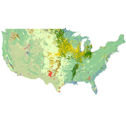
农作物数据层 (CDL) 是一种针对特定农作物的土地覆盖数据层,每年都会使用中等分辨率的卫星图像和广泛的农业地面实况数据为美国大陆创建。CDL 由美国农业部国家农业统计局 (NASS) 研究与开发部门创建,… 农业 农作物 土地覆盖 美国农业部 -
WAPOR 实际蒸发蒸腾量和截留量 2.0

实际蒸散量和截留量 (ETIa)(旬,单位为 mm/天)是土壤蒸发量 (E)、冠层蒸腾量 (T) 和被叶片截留的降雨蒸发量 (I) 的总和。每个像素的值表示特定旬的平均每日 ETIa。 农业 fao wapor 水 水蒸气 -
WAPOR 实际蒸散量和截留量 3.0

实际蒸散量和截留量 (ETIa)(旬,单位为 mm/天)是土壤蒸发量 (E)、冠层蒸腾量 (T) 和被叶片截留的降雨蒸发量 (I) 的总和。每个像素的值表示特定旬的平均每日 ETIa。 农业 fao wapor 水 水蒸气 -
WAPOR Daily Reference Evapotranspiration 2.0

参考蒸散量 (RET) 是指假设的参考作物的蒸散量,它模拟了水分充足的草地表面的行为。每个像素表示以毫米为单位的每日参考蒸散量。 农业 fao wapor 水 水蒸气 -
WAPOR Daily Reference Evapotranspiration 3.0
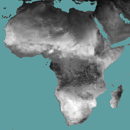
参考蒸散量 (RET) 是指假设的参考作物的蒸散量,它模拟了水分充足的草地表面的行为。每个像素表示以毫米为单位的每日参考蒸散量。 农业 fao wapor 水 水蒸气 -
WAPOR Dekadal Evaporation 2.0

蒸发量 (E) 数据分量(以十天为单位,单位为 mm/天)是土壤表面的实际蒸发量。每个像素的值表示相应旬的平均每日实际蒸发量。 农业 fao wapor 水 水蒸气 -
WAPOR Dekadal Evaporation 3.0
蒸发量 (E) 数据分量(以十天为单位,单位为 mm/天)是土壤表面的实际蒸发量。每个像素的值表示相应旬的平均每日实际蒸发量。 农业 fao wapor 水 水蒸气 -
WAPOR Dekadal Interception 2.0

截留 (I) 数据分量(旬,单位为 mm/天)表示植被冠层截留的降雨蒸发量。截留是指降雨被树叶截获的过程。其中一部分收集到的雨水会再次蒸发。每个像素的值表示平均… 农业 fao wapor 水 水蒸气 -
WAPOR Dekadal Interception 3.0
截留 (I) 数据分量(旬,单位为 mm/天)表示植被冠层截留的降雨蒸发量。截留是指降雨被树叶截获的过程。其中一部分收集到的雨水会再次蒸发。每个像素的值表示平均… 农业 fao wapor 水 水蒸气 -
WAPOR 十天净初级生产力 2.0

净初级生产力 (NPP) 是生态系统的一项基本特征,表示在光合作用的驱动下,二氧化碳转化为生物质的过程。像素值表示相应旬的平均每日 NPP。 农业 fao 植物生产力 wapor 水 -
WAPOR Dekadal Reference Evapotranspiration 2.0

参考蒸散量 (RET) 是指假设的参考作物的蒸散量,它模拟了水分充足的草地表面的行为。每个像素的值表示相应旬的日参考蒸散量的平均值。 农业 fao wapor 水 水蒸气 -
WAPOR Dekadal 参考蒸发蒸腾量 3.0
参考蒸散量 (RET) 是指假设的参考作物的蒸散量,它模拟了水分充足的草地表面的行为。每个像素的值表示相应旬的日参考蒸散量的平均值。 农业 fao wapor 水 水蒸气 -
WAPOR Dekadal Transpiration 2.0

蒸腾量 (T) 数据分量(以旬为单位,单位为 mm/天)是植被冠层的实际蒸腾量。每个像素的值表示相应旬的平均每日实际蒸腾量。 农业 fao wapor 水 水蒸气 -
WAPOR Dekadal Transpiration 3.0

蒸腾量 (T) 数据分量(以旬为单位,单位为 mm/天)是植被冠层的实际蒸腾量。每个像素的值表示相应旬的平均每日实际蒸腾量。 农业 fao 全球 wapor 水 水汽 -
WRI/Google DeepMind 全球森林损失驱动因素 2001-2022 年 v1.0

此数据集以 1 公里分辨率在全球范围内绘制了 2001 年至 2022 年间树木覆盖损失的主要驱动因素。该数据由世界资源研究所 (WRI) 和 Google DeepMind 共同制作,是使用在全球范围内收集的一组样本训练的全球神经网络模型 (ResNet) 开发而成… 农业 森林砍伐 森林 森林生物质 Google landandcarbon -
WRI/Google DeepMind 全球森林损失驱动因素 2001-2023 年 v1.1

此数据集以 1 公里分辨率在全球范围内绘制了 2001 年至 2023 年间树木覆盖率下降的主要驱动因素。该数据由世界资源研究所 (WRI) 和 Google DeepMind 共同制作,是使用在全球范围内收集的一组样本训练的全球神经网络模型 (ResNet) 开发而成… 农业 森林砍伐 森林 森林生物质 Google landandcarbon -
WRI/Google DeepMind,“2001-2024 年全球森林损失驱动因素”v1.2

此数据集以 1 公里分辨率在全球范围内绘制了 2001 年至 2024 年间森林覆盖损失的主要驱动因素。该数据由世界资源研究所 (WRI) 和 Google DeepMind 共同制作,是使用在全球范围内收集的一组样本训练的全球神经网络模型 (ResNet) 开发而成… 农业 森林砍伐 森林 森林生物质 Google landandcarbon
Datasets tagged agriculture in Earth Engine
[null,null,[],[],[]]
