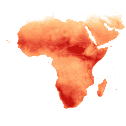
Reference evapotranspiration (RET) is defined as the evapotranspiration from a
hypothetical reference crop and it simulates the behaviour of a well-watered
grass surface. The value of each pixel represents the average of the daily
reference evapotranspiration for that specific dekad.
Bands
Pixel Size 18924 meters
Bands
Name
Units
Scale
Pixel Size
Description
L1_RET_D
mm
0.1
meters
Reference Evapotranspiration (Dekadal) [mm]
Terms of Use
Terms of Use
The Food and Agriculture Organization of the United Nations (FAO) is
mandated to collect, analyze, interpret, and disseminate information related
to nutrition, food, and agriculture. In this regard, it publishes a number
of databases on topics related to FAO's mandate, and encourages the use of
them for scientific and research purposes. Consistent with the principles
of openness and sharing envisioned under the Open Data Licensing For
Statistical Databases, and
consistent with the mandate of FAO, data from the Water Productivity Open
Access Portal (WaPOR), as part
of AQUASTAT - FAO's Global Information
System on Water and Agriculture, is available free to the user community.
Citations
Citations:
FAO 2018. WaPOR Database Methodology: Level 1. Remote Sensing for Water
Productivity Technical Report: Methodology Series. Rome, FAO. 72 pages.
Reference evapotranspiration (RET) is defined as the evapotranspiration from a hypothetical reference crop and it simulates the behaviour of a well-watered grass surface. The value of each pixel represents the average of the daily reference evapotranspiration for that specific dekad.
[null,null,[],[[["\u003cp\u003eThe FAO/WAPOR/2/L1_RET_D dataset provides dekadal (10-day) reference evapotranspiration (RET) data from 2009 to 2023.\u003c/p\u003e\n"],["\u003cp\u003eRET represents the evapotranspiration from a hypothetical reference crop, simulating a well-watered grass surface.\u003c/p\u003e\n"],["\u003cp\u003eData is available at a resolution of 18924 meters and is provided by the Food and Agriculture Organization of the United Nations (FAO).\u003c/p\u003e\n"],["\u003cp\u003eThe dataset is free to use for research, education, and nonprofit purposes under FAO's Open Data Licensing.\u003c/p\u003e\n"],["\u003cp\u003eValues represent the average daily reference evapotranspiration for each dekad in millimeters (mm).\u003c/p\u003e\n"]]],["The FAO WaPOR database provides dekadal (10-day) reference evapotranspiration (RET) data from January 1, 2009, to March 11, 2023. This dataset, accessible via Google Earth Engine, simulates evapotranspiration from a well-watered grass surface. Each pixel represents the average daily RET for a dekad in millimeters. It's available for free use, emphasizing open data for research purposes. Users can access the data via the provided Earth Engine snippet, and the dataset's provided citation links.\n"],null,["# WAPOR Dekadal Reference Evapotranspiration 2.0\n\nDataset Availability\n: 2009-01-01T00:00:00Z--2023-03-11T00:00:00Z\n\nDataset Provider\n:\n\n\n [FAO UN](https://wapor.apps.fao.org/catalog/WAPOR_2/1/L1_RET_D)\n\nCadence\n: 10 Days\n\nTags\n:\n[agriculture](/earth-engine/datasets/tags/agriculture) [fao](/earth-engine/datasets/tags/fao) [wapor](/earth-engine/datasets/tags/wapor) [water](/earth-engine/datasets/tags/water) [water-vapor](/earth-engine/datasets/tags/water-vapor) \n\n#### Description\n\nReference evapotranspiration (RET) is defined as the evapotranspiration from a\nhypothetical reference crop and it simulates the behaviour of a well-watered\ngrass surface. The value of each pixel represents the average of the daily\nreference evapotranspiration for that specific dekad.\n\n### Bands\n\n\n**Pixel Size**\n\n18924 meters\n\n**Bands**\n\n| Name | Units | Scale | Pixel Size | Description |\n|------------|-------|-------|------------|-----------------------------------------------|\n| `L1_RET_D` | mm | 0.1 | meters | Reference Evapotranspiration (Dekadal) \\[mm\\] |\n\n### Terms of Use\n\n**Terms of Use**\n\nThe Food and Agriculture Organization of the United Nations (FAO) is\nmandated to collect, analyze, interpret, and disseminate information related\nto nutrition, food, and agriculture. In this regard, it publishes a number\nof databases on topics related to FAO's mandate, and encourages the use of\nthem for scientific and research purposes. Consistent with the principles\nof openness and sharing envisioned under the [Open Data Licensing For\nStatistical Databases](http://www.fao.org/3/ca7570en/ca7570en.pdf), and\nconsistent with the mandate of FAO, data from the [Water Productivity Open\nAccess Portal (WaPOR)](https://wapor.apps.fao.org/home/WAPOR_2/1), as part\nof [AQUASTAT](http://www.fao.org/aquastat/en/) - FAO's Global Information\nSystem on Water and Agriculture, is available free to the user community.\n\n### Citations\n\nCitations:\n\n- FAO 2018. WaPOR Database Methodology: Level 1. Remote Sensing for Water\n Productivity Technical Report: Methodology Series. Rome, FAO. 72 pages.\n- FAO 2020. WaPOR V2 Database Methodology. Remote Sensing for Water\n Productivity Technical Report: Methodology Series. Rome, FAO.\u003chttps://www.fao.org/3/ca9894en/CA9894EN.pdf\u003e\n\n### Explore with Earth Engine\n\n| **Important:** Earth Engine is a platform for petabyte-scale scientific analysis and visualization of geospatial datasets, both for public benefit and for business and government users. Earth Engine is free to use for research, education, and nonprofit use. To get started, please [register for Earth Engine access.](https://console.cloud.google.com/earth-engine)\n\n### Code Editor (JavaScript)\n\n```javascript\nvar coll = ee.ImageCollection('FAO/WAPOR/2/L1_RET_D');\nvar image = coll.first();\nMap.setCenter(17.5, 20, 3);\nMap.addLayer(image, {min: 0, max: 100});\n```\n[Open in Code Editor](https://code.earthengine.google.com/?scriptPath=Examples:Datasets/FAO/FAO_WAPOR_2_L1_RET_D) \n[WAPOR Dekadal Reference Evapotranspiration 2.0](/earth-engine/datasets/catalog/FAO_WAPOR_2_L1_RET_D) \nReference evapotranspiration (RET) is defined as the evapotranspiration from a hypothetical reference crop and it simulates the behaviour of a well-watered grass surface. The value of each pixel represents the average of the daily reference evapotranspiration for that specific dekad. \nFAO/WAPOR/2/L1_RET_D, agriculture,fao,wapor,water,water-vapor \n2009-01-01T00:00:00Z/2023-03-11T00:00:00Z \n-39.9953437 -30.15 40.0044643 65.13 \nGoogle Earth Engine \nhttps://developers.google.com/earth-engine/datasets\n\n- [](https://doi.org/https://wapor.apps.fao.org/catalog/WAPOR_2/1/L1_RET_D)\n- [](https://doi.org/https://developers.google.com/earth-engine/datasets/catalog/FAO_WAPOR_2_L1_RET_D)"]]