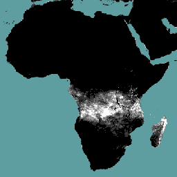
The interception (I) data component (dekadal, in mm/day) represents the evaporation
of intercepted rainfall from the vegetation canopy. Interception is the process
where rainfall is captured by the leaves. Part of this captured rainfall will
evaporate again. The value of each pixel represents the average daily evaporated
interception for that specific dekad.
Bands
Pixel Size 248.2 meters
Bands
Name
Units
Scale
Pixel Size
Description
L1-I-D
mm
0.1
meters
Interception (Dekadal) [mm]
Terms of Use
Terms of Use
The Food and Agriculture Organization of the United Nations (FAO) is
mandated to collect, analyze, interpret, and disseminate information related
to nutrition, food, and agriculture. In this regard, it publishes a number
of databases on topics related to FAO's mandate, and encourages the use of
them for scientific and research purposes. Consistent with the principles
of openness and sharing envisioned under the Open Data Licensing For
Statistical Databases, and
consistent with the mandate of FAO, data from the Water Productivity Open
Access Portal (WaPOR), as part
of AQUASTAT - FAO's Global Information
System on Water and Agriculture, is available free to the user community.
Citations
Citations:
FAO 2023. WaPOR Database Methodology: Level 1. Remote Sensing for Water Productivity
Technical Report: Methodology Series. Rome, FAO. 72 pages.
The interception (I) data component (dekadal, in mm/day) represents the evaporation of intercepted rainfall from the vegetation canopy. Interception is the process where rainfall is captured by the leaves. Part of this captured rainfall will evaporate again. The value of each pixel represents the average daily evaporated interception for that …
[null,null,[],[],[],null,["Dataset Availability\n: 2009-01-01T00:00:00Z--2025-08-11T00:00:00Z\n\nDataset Provider\n:\n\n\n [FAO UN](https://www.fao.org/in-action/remote-sensing-for-water-productivity/wapor-data-access/en)\n\nCadence\n: 10 Days\n\nTags\n:\n[agriculture](/earth-engine/datasets/tags/agriculture) [fao](/earth-engine/datasets/tags/fao) [wapor](/earth-engine/datasets/tags/wapor) [water](/earth-engine/datasets/tags/water) [water-vapor](/earth-engine/datasets/tags/water-vapor) \n\nDescription \nThe interception (I) data component (dekadal, in mm/day) represents the evaporation\nof intercepted rainfall from the vegetation canopy. Interception is the process\nwhere rainfall is captured by the leaves. Part of this captured rainfall will\nevaporate again. The value of each pixel represents the average daily evaporated\ninterception for that specific dekad.\n\nBands\n\n\n**Pixel Size**\n\n248.2 meters\n\n**Bands**\n\n| Name | Units | Scale | Pixel Size | Description |\n|----------|-------|-------|------------|-------------------------------|\n| `L1-I-D` | mm | 0.1 | meters | Interception (Dekadal) \\[mm\\] |\n\nTerms of Use\n\n**Terms of Use**\n\nThe Food and Agriculture Organization of the United Nations (FAO) is\nmandated to collect, analyze, interpret, and disseminate information related\nto nutrition, food, and agriculture. In this regard, it publishes a number\nof databases on topics related to FAO's mandate, and encourages the use of\nthem for scientific and research purposes. Consistent with the principles\nof openness and sharing envisioned under the [Open Data Licensing For\nStatistical Databases](http://www.fao.org/3/ca7570en/ca7570en.pdf), and\nconsistent with the mandate of FAO, data from the [Water Productivity Open\nAccess Portal (WaPOR)](https://www.fao.org/in-action/remote-sensing-for-water-productivity/wapor-data-access/en), as part\nof [AQUASTAT](http://www.fao.org/aquastat/en/) - FAO's Global Information\nSystem on Water and Agriculture, is available free to the user community.\n\nCitations \nCitations:\n\n- FAO 2023. WaPOR Database Methodology: Level 1. Remote Sensing for Water Productivity\n Technical Report: Methodology Series. Rome, FAO. 72 pages.\n- FAO 2023. WaPOR V3 Database Methodology. Remote Sensing for Water\n Productivity Technical Report: Methodology Series. Rome, FAO.\n \u003chttps://www.fao.org/3/cc6964en/cc6964en.pdf\u003e\n\nExplore with Earth Engine **Important:** Earth Engine is a platform for petabyte-scale scientific analysis and visualization of geospatial datasets, both for public benefit and for business and government users. Earth Engine is free to use for research, education, and nonprofit use. To get started, please [register for Earth Engine access.](https://console.cloud.google.com/earth-engine)\n\nCode Editor (JavaScript) \n\n```javascript\nvar coll = ee.ImageCollection('FAO/WAPOR/3/L1_I_D');\nvar image = coll.first();\nMap.setCenter(17.5, 20, 3);\nMap.addLayer(image, {min: 0, max: 50});\n```\n[Open in Code Editor](https://code.earthengine.google.com/?scriptPath=Examples:Datasets/FAO/FAO_WAPOR_3_L1_I_D) \n[WAPOR Dekadal Interception 3.0](/earth-engine/datasets/catalog/FAO_WAPOR_3_L1_I_D) \nThe interception (I) data component (dekadal, in mm/day) represents the evaporation of intercepted rainfall from the vegetation canopy. Interception is the process where rainfall is captured by the leaves. Part of this captured rainfall will evaporate again. The value of each pixel represents the average daily evaporated interception for that ... \nFAO/WAPOR/3/L1_I_D, agriculture,fao,wapor,water,water-vapor \n2009-01-01T00:00:00Z/2025-08-11T00:00:00Z \n-40.0044644 -30.0044643 40.0044643 65.0044644 \nGoogle Earth Engine \nhttps://developers.google.com/earth-engine/datasets\n\n- [](https://doi.org/https://www.fao.org/in-action/remote-sensing-for-water-productivity/wapor-data-access/en)\n- [](https://doi.org/https://developers.google.com/earth-engine/datasets/catalog/FAO_WAPOR_3_L1_I_D)"]]