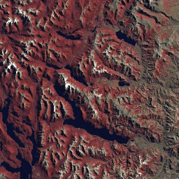
GLS2005 데이터 세트는 2004년에서 2007년 사이에 수집되었으며 지구의 육지를 포함하는 9,500개의 정사 보정된 잎이 있는 중간 해상도 위성 이미지 모음입니다. GLS2005는 주로 Landsat 5와 갭이 채워진 Landsat 7 데이터를 사용하며 EO-1 ALI 및 Terra ASTER 데이터가 데이터 홀을 채웁니다.
이 데이터 세트에는 L5 TM 및 L7 ETM+ 센서의 이미지만 포함되며, 이 두 센서에 공통적으로 있는 6개 밴드(10, 20, 30, 40, 50, 70)만 포함됩니다.
대역
픽셀 크기 30미터
대역
이름
픽셀 크기
파장
설명
10
미터
0.45~0.52μm
파란색
20
미터
0.52~0.60μm
초록색
30
미터
0.63~0.69μm
빨간색
40
미터
0.76~0.90μm
근적외선
50
미터
1.55~1.75μm
단파 적외선 1
70
미터
2.08~2.35μm
단파 적외선 2
이용약관
이용약관
Landsat 데이터 세트는 연방 정부에서 생성한 데이터이므로 퍼블릭 도메인에 속하며 저작권 제한 없이 사용, 전송 또는 복제할 수 있습니다.
데이터 소스로서 USGS를 인용하거나 출처를 표시하려면 아래 예와 같은 텍스트 인용구를 포함해야 합니다.
GLS2005 데이터 세트는 2004년에서 2007년 사이에 수집되었으며 지구의 육지를 포함하는 9,500개의 정사보정된 잎이 있는 중간 해상도 위성 이미지 모음입니다. GLS2005는 주로 Landsat 5와 EO-1 ALI 및 Terra ASTER 데이터로 데이터 격차를 채운 Landsat 7 데이터를 사용합니다. 이 데이터 세트에는 다음이 포함됩니다.
[null,null,[],[[["\u003cp\u003eThe GLS2005 dataset comprises approximately 9,500 orthorectified, medium-resolution satellite images of Earth's landmasses, collected between 2004 and 2007.\u003c/p\u003e\n"],["\u003cp\u003ePrimarily using Landsat 5 and 7 data, GLS2005 also incorporates EO-1 ALI and Terra ASTER data to fill gaps, offering a comprehensive global land survey.\u003c/p\u003e\n"],["\u003cp\u003eThis dataset includes six spectral bands (blue, green, red, near-infrared, and two shortwave infrared bands) at a 30-meter resolution, compatible with both Landsat 5 TM and Landsat 7 ETM+ sensors.\u003c/p\u003e\n"],["\u003cp\u003eGLS2005 data is freely available for use, transfer, and reproduction without copyright restrictions, as it is considered public domain data created by the USGS.\u003c/p\u003e\n"],["\u003cp\u003eUsers are encouraged to acknowledge the USGS as the data source when utilizing GLS2005 imagery.\u003c/p\u003e\n"]]],[],null,["# Landsat Global Land Survey 2005, Landsat 5+7 scenes\n\nDataset Availability\n: 2003-07-29T00:00:00Z--2008-07-29T00:00:00Z\n\nDataset Provider\n:\n\n\n [USGS](https://www.usgs.gov/landsat-missions/global-land-survey-gls)\n\nTags\n:\n[gls](/earth-engine/datasets/tags/gls) [landsat](/earth-engine/datasets/tags/landsat) [radiance](/earth-engine/datasets/tags/radiance) [satellite-imagery](/earth-engine/datasets/tags/satellite-imagery) [usgs](/earth-engine/datasets/tags/usgs) \n\n#### Description\n\nThe GLS2005 data set is a collection of 9500\northorectified leaf-on medium-resolution satellite images collected between\n2004 and 2007 and covering the Earth's land masses. GLS2005 uses mainly Landsat\n5 and gap-filled Landsat 7 data with EO-1 ALI and Terra ASTER data filling in\nany data holes.\n\nThis dataset contains images from just the L5 TM and L7 ETM+ sensors, and only the 6 bands that those two sensors have in common: 10, 20, 30, 40, 50, and 70.\n\n### Bands\n\n\n**Pixel Size**\n\n30 meters\n\n**Bands**\n\n| Name | Pixel Size | Wavelength | Description |\n|------|------------|----------------|----------------------|\n| `10` | meters | 0.45 - 0.52 μm | Blue |\n| `20` | meters | 0.52 - 0.60 μm | Green |\n| `30` | meters | 0.63 - 0.69 μm | Red |\n| `40` | meters | 0.76 - 0.90 μm | Near infrared |\n| `50` | meters | 1.55 - 1.75 μm | Shortwave infrared 1 |\n| `70` | meters | 2.08 - 2.35 μm | Shortwave infrared 2 |\n\n### Terms of Use\n\n**Terms of Use**\n\nLandsat datasets are federally created data\nand therefore reside in the public domain and may be used, transferred, or reproduced without copyright restriction.\n\nAcknowledgement or credit of the USGS as data source should be provided\nby including a line of text citation such as the example shown below.\n\n(Product, Image, Photograph, or Dataset Name) courtesy of\nthe U.S. Geological Survey\n\nExample: Landsat-7 image courtesy of the U.S. Geological Survey\n\nSee the\n[USGS Visual Identity System Guidance](https://www.usgs.gov/information-policies-and-instructions/usgs-visual-identity-system)\nfor further details on proper citation and acknowledgement of USGS products.\n\n### Explore with Earth Engine\n\n| **Important:** Earth Engine is a platform for petabyte-scale scientific analysis and visualization of geospatial datasets, both for public benefit and for business and government users. Earth Engine is free to use for research, education, and nonprofit use. To get started, please [register for Earth Engine access.](https://console.cloud.google.com/earth-engine)\n\n### Code Editor (JavaScript)\n\n```javascript\nvar dataset = ee.ImageCollection('LANDSAT/GLS2005');\nvar trueColor321 = dataset.select(['30', '20', '10']);\nMap.setCenter(6.746, 46.529, 6);\nMap.addLayer(trueColor321, {}, 'True Color (321)');\n```\n[Open in Code Editor](https://code.earthengine.google.com/?scriptPath=Examples:Datasets/LANDSAT/LANDSAT_GLS2005) \n[Landsat Global Land Survey 2005, Landsat 5+7 scenes](/earth-engine/datasets/catalog/LANDSAT_GLS2005) \nThe GLS2005 data set is a collection of 9500 orthorectified leaf-on medium-resolution satellite images collected between 2004 and 2007 and covering the Earth's land masses. GLS2005 uses mainly Landsat 5 and gap-filled Landsat 7 data with EO-1 ALI and Terra ASTER data filling in any data holes. This dataset contains ... \nLANDSAT/GLS2005, gls,landsat,radiance,satellite-imagery,usgs \n2003-07-29T00:00:00Z/2008-07-29T00:00:00Z \n-90 -180 90 180 \nGoogle Earth Engine \nhttps://developers.google.com/earth-engine/datasets\n\n- [](https://doi.org/https://www.usgs.gov/landsat-missions/global-land-survey-gls)\n- [](https://doi.org/https://developers.google.com/earth-engine/datasets/catalog/LANDSAT_GLS2005)"]]