- 数据集可用时间
- 2000-02-24T00:00:00Z–2024-06-01T00:00:00Z
- 数据集生产者
- 美国地质调查局地球资源观测与科学中心下属的美国国家航空航天局陆地过程分布式主动存档中心
- 时间分辨率
- 1 天
- 标签
说明
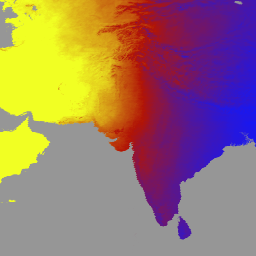
MCD18A1 版本 6.1 是一款中等分辨率成像光谱辐射计 (MODIS) Terra 和 Aqua 组合向下短波辐射 (DSR) 格网 3 级产品,以 1 公里像素分辨率每日生成,并每 3 小时提供一次 DSR 估计值。DSR 是指陆地表面在短波谱(300-4,000 纳米)范围内的入射太阳辐射,是陆地表面模型中的一个重要变量,可用于解决各种科学和应用问题。MCD18 产品基于一种原型算法,该算法使用 MODIS 数据的多时态签名来推导地表反射率,然后使用查找表 (LUT) 方法计算入射 DSR。LUT 考虑了不同类型的气溶胶和云负载,以及各种照明/观测几何形状。全球 DSR 产品由 MODIS 和地球静止卫星数据生成。 如需详细了解用于创建这些数据的方法,请参阅算法理论基础文档。
频段
波段
像素大小:1,000 米(所有波段)
| 名称 | 单位 | 最小值 | 最大值 | 像素大小 | 说明 | ||||||||||||||||||||||||||||||||||||||||||||||||||||||||||||||||||||||||||||||||||||||||||||||
|---|---|---|---|---|---|---|---|---|---|---|---|---|---|---|---|---|---|---|---|---|---|---|---|---|---|---|---|---|---|---|---|---|---|---|---|---|---|---|---|---|---|---|---|---|---|---|---|---|---|---|---|---|---|---|---|---|---|---|---|---|---|---|---|---|---|---|---|---|---|---|---|---|---|---|---|---|---|---|---|---|---|---|---|---|---|---|---|---|---|---|---|---|---|---|---|---|---|---|---|
DSR |
瓦/平方米 | 0 | 1400 | 1000 米 | MODIS 过境时的瞬时总 DSR |
||||||||||||||||||||||||||||||||||||||||||||||||||||||||||||||||||||||||||||||||||||||||||||||
Direct |
瓦/平方米 | 0 | 1400 | 1000 米 | MODIS 过境时的瞬时直接 DSR |
||||||||||||||||||||||||||||||||||||||||||||||||||||||||||||||||||||||||||||||||||||||||||||||
Diffuse |
瓦/平方米 | 0 | 1400 | 1000 米 | MODIS 过境时的瞬时漫射 DSR |
||||||||||||||||||||||||||||||||||||||||||||||||||||||||||||||||||||||||||||||||||||||||||||||
GMT_0000_DSR |
瓦/平方米 | 0 | 1400 | 1000 米 | 格林尼治标准时间 00:00 的总 DSR |
||||||||||||||||||||||||||||||||||||||||||||||||||||||||||||||||||||||||||||||||||||||||||||||
GMT_0300_DSR |
瓦/平方米 | 0 | 1400 | 1000 米 | GMT 03:00 的总 DSR |
||||||||||||||||||||||||||||||||||||||||||||||||||||||||||||||||||||||||||||||||||||||||||||||
GMT_0600_DSR |
瓦/平方米 | 0 | 1400 | 1000 米 | GMT 06:00 时的总 DSR |
||||||||||||||||||||||||||||||||||||||||||||||||||||||||||||||||||||||||||||||||||||||||||||||
GMT_0900_DSR |
瓦/平方米 | 0 | 1400 | 1000 米 | GMT 09:00 的 DSR 总数 |
||||||||||||||||||||||||||||||||||||||||||||||||||||||||||||||||||||||||||||||||||||||||||||||
GMT_1200_DSR |
瓦/平方米 | 0 | 1400 | 1000 米 | 格林尼治标准时间 12:00 的总 DSR |
||||||||||||||||||||||||||||||||||||||||||||||||||||||||||||||||||||||||||||||||||||||||||||||
GMT_1500_DSR |
瓦/平方米 | 0 | 1400 | 1000 米 | 格林尼治标准时间 15:00 的总 DSR |
||||||||||||||||||||||||||||||||||||||||||||||||||||||||||||||||||||||||||||||||||||||||||||||
GMT_1800_DSR |
瓦/平方米 | 0 | 1400 | 1000 米 | GMT 18:00 的总 DSR |
||||||||||||||||||||||||||||||||||||||||||||||||||||||||||||||||||||||||||||||||||||||||||||||
GMT_2100_DSR |
瓦/平方米 | 0 | 1400 | 1000 米 | GMT 21:00 的总 DSR |
||||||||||||||||||||||||||||||||||||||||||||||||||||||||||||||||||||||||||||||||||||||||||||||
DSR_Quality |
1000 米 | 质量标志 |
|||||||||||||||||||||||||||||||||||||||||||||||||||||||||||||||||||||||||||||||||||||||||||||||||
使用条款
使用条款
通过 LP DAAC 获取的 MODIS 数据和产品在后续使用、销售或再分发方面没有任何限制。
引用
引用:
如需了解如何引用 LP DAAC 数据集,请访问 LP DAAC 的“引用我们的数据”页面。
DOI
通过 Earth Engine 探索
代码编辑器 (JavaScript)
var dataset = ee.ImageCollection('MODIS/061/MCD18A1')
                  .filter(ee.Filter.date('2000-01-01', '2001-01-01'));
var gmt_1200_dsr = dataset.select('GMT_1200_DSR');
var gmt_1200_dsr_vis = {
  min: 0,
  max: 350,
  palette: ['0f17ff', 'b11406', 'f1ff23'],
};
Map.setCenter(6.746, 46.529, 2);
Map.addLayer(
    gmt_1200_dsr, gmt_1200_dsr_vis,
    'Total dsr at GMT 12:00');