- Disponibilité des ensembles de données
- 2000-02-24T00:00:00Z–2023-02-10T00:00:00Z
- Fournisseur de l'ensemble de données
- Cadence
- 1 jour
- Tags
Description
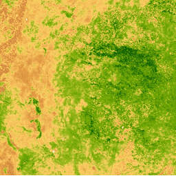
L'indice de végétation par différence normalisée est généré à partir des bandes proche infrarouge et rouge de chaque scène, sous la forme (NIR - Red) / (NIR + Red), et sa valeur est comprise entre -1,0 et 1,0. Ce produit est généré à partir des composites de réflectance de surface MODIS/006/MCD43A4.
Bracelets
Bandes de fréquences
| Nom | Min | Max | Taille des pixels | Description |
|---|---|---|---|---|
NDVI |
-1* | 1* | 463,313 mètres | Indice de végétation par différence normalisée |
Conditions d'utilisation
Conditions d'utilisation
Les données et produits MODIS acquis via le LP DAAC ne sont soumis à aucune restriction concernant leur utilisation, leur vente ou leur redistribution ultérieures.
Explorer avec Earth Engine
Éditeur de code (JavaScript)
var dataset = ee.ImageCollection('MODIS/MCD43A4_006_NDVI')
                  .filter(ee.Filter.date('2018-04-01', '2018-06-01'));
var colorized = dataset.select('NDVI');
var colorizedVis = {
  min: 0,
  max: 1,
  palette: [
    'ffffff', 'ce7e45', 'df923d', 'f1b555', 'fcd163', '99b718', '74a901',
    '66a000', '529400', '3e8601', '207401', '056201', '004c00', '023b01',
    '012e01', '011d01', '011301'
  ],
};
Map.setCenter(-7.03125, 31.0529339857, 2);
Map.addLayer(colorized, colorizedVis, 'Colorized');