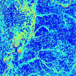
정규화된 차이 물 지수 (NDWI)는 식물 덮개의 액체 물 함량 변화에 민감합니다. 근적외선 대역과 두 번째 적외선 대역에서 파생됩니다.1.24μm(사용 가능한 경우) 및 가장 가까운 사용 가능한 적외선 대역(사용 불가능한 경우) 값의 범위는 -1.0~1.0입니다. 자세한 내용은 Gao (1996)을 참고하세요. 이 제품은 MODIS/006/MYD09GA 표면 반사율 합성에서 생성됩니다.
대역
대역
이름
픽셀 크기
설명
NDWI
463.313미터
정규화된 차이 물 지수
이용약관
이용약관
LP DAAC를 통해 획득한 MODIS 데이터 및 제품에는 후속 사용, 판매 또는 재배포에 대한 제한이 없습니다.
정규화된 차이 물 지수 (NDWI)는 식생 캐노피의 액체 물 함량 변화에 민감합니다. 근적외선 대역과 두 번째 적외선 대역에서 파생됩니다. 두 번째 적외선 대역은 사용 가능한 경우 약 1.24μm이고, 그렇지 않은 경우 사용 가능한 가장 가까운 적외선 대역입니다. 값의 범위는 -1.0~1.0입니다. Gao (1996)를 참고하세요.
[null,null,[],[[["\u003cp\u003eThe MODIS/MYD09GA_006_NDWI dataset provides daily Normalized Difference Water Index (NDWI) data derived from MODIS Aqua surface reflectance composites.\u003c/p\u003e\n"],["\u003cp\u003eNDWI is sensitive to changes in liquid water content of vegetation canopies and ranges from -1.0 to 1.0.\u003c/p\u003e\n"],["\u003cp\u003eThis dataset is freely available for use with Google Earth Engine and has global coverage from 2002 to 2023.\u003c/p\u003e\n"],["\u003cp\u003eThe dataset has a spatial resolution of 463.313 meters and can be used to monitor vegetation water content changes.\u003c/p\u003e\n"],["\u003cp\u003eMODIS data acquired through the LP DAAC has no restrictions on subsequent use, sale, or redistribution.\u003c/p\u003e\n"]]],["The dataset, provided by Google, contains the Normalized Difference Water Index (NDWI) derived from MODIS/MYD09GA surface reflectance. This daily, global dataset, available from 2002-07-04 to 2023-02-25, measures liquid water content in vegetation using Near-IR and another IR band, with values ranging from -1.0 to 1.0. It is free for research, education, and nonprofit use via the Earth Engine platform. The NDWI band has a pixel size of 463.313 meters.\n"],null,["# MODIS Aqua Daily NDWI\n\nDataset Availability\n: 2002-07-04T00:00:00Z--2023-02-25T00:00:00Z\n\nDataset Provider\n:\n\n\n [Google](https://earthengine.google.com/)\n\nCadence\n: 1 Day\n\nTags\n:\n aqua \n daily \n global \n modis \n myd09ga \n ndwi \n surface-reflectance \n usgs \nvegetation-indices \n\n#### Description\n\nThe Normalized Difference Water Index (NDWI) is sensitive\nto changes in liquid water content of vegetation canopies. It is\nderived from the Near-IR band and a second IR band, ≈1.24μm when\navailable and the nearest available IR band otherwise. It ranges in\nvalue from -1.0 to 1.0. See\n[Gao (1996)](https://www.sciencedirect.com/science/article/pii/S0034425796000673)\nfor details. This product is generated from the MODIS/006/MYD09GA surface reflectance composites.\n\n### Bands\n\n**Bands**\n\n| Name | Pixel Size | Description |\n|--------|----------------|-----------------------------------|\n| `NDWI` | 463.313 meters | Normalized Difference Water Index |\n\n### Terms of Use\n\n**Terms of Use**\n\nMODIS data and products acquired through the LP DAAC have no restrictions on subsequent use, sale, or redistribution.\n\n### Explore with Earth Engine\n\n| **Important:** Earth Engine is a platform for petabyte-scale scientific analysis and visualization of geospatial datasets, both for public benefit and for business and government users. Earth Engine is free to use for research, education, and nonprofit use. To get started, please [register for Earth Engine access.](https://console.cloud.google.com/earth-engine)\n\n### Code Editor (JavaScript)\n\n```javascript\nvar dataset = ee.ImageCollection('MODIS/MYD09GA_006_NDWI')\n .filter(ee.Filter.date('2018-04-01', '2018-06-01'));\nvar colorized = dataset.select('NDWI');\nvar colorizedVis = {\n min: 0.0,\n max: 1.0,\n palette: ['0000ff', '00ffff', 'ffff00', 'ff0000', 'ffffff'],\n};\nMap.setCenter(-7.03125, 31.0529339857, 2);\nMap.addLayer(colorized, colorizedVis, 'Colorized');\n```\n[Open in Code Editor](https://code.earthengine.google.com/?scriptPath=Examples:Datasets/MODIS/MODIS_MYD09GA_006_NDWI) \n[MODIS Aqua Daily NDWI](/earth-engine/datasets/catalog/MODIS_MYD09GA_006_NDWI) \nThe Normalized Difference Water Index (NDWI) is sensitive to changes in liquid water content of vegetation canopies. It is derived from the Near-IR band and a second IR band, ≈1.24μm when available and the nearest available IR band otherwise. It ranges in value from -1.0 to 1.0. See Gao (1996) ... \nMODIS/MYD09GA_006_NDWI, aqua,daily,global,modis,ndwi,surface-reflectance,usgs,vegetation-indices \n2002-07-04T00:00:00Z/2023-02-25T00:00:00Z \n-90 -180 90 180 \nGoogle Earth Engine \nhttps://developers.google.com/earth-engine/datasets\n\n- [](https://doi.org/https://earthengine.google.com/)\n- [](https://doi.org/https://developers.google.com/earth-engine/datasets/catalog/MODIS_MYD09GA_006_NDWI)"]]